Sunday, February 22, 2015

New Madrid EARTHQUAKE of 1811-12 created a SINK to the SW, causing the river to Reverse and Spill into the basins in Arkansas and Missouri. The Mississippi River forms a Figure 8 near New Madrid, which remains today (even as other Meanders move Downstream)! This Greatest USA quake of all recorded history is a MODEL for other LATERAL MOVEMENTS of Earth Tides, where the 3 "Jerks" proceeded from Big Lake Arkansas NorthEast-ward to Illinois.

SUMMARY: Gravitationional "Holes" may be RECOGNIZED as part of a FIGURE 8, with one portion missing. a "Slice" occurs along a Meridian, allowing the RATIO of the 2 diameters to determine which Solar System Body has effectuated it. 2.16 "belongs" to the Moon/Sun ratio, while 1.88 indicates Mars, 1/1.625 for Venus, and 2.5 or 11.86 belong to Jupiter. A Stationary Figure 8 indicates the LaGrange Gravitation of Asteroids, such as "Hilda" creating HEAT and STABILITY.

The PARTIAL FIGURE 8 is a PROMINENT Development on BOTH LAND and RIVERS; it will be COMPARED to others in my COLLECTION. Shown will be the one SEEN on Ceres (Largest LaGrange line on Earth is 16,000 km, or .4 times Circumference). Vapor jets on Ceres appear at this FRACTIONAL Relation!

Mississippi River CONFLUENCE with the Ohio:
New Madrid TOWN DETAIL:

The one most easily HIKED and viewed is at the Hurricane FAULT, Hf, and the Virgin River:
FIGURE 8 at Hf and the Laverkin Virgin River:
ENLARGED: 
The Virgin River ERODES the OUTER BANKS, so that EROSION "eats" the NORTH BANK to the RIGHT, and the South Bank to the LEFT; this forms a CLOCKWISE ROTATION of the Canyons, with TIME! CW entails a SINKING Development!

Figure 8 is shown for an ERODED MESA:
DIVIDER measured::

DIGITAL PHOTO from the Field:
VIEW from the South:
FROM NORTH
ENLARGED NORTH End:
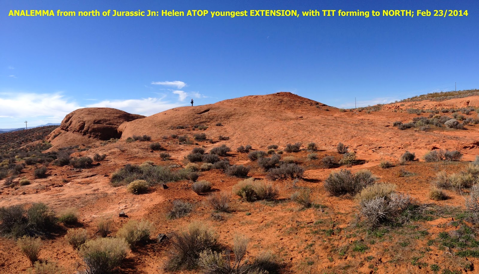
ANALEMMA encompasses a FIGURE 8:

Ceres is an ORB, which exhibits 2 BRIGHT SPOTS, and the PHOTOS are becoming more CLEAR as the survey APPROACHES, Vesta encountered First:
CERES Compared to our Moon:


BRIGHT SPOT in a SUBSEQUENT diagrammatic  PHOTO:

CLOSER:
NOTICE that the 2 "BRIGHT SPOTS" appear to be inside a CRATER. This is NOT NECESSARILY a Strike Crater, since there are 3 other CATEGORIES of  CIRCULAR HOLES:
2. SINKHOLES, as with LIMESTONE CAVES;
3. Gravitational HOLE with a SLICE, and,
4. VOLCANIC, and Phreatic (Steam driven) may be in this Category!

Watch for the "SLICE" as closer views  are available!
"BRIGHT SPOT" will be UP-DATED as photos are taken CLOSER.
A faint SLICE can be seen with N-S orientation, above.
LABELLED, for Crater LOCATION: 
ARCUATE Feature, with a CENTER HOLE, is NOT necessarily an IMPACT Feature!
Ceres in a 5/19/2007 Photo, above, shows Spots and ARCUATE Scribes. Below are more recent Photos:
Ceres WHITE SPOTS form a TRIANGLE:

FURTHER DISTANT:
CLOSER:
LENGTHWISE:
TRIANGULAR  Crater arrangement (in Center) awaits enlargement! White Duo remains in the LaGrange Point #1 position!

LOOKING at Earth from SPACE, the COLORADO PLATEAU and the lesser Basin Range is SIMILAR, with a SLICE (Hurricane, Wasatch Fault) between Cp,  B and R- where CP is  "RAISED: and BR has SUNK! TOGETHER, this forms a HOLE- SLICE- SINK to the West:
Cp is OUTLINED in Yellow, with Basin and Range to the WEST, above.

Lake MALHEUR, OR:

NOTICE the CONTRAST between WHITE EVAPORITIC DEPOSITS and the seasonal fresh water LAKE:
NOTICE the WHITE SPOT- which in this CASE is a "DRY LAKE"!
Turkey's Tuz Gulu is another EVAPORITIC BASIN, exhibiting a "White Spot":
ENLARGED
WIDE:
Another is Lake Frume in South Australia, which has a Ratio of 1.291 for its Orthogonal Measurements::
Ratio of the SINK/UPLIFT is 36/26=1.3846, (V/S);
Reverse "S" indicates SINKING, as Contrasted to S- which is for RISING, Normally! Anomalies are indicated for EXCEPTIONS, and they should be further Investigated:

SUMMARY: EROSION creates these ANALEMMA and Figure 8 STRUCTURES! The PROCESS is guided by the FRACTURES- which determine where the erosion occurs FIRST. NON-FRACTURED Rock remains HIGHER than eroded base, and the difference in ELEVATION creates RISING or CCW "Twist", thereby COMPACTING the Remnants1 
Easily seen is how METAMORPHISM develops; when POROSITY REDUCES to Zero, SHALLOW METAMORPHISM BEGINS!

Friday, February 20, 2015

Earth's MOON has a regularity to its LIBRATION ("Rocking"), and the Locking of the its Bulge with the Earth has produced Quarterly INSTABILITIES with the Earth's Crust: 1024 m.y. capture, 256 PTr (Permian-Triassic orogeny), 64 KT extinction, 16 Columbia Flood basalts, 4 m.y. NW Passage opening at Byam Martin Island, 1 Cape Hatteras Eastward protrusion, 250 k.y. Mississippi Delta southern movement, 62.5 k.y. Mendocino westward, and 15,625 year Last Ice Age advance. Regularity also occurs with the CW rotation of the Location, from NW shove of PTr, N-S of KT through 89.9W longitude (80E of the Prime Natural Meridian, PNM), Westward of basalts, N-S of Byam Martin, Eastward of Cape Hatteras, Southward of the Delta! Discovery of an INTERACTION of a passing Galaxy at 70,000 years (ago), rises the QUESTIONS: Is the 70,000 more accurately 62,500 years, and Is there a REGULARITY with the Quartering of the Libration CYCLE?

The KT cycle, MEASURED by Geologists is 65 m.y. by RADIOACTIVITY, and 64 m.y. by the PROGRESSION with the BINARY THEOREM (by DIVISIONS of 4)! This is most viewed in the Gulf of Mexico "HOLE" with the SLICE at 89.6W Longitude, where the slice occurs from the TIKAL marker to Yucatan, to the CENTER of the Gulf, to Lake Ponchartrain, to the 1811 to 1812 New Madrid QUAKE, to the Clintonville, WI "BANGS" to the Hudson Bay HOLE:

DETAIL East of the 89.6 Meridian:

CONTRIBUTING Material:
DIAGRAMS of Oort and Kuiper BELTS: 
Oort Cloud

CLOSE ENCOUNTER of .8 LIGHT YEAR Feature:
DETAIL, Presumed ARTISTIC SKETCH:

There are SEVERAL 62,500 year AGE "HOLES" along the Mogollon Rim, indicating that this NW-SE scarp was prominant during the EPISODE:
 METEOR CRATER:
LAKE STONE,MAN, off !-15:

Dante descent:


AGE of 62,500 years is CALCULATED from the PROGRESSION: 16 m.y.; 4, 1, 250 k.y.; 62.5 k.y., by NOTICING the QUARTERING PROGRESSION!
QUESTION arises: "How confident are the CALCULATORS for the 70,000 yeasr CLOSE ENCOUNTER?

Sunday, February 15, 2015

Attaturk decimated the OLDER CULTURES, by OUTLAWING the FEZ! He ignored the more BASIC part- that of the HITTITE Tassel-toed SHOES, which survive today in the KOY, with the KOYLI (villagers). Have WESTERN CULTURES separated themselves from the EARTH, more than the Thickness of the PADDED SOLES?

The CULTURE extends from the HATTI to the Hittite: 2200 to 1200 BC. Note the Tassel-Toed SHOES:
HITTITE EMPIRE was extensive:

PETROGLYPHS:
MAP including EGYPT:
PEASANT (koyli) SHOES:
TURKEY sits at the "LOOM of HISTORY", and is the CROSSROADS between East and West CULTURES. Kemal Attaturk was the Hero of the Gallopoli (Gelibolu) Battles of WW1, and became the President to align Turkey to the West:

Kemal realized that he must absorb as much of the WEST as possible. He gave the order to "ELIMINATE the Fez", but thought very little of the CONTINUATION of the Past via the FOOTWARE! 

MODERN REPLICA:
EGYPTIAN Empires were SIMULTANEOUS with the Hatti to Hittite CULTURES:
RAMSES

TURKISH Village today:
Turkish Koy, or Village; Koyli is the Villager:
The Tassel-toed SHOE is rare now:
The Prayer RUG or Kilim:

Although my "Turk" is slipping away, I remember TURKEY fondly; in my MIND'S EYE, I can see Ferhan, Guler, Safa bey, and the METU Campus!

Tuz Gulu (Salt Lake) was an interesting WHITE SPOT South of Ankara:
Reverse "S" indicates SINKING of the Anatolian Plateau:
ENLARGED:
U
Tuz Gulu was on the Road to the Sunny Mediterranean!

To Be Continued!