 Above is a Google photo of the NW portion of the North American Quadransphere (my term). This presentation, along with other portions, will be used to show that there is a quarter of the globe which moves somewhat independently of the other three (or four) quadrants and oceans. There are portions of the Crust of the earth which protrude above the oceans and react differently to mechanical forces imposed on them, compared to the surrounding oceans and their thinner and more rigid depressions filed with salt water. You will find that the analysis shows entities and movements which are not in the mainstream of features accepted by proponents of the PLATE TECTONICS THEORY.
 At first, I assumed that there was value to the PTT, and that I could use this as a basis for evaluating what was shown on Google Earth. After a year of analysis, I had to discard the parts pertaining to the continental crust, since the lighter and more elevated land masses did not agree with the ideas about “hotspots, mantle plumes, or rectangular plates”. I discarded the theory for explaining events on continents, rationalizing that the theory was developed from ocean observations (MAR spreading and transforming movements on the ocean floors). However, with continued work in ocean basins- where the principal movements seemed to be of a circular geometry, I finally had to abandon using the theory for mechanical movements altogether. Its original discovery of spreading along the Mid-Atlantic rift seems to be of value, and I do not discard that contribution. This feature may be related to a non-mechanical impetus- that of magnetic changes in the Earth’s Core or Mantle- and that is not my field. Hence, I allude to it but try to analyze only the Earth Mechanics’ involvement.
 Above is a Google Earth photo, which shows an important feature FOR understanding the movements of the crust at boundaries of the ocean basins- that of rotation of island arcs throughout time. I name this feature- which has important revelations- the ALEUTIAN SPIRAL. It will reveal several laws of movements of the crust which do not agree with the PLATE TECTONIC THEORY. We will refer to it, using its historic traces and rotations as references for the entire QUADRANSPHERE.
Below is my diagram for one entity which starts the development of movements and activities for crustal masses. This shows how the Mantle drags the Crust, due to its slightly faster spin than the crust- which is slowed by EARTH TIDES and its closer proximity to the moon, than is the Mantle. The diagram is distorted and exaggerated, spatially, but shows the important features of Mantle Drag and Tidal Shove to the west.
 1. THE DIAGRAM- ARRANGED BY ME AS AN ORIGINAL- SHOWS HOW THE FASTER-MOVING MANTLE DRAGS THE CRUST EASTWARD, CREATING SUBDUCTION. THIS IS ONLY ONE OF 4 MECHANICS' ACTIONS, WHICH DETERMINE THE STRUCTURAL ANOMALIES NOTICED IN THE EARTH'S CRUST.
 2. LINEAR MOVEMENTS (THRUSTS) CREATE A DYNAMIC WHICH CORIOLIS SENSES AND WITH WHICH ROTATIONS OF THE CRUST- ENCIRCLING THE LINEAR- ARE INITIATED.
3. ASTEROID STRIKES DISTORT THESE MOVEMENTS, AND CREATE OTHER WOBBLES AND MOVEMENTS OF THE CRUST. THESE ARE LARGE OR INSIGNIFICANT, ACCORDING TO THE SIZE OF THE IMPACT. THE LARGEST I HAVE STUDIED WAS PTr (PERMIAN-TRIASSIC BOUNDARY), THE NEXT WAS KT(CRETACEOUS-TERTIARY BOUNDARY) AND OTHERS WHICH ARE SMALLER BUT SIGNIFICANT WHICH OCCURRED AT 41 M.(OE), 28 M.Y.(MIOCENE) AND THE ONE WHICH INITIATED THE ICE AGE AT APPROXIMATELY 2 M.Y.
4. THE 4TH ENTITY IS THAT OF BULGES- SUCH AS THE EQUATORIAL BULGE, EB, WHICH TERMINATES AT MENDOCINO, CA AT 40N LATITUDE (THERE ARE OTHERS, PARTICULARLY THE PEAR-SHAPED ANOMALY IN THE SOUTH PACIFIC- PROBABLY INITIATED BY PTr), AND ANY SIGNIFICANTLY-ELEVATED MOUNTAIN OR DOME). I WILL INCORPORATE THESE ALL- USING FIELD DATA, GOOGLE EARTH, DIGITAL PHOTOGRAPHS, AND EARTH SATELLITE VIEWS OF ATMOSPHERICS AND OCEAN MOVEMENTS (WHICH ARE DETERMINED BY MOON-CREATED TIDES, OR EARTH TIDES).
 THE QUADRANSPHERE (MY WORD!) IS AN ELLIPSE WITH GAPS. THE TWO MOST IMPORTANT ARE IN THE EASTERN PACIFIC, SOUTH OF HAWAII AND THAT BETWEEN THE PUERTO RICO TRENCH AND THE MAR (MID-ATLANTIC RIDGE):
BELOW IS A MODEL FOR THE CORE-MANTLE INTERFACE, WHERE THE CORE IS HYPOTHESIZED TO ROTATE FASTER THAN THE MANTLE. I DON'T USE THIS MODEL, SINCE I FIND THAT ALL STRUCTURAL CHANGES INVESTIGATED ARE THE RESULT OF CRUSTAL MOVEMENTS (VERSUS THE SLIGHTLY FASTER-MOVING MANTLE). THE GAP SHOWN IN THE ATLANTIC NE OF THE PUERTO RICO TRENCH IS SHOWN, BUT THE GAP SE OF HAWAII IS NOT SHOWN. THIS IS AN IMPORTANT DIFFERENCE, SINCE I FIND NO CRUSTAL ANOMALIES IN THAT REGION. THE NORTH AMERICAN QUADRANSPHERE, Qsna, IS AN ELLIPSE (AS IS SHOWN IN THE MATSUSHIMA-PINE ISLAND) MODEL, BUT IT SO FAR SEEMS TO BE MOTIVATED BY ASTEROID STRIKES AND CORIOLIS ROTATIONS OF THE CRUST:
NOTE: THE FOLLOWING REPORT AND ANALYSIS IS AN ON-GOING INVESTIGATION. YOU WILL FIND MINOR ERRORS (AND SOME MAJOR ONES, since I initially believed that there was some VALUE to the PLATE TECTONIC THEORY. I NOW FIND THAT THE ONLY USEFUL PART OF IT IS THAT AT THE MAR, WHICH SHOWS THE MAGNETIC STRIPING AS A RESULT OF EXTENSION AND LATERAL MOVEMENT ALONG THE RIDGE). THESE ARE GRADUALLY BEING CORRECTED AS I PROCESS MORE CASES PERTAINING TO THE CIRCUIT MADE BY THE ROTATING QUADRANSPHERE. FOR EXAMPLE, IT NOW APPEARS THAT THE REASON THAT ICELAND REMAINS RELATIVELY STATIONARY THROUGHOUT TIME IS THAT THE KT STRIKE HAS BEEN OFFSET BY A STRIKE OCCURING APPROXIMATELY 34 TO 41 M.Y. AGO. THIS IS SIGNIFICANT, AND I AM LOOKING AT OTHER FEATURES WHICH BEAR ON THIS MAJOR DEVELOPMENT. CONTINUE!

THE NORTH AMERICAN QUADRANSPHERE, Qsna, IS TRACED BY A PARTIAL ELLIPSE, FROM CENTRAL AMERICA TO THE PUERTO RICO TRENCH (THEN A GAP TO THE MID-ATLANTIC RIDGE), TO THE ARCTIC OCEAN (SHIFT AT GAKKEL RIDGE TO LOMONOTOV), AND THROUGH SIBERIA TO THE HAWAIIAN-EMPEROR SEAMOUNT CHAIN, TO THE BIG ISLAND OF HAWAII (LOIHI IS THE YOUNGEST FEATURE INVESTIGATED). THERE IS NO INFORMATION FOR THE DEEP NORTH PACIFIC OCEAN SOUTH OF HAWAII (THERE IS A GAP THERE, AS WITH THE CASE FOR THAT OCCURRING NE OF THE PUERTO RICO TRENCH, AND WE WILL START WITH CENTRAL AMERICA, WHERE A RIFT HAS DEVELOPED OFFSHORE. THE INITIATION IS COMPLICATED BY THE KT STRIKE AT YUCATAN, MEXICO, AND I HOPE THAT LIGHT WILL BE SHED ON THIS ANALYSIS TO DETERMINE WHETHER THIS STRIKE RE-STARTED THE WHOLE ROTATION, AFTER RECOVERING FROM THE PTr STRIKE OFF-SHORE AUSTRALIA. THE INITIATION IS SHOWN BELOW, IN A GOOGLE PHOTO OF THE REGION, WHERE CENTRAL AMERICA HOLDS THE CLUES TO THIS "EARTH-SHAKING EVENT".
 BELOW IS A SAMPLE OF THE COMPLEXITY FOUND NEAR THE BAJA PENINSULA- WHICH IS THE RESULT OF A TRANSFORM SHEARING THE BASIN ALL THE WAY TO MAUI. THIS IS THE RESULT OF A 2 M.Y. RADIO-DATED EVENT INTERFERING WITH THE ROTATION CREATED AS A RESULT OF THE VARIOUS STRIKES FROM KT AND (SUBSEQUENTLY) OTHERS SHOWN ALONG THE HI-E SEAMOUNT CHAIN. THESE HAVE BEEN MEASURED BY RADIO-DATING THE OBVIOUS INFLECTIONS AND SEAMOUNTS AT THE INTERSECTIONS NOTICED FOR THE CHAIN:
  PHOTO ABOVE IS AN EXPANDED VIEW OF THE BELOW GOOGLE PHOTO OF THE BAJA PENINSULA. THIS CONTRAST SHOWS THE ROTATION ON LARGE AND SMALL SCALES- OF THE OFFSHORE SEDIMENTS- AS THEY ARE STRAINED BY ASTEROID STRIKES (PROBALY EXAGGERATING THOSE MOVEMENTS ALREADY CREATED BY OTHER EARTH MECHANIC'S INFLUENCES:
GPS HAS MEASURED THE MOVEMENTS, REPRESENTED BY VECTORS, OF VARIOUS LOCATIONS ON THE EARTH'S SURFACE. THESE ARE SHOWN BELOW, TO CHECK MY WORK ON ANALYSES MADE USING CIRCULAR RIVER PATHS, SLICKENSIDES' STRIATIONS AND "CAT STEPS" DIRECTIONAL INDICATIONS, SHEAR OF CONCRETE SLABS, AND SHIFT OF RIVER MEANDERS AND OSCILLATIONS ACROSS RIVERS:

Notes for the GPS movement vectors shown above:
1. GPS IS MEASURED WITH CRUSTAL VECTORS REFERENCED TO EARTH, where land mass moves NW as seen AT HILO, HI. WHEN A VECTOR IS TO THE SW, THE CRUST MOVES SW RELATIVE TO THE NORTH POLE. At the Aleutian Islands, it is moving SW, and this introduces the first problem to those who believe in a northward shove of the Emperor seamounts with time. The GPS measurements cast doubt on the assertion that there are "hotspots", plate movements to the north, and MANTLE PLUMES, CREATING THE ISLANDS.
 BY MY APPRAISAL, HI IS MOVING ALONG THE KONA COAST CW (SINKING), OPPOSITELY TO THAT ON THE EASTERN SIDE OF THE ISLAND WHERE THERE IS STILL ACTIVE RISE OF MAGMA. THE WEST SIDE IS SHRINKING AND COOLING. THE ISLAND'S EAST SIDE IS MOVING DIFFERENTLY THAN THE WEST SIDE; IN OTHER WORDS, ROTATION IS CW AT KONA, AND CCW AT HILO.

THE KILAUEA CIRCULAR ROTATION IS SHOWN, UNINFLUENCED BY MY ANALYSES, ABOVE.
2. After exiting EB, north of the transform crossing the 41 m.y. kink in the HI-Emperor seamount chain, the Pacific track is N-S, as shown by the track south of the Aleutian Islands.
3. The map may be folded along the 170E Longitude line, to find that there is some regularity to the GPS vectors IN THE NORTH PACIFIC (BUT NOT IN THE SOUTH). Opposite (10K KM DISTANCE) almost antipodally to this 170 line at 30W longitude line, is the MAR (Mid-Atlantic Ridge), and there is no longer subduction but spreading (rifting AND LATERAL FAULTING, and a major deviation of rifting occurs north of the Equator, where a lateral bulge paralleling the West Africa coastline occurs until 30N latitude). This strongly suggests that subduction, spreading, and movement of both the Pacific Basin and MAR are connected ON THE SEMI-HEMISPHERIC PORTION OF the GLOBE.

4. The main departure from 3. above is for the Australian plate- which is shearing against its neighbors of Indonesia and the Pacific Basin basin east of New Zealand.

THE SOUTHERN BORDER OF Qsna LIES AT THE WEST COAST OF MEXICO, AND WE WILL ATTACK THE COMPLICATED VECTORS SOUTH OF BAJA LATER (there are GAPS in the trace of the QUADRANSPHERE, so that the trace is not continuous). It appears that the KT strike movements may have been later offset by the OE movements of late Eocene age, so that ICELAND APPEARS TO REMAIN RELATIVELY FIXED IN EARTH SPACE:

I can now see that the earth’s response is to display DISRUPTIONS TO ITS BEHAVIOR via three independent forces, creating the dynamics of the Crust:
A. Equatorial Bulge Diminution, EBD, which is due to the tidal friction between earth and moon, causing slowing of the spin rate of the earth and length of day increase, LOD. This factor creates a lengthening of the day by 24 seconds each million years, or 6 nautical miles (6 minutes of arc) and shear to the East along latitude lines between 40N and 40S latitudes. (NOTE: I HAVE SUBSEQUENTLY FOUND BY MEASUREMENTS ON GOOGLE EARTH, THAT THE SHEAR IS LARGER- 20 KM EACH M.Y. COMPARED TO THIS LONG TERM MOVEMENT OF ABOUT 11 KM) THE EQUATORIAL BULGE, EB, LATITUDES GREATER THAN 40N MOVE EASTWARD RELATIVE TO THOSE INSIDE THE BULGE. THIS MAKES IT APPEAR THAT THE ZONE INSIDE EB MOVES WESTWARD WITH TIME;
B. Coriolis Rotation, which is created by the difference in surface spin velocity along latitude lines (velocity at the edge of a parcel of mass is less as distance from the Equator is increased). Notice the CCW rotation for Mt. St. Helens, below, creating a circular presentation of a minor stream- which displaces the major stream to the west by the rotation;

and,
C. Meteor Strikes- mechanical shocks, which create shear in the Crust along the direction of impact.

There is a 4th factor- BULGES IN THE EARTH DUE TO ITS PEAR SHAPE (SOUTH PACIFIC AND THE AUSTRALIAN CONTINENT), and we will incorporate it later.
Examples for A. include the SHIFT OF A BULGE WESTWARDS (SIERRA MOUNTAINS, CA) BETWEEN THE 41 M.Y. TRANSFORM AT MENDOCINO TO THE GARLOCK FAULT (which traces E-W),visible until the HI-E SEAMOUNT CHAIN IS REACHED. THIS IS A SEGMENT OF THE CRUST WHICH IS MOVING WESTWARD, OPPOSITE TO THAT SURROUNDING IT (THE CASCADE VOLCANIC BELT TO THE NORTH AND THE DEATH VALLEY AND GEOTHERMAL REGION BELOW TO THE SOUTH AND EAST). NOTE THAT THE PHOTO HAS BEEN ROTATED 45 DEGREES, SO THAT THE MAXIMUM BREADTH MAY BE EXTENDED

Examples of B. include the rotation of cells within cells of protruding land mass, as Coriolis force affects the taller of mountains versus the lower elevations, and the north side of any feature versus the south side (the side where the Earth surface velocity vector is greater, referenced to space. REFER TO THE GOOGLE PHOTO OF THE E-W TRENDING UINTA MOUNTAINS, BELOW, TO SEE HOW ROTATIONS OCCUR AT THE INTERSECTION OF THE EQUATORIAL BULGE (LESS THAN 40N LATITUDE) AND THE CORIOLIS ROTATION OF THE MOUNTAINS TO CREATE THE GREEN RIVER CUT THROUGH THE RISE TO PRODUCE THE FLAMING GORGE:

My analyzed version of the Uinta Mountains is shown below:

Examples of C. include the obvious inflection of the Hawaiian-Emperor chain at the 41 m.y. age as it was deviated by the RISE OF THE SIERRAS, and subsequent tidal shove of the mountain bulge westward (SEE THE FIRST PHOTO SHOWN IN THIS BLOG ABOVE), and the portrait of Equatorial transforms in the Atlantic basin as they shear 300 miles or so (westward on the north side of the Equator) after the KT strike near Yucatan, Mexico:
All three of these entities are independent of each other- Lunar Friction, Earth surface velocity and Coriolis Force, and Meteors from space- so that we have to sort out the results of these individual movements, as they are presented on Google Earth Photos. In the case of the Hawaiian chain, it is apparent that the orientation of the chain is not dominated by the northward movement of the Pacific Basin, as is shown in the following Photo:

The above photo shows that there is Coriolis spin, shear and HEAT development within the latitudes between the two E-W transforms shown (Maui to Baja and the Line Islands-Jalisco transforms). Since there is reversal of direction of the vectors, there is a reactionary cell, RC, within the larger basin movement, and the portrait of the HI island is barely affected (HI does deviate from its N120E track, but maintains a dominant eastward vector).
The reasoning for the vector resultant shown on the HI diagram is determined by a divergence of the two tracks of rotating volcanoes, from the east side of the chain to the west,- GPS vector for the HI islands is NW, the Pacific Basin moves northward, and there is no subduction under the west coast of North America to the east of the large remaining islands (as shown by the coast of North America from 40N- Mt Lassen- to Jalisco, Mexico. This has previously been explained by the Plate Tectonics Theory, using the movement over Mantle Hotspots, while ignoring Coriolis Tectonics and Meteoric strikes. My assessment is that all of Earth movements noticed in landmasses (protruding continents and islands) arise from forces acting mainly on the Crust. Possibly we can sort all of these independently-acting forces by some obvious categorization.
First, water tides are fast-acting, mainly in oceans, and there is little noticeable effect on landmasses. This allows ocean basins to contrast greatly with landmasses, when studying Coriolis effects. Whereas ocean basins present plate movements, continents present Coriolis rotations.
Secondly, the Equatorial bulge occurs in the 40N to 40S (subject to rearrangement by Polar Wandering) latitudes, and is expected to contrast with effects noticed in more distant-from-the Equator parallels. Thirdly, Meteoric strikes are randomly-occurring (ignoring cyclical comet events and periodicity of asteroids), and should be easily sorted out. The Line Islands orientation, and the drastic deviation along the Equator of E-W transforms in the Atlantic Ocean show that these obviously contrasting entities deviate from other events shown on Google Earth photos.
GOOGLE PHOTO BELOW, OF THE MEEJI AND KIMMEI SEAMOUNTS ALLOWS A DETERMINATION OF THE ROTATION OF THE GREAT CELL THERE. NORTH OF THE MENDOCINO TRANSFORM, THE MOVEMENT IS TO THE EAST, WITH THE SOUTH SIDE TO THE WEST (SEE THE COASTLINE OF CA TO SEE THE DIFFERENCE IN MOVEMENT OF ABOUT 100 KM). THIS TRANSFORM CONTINUES TO THE LARGE CELL AT THE SEAMOUNT CHAIN, AND THE CELL THEREFORE IS ROTATING CCW. THIS REQUIRES THAT THE CHAIN, ON THE EAST SIDE, BE PROGRESSING TO THE SOUTH. SIMULTANEOUSLY, THE EQUATORIAL BULGE IS TERMINATING FURTHER TO THE SOUTH, AT 31N (COMPARED TO 40N LATITUDE AT MENDOCINO). THIS DOESN'T FIT WITH THE ASSERTION THAT THE PACIFIC PLATE IS MOVING NORTHWARD- MERELY THAT THE WHOLE ROTATION IS CREATING THE ILLUSION OF PLATE MOVEMENT.
 MY REMARKS ARE SHOWN BELOW:
The solution to the development of the HI-E chain lies with the finding that it is not involved with a “hotspot” or movement of rectangular plates, but with its MIRROR symmetry with the western portion of the PACIFIC HOURGLASS.


THE HOURGLASS IS ROTATED 45 DEGREES, SO THAT THE MAXIMUM EXTENT MAY BE VISUALIZED, AND EXPANDED TO SHOW THE PATTERN OF CIRCULAR ARRANGEMENTS OF VENTS WITHIN IT:

Further, once it is accepted that there is Coriolis rotation transpiring in the Central Pacific basin (via vents making circular patterns), then it can be seen that the inflections in the HI-E chain are due to shear along transforms. Notice that the segment from the 41 m.y. kink at the Kimmei to the Midway Island (28 m.y. age) is coincident with the westward movement of the CA coastline from Mendocino to the Las Angeles Garlock E-W fault. This is caused by the tidal push of the Sierras along a 700 km inter-transform zone- to the west.


A. West Indies to the Mid-Atlantic Ridge MAR
Google Photo below shows the first area of interest. There is no doubt of the eastward movement of the West Indies (which shows that the front containing the vulcanism is moving to the east). The Puerto Rican trench is parallel to this movement, and easily seen as the southern boundary of the NA Quadransphere. But what then?

There are several portraits seen on the map BELOW, several of which can be anticipated:
1. Division of the Crust at the 40N Latitude, which we have already noticed at Mendocino is the northern boundary of the Equatorial Bulge, EB. This divides slower-moving Crust south of 40N from that to the north, because of the greater tidal friction in the EB latitudes;
2. Rotation of the crust about the 40N Latitude, creating right-lateral shear. This yields features, such as Long Island and Uinta Mountains, extending E-W as they are dragged to the west by the slower-moving EB;
3. A Circle of vents or seamounts which move CW with time- due to opposing movements on either side of 40N. The diameter of this feature depends upon the length of a section of transform which is unaffected by other mechanical events (interferences from asteroid strikes and significant wobbles of the Poles);
4. Traces of fossil events (superseded by young ones), such as the Permian-Triassic, PTr, strike- which imprinted NW lines of shear towards the Atlantic coast and the Appalachian Mountains; and,
5. Features such as the Azores Islands which indicate active and as yet undocumented dynamics. These are shown below:


The Azores are west of Gibraltar, near the EB north boundary at 40N, active, and indicate that EB terminates short of the continental EB (as it does in the Pacific, occurring at lesser latitudes with greater distance from the continent). The Azores to Gibraltar ridge lies near the 38N parallel, and I assume that the Mediterranean Sea bottom is sheared by the 38N to 40N EB boundary against the European landmass. Europe would be moving relatively faster than EB- shearing off Africa in the process. This requires that Africa be in a separate Quadransphere than is Asia-Europe. Best not to leap too far ahead, since the NA Quadransphere is the simplest of the four crustal blocks. They are all moving under different impetus: Australia by the PTr strike, Africa by the great rift, North America by the KT strike off Yucatan, and South America by the combination of Mantle drag and the Andes moving westward. Coriolis rotation, affecting all of them of course, is initiated by any independent movement- such as shear at EB, asteroid strikes, and expansion by heat from radioactivity or solar input.
Arctic Ocean Dynamics
B. THE DIVERGENCE OF TWO QUADRANSPHERES, FOR NA AND ASIA-EUROPE, OCCURS JUST SOUTH OF ICELAND, AND A RIDGE OF SPREADING AND SHEARING IS SHOWN BELOW:
 TRACE OF THE NA QUADRANSPHERE IN THE ARCTIC
 NOW THERE ARE SUFFICIENT DATA FROM MEASUREMENTS TO MAKE A PRELIMINARY ASSESSMENT OF THE SOURCE OF HEAT AT ICELAND: IT OCCURS BETWEEN ICELAND AND GREENLAND.
Iceland is the location where there is divergence of the NA and Europe Quadranspheres- the one of interest proceeding north of Greenland and indicating several abrupt dislocations (as shown by inflections in the trace, or large angular changes in the path).
NOTE: AN INLAND LAKE, COVERED BY ICE, OCCURS INSIDE THE ISLAND OF GREENLAND. THIS MEANS THAT A DEPRESSION OR SINK HAS CREATED CW ROTATION OF THAT PART OF GREENLAND (FOUND BY GEOPHYSICAL MEASUREMENTS).
ANALYSES OF CIRCULAR PATTERNS AND RIFTS SHOWN NEAR AND AROUND THE ISLAND OF ICELAND:

The appearance is one of significant polar wandering, and the fragmentation of islands is similar to that in the West Indies, where the KT strike has produced a recognizable pattern (circular Gulf of Mexico, vulcanism, many islands, and dislocation of the boundary of the NA Quadransphere). It appears that Hudson Bay (60N 85W, with antipode: 60S 95E) is the site of an asteroid strike which may have created this overall pattern. Below is the antipode location, which may have an error of several degrees, because of the indistinct center of Hudson Bay


 Deferring the possible Hudson Bay strike, and continuing toward the North Pole, the bifurcation of the MAR at Iceland has imprinted several patterns of grids and transforms.
 Arctic rift bifurcation


There is a shift of MAR to the left west of Norway, and another at the Lomonosov Ridge. While Greenland rotates CW, as evidenced by the curvature of its most southerly tail (creating the Lomonosov shift to the east), the rotation about Iceland is CCW- as seen by the shift offshore Norway. Although this congruence of rotations is not in conflict, there is another rotation of the western part of Iceland WHICH DOES CONFLICT- CREATING THE HEAT AND VULCANISM THERE. This smaller rotation evidently is due to the divergence of the island to separate the NA and Europe Quadranspheres. The end result of all this is to rotate NA CCW (rising), while rotating NORTHERN Europe-Asia CW (sinking). This could be reason why the main rivers in Europe drain northward, while those in Canada do not (they drain to the east or west). Also, northern Europe is geologically old , while NA is post Paleozoic west of the Rockies.
 GAKKEL RIDGE, IN THE ARCTIC, INDICATES THAT IT IS OLDER THAN THE KT STRIKE, IS SIMILAR TO THE RIDGE AT GOVENA (WHICH IS ALSO PRE-KT), AND IS YOUNGER THAN A FAINTER LOMONOSOV RIDGE. THIS PLACES THE ENTIRE FEATURE AS REACTING TO KT AND SHEARING SOUTH AND EASTWARD TOWARDS ICELAND. NOTE COMMENTS RELATING THE FEATURES WHICH ARE ANALYZED FOR DIMNESS, FOR SUPER-POSITION ONTO OTHER TRANSFROMS (WHICH MAKES THEMN YOUNGER, RELATIVELY), FOR ROTATION, AND FOR ORIENTATION OF SHEAR DIRECTION:
This is all very interesting, but we must still determine the latest path of the NA rotation near the north pole, and it is mostly obscure in the shallows of the Arctic (south of the Lomonosov Ridge to the Bering Strait). The rather abrupt shifts of the MAR rifting ridges and spreading centers hints that we are dealing with two asteroid strikes- possibly the ones at 28 and 41 m.y. noticed in the Pacific (creating the inflections in the HI-Emperor seamount chain trace). These would be in the Miocene and Oligocene, and be most noticeable for the great shift at the Kimmei seamount and more subtly at Midway Island. This is a very tentative scenario, depending upon asteroid crater finds in the field. This is not very likely, for that part of the Pacific, where there are few islands for field work.

BELOW IS THE SECTION NECESSARY TO INVESTIGATE FURTHER:
 Grid patterns in the North Atlantic, near Iceland
Solving the complicated pattern of Iceland’s dynamics requires further analysis of the progression of transforms and rotations about the island of Iceland. This is shown above, as an analysis of the dimness of transforms as they are rotated. The most recent is east of the island, which has on obvious shift to the west or CCW rotation. This contrasts with that on the west side, which rotates oppositely. The combination of age and opposing rotations leads me to conclude that we are viewing the history of the ice age, as the weight of the ice created sinking (cw rotation) and later rising or uplift- as the ice was removed. This happened over a 2 million year interval, and the response time has been analyzed for Whidbey Island as being on the order of less than 10k years. That is, the reversal of rotation is sensitive to a few thousand years. Hence the two tracks of gridline shifts are indicative of an earlier sinking, with later rising. This analysis concludes that the vulcanism of Iceland is due to the combination of the divergence of the NA and Asia-Europe Quadranspheres and the reversal of rotation- creating both HEAT OF BRITTLE FRICTION and SPREADING (RIFTING) of the CRUST TO ALLOW EMERGENCE OF LAVA FROM A DEPTH WHERE IT IS NORMALLY HOT. All this hints that the revolution of the earth about the sun was elongated by a possible close encounter from space, and that it has gradually returned to its previous normal path to warm the earth to its earlier state, in the last few thousand years.
Quadransphere Fossil Traces in the Arctic The path of the rotation of Qsna is not straightforward for the Arctic Ocean and its surroundings. The suspected asteroid strike in Hudson Bay and the Tertiary anomalies at 28 and 41 m.y. have introduced displacements, which are more noticeable in this region. These comments are speculations, but the patterns of asteroid strike geography and inflections in linear traces of islands around the globe are becoming of value to interpretation of regions of doubtful Geology. Areas of continental shelf and those exhibiting siltation on the ocean floor have combined to make obscure the factors necessary for Coriolis and shear analysis. Hence we must resort to scenarios, with which we might make appraisals as to likelihood of Accuracy.
Below are shown Google Earth photos, which yield a new perspective on Coriolis rotations in the Arctic, North America, and Siberia:
 ABOVE IS THE TRACE OF SILTATION SHOWN IN THE ARCTIC, WITH THE LENA RIVER, RUSSIA PATH (which appears to have been initiated by the rifting in the Arctic Ocean). BELOW IS SHOWN THE LARGER VIEW, SHOWING THE VARIOUS ROTATIONS OF LARGEST DIAMETER:
These photos show that the larger picture of the Lena and Obskaya Rivers forms concentric circles, which may yield a border zone containing the path of the trend of the Gakkel or Hansen rift zone (which appears to be the most active extension of the Mid-Atlantic Ridge). This trend may yield the border of the youngest Coriolis cell- which might determine the border of the NA Quadransphere. It is expected that Polar Wandering or shift of the north pole- due to asteroid strikes or major mechanics events- will yield both fossil and present borders of Qsna.
Notice in the above photos, that the path of the Russian Yenisey river presents an arc which is roughly similar to the arc of the Aleutians. A smaller arc lies on the trace of the Lena River, which seems to be an extension of the Gakkel or Hansen rift (which is a young geothermal feature). This Coriolis cell, rotating inside the larger Yenisey arc, may yield a border of the Qsna. If so, it will be west of the expected boundary through the Diomede Islands. The next step will be to determine which is the younger, or present shear path, of the border of Qsna. More likely, the Yenisey trace fits the pattern of the rotation of the Kurils, and the Lena presents the most useful of Coriolis rotations for Qsna location. This tentative location reveals that Qsna lies closer to the Diomedes, but is somewhat displaced (westward) by the Aleutian rotation. Siltation or continental shelf movement obscures both Siberian and Alaskan waters’ shear paths, and the only revelation pertains to the linear or shear traces in the Chukchi Sea. This portrait indicates a path toward the Diomedes, but its age relative to active features- such as the Gakkel Ridge- must be determined. One scenario would be to consider that the Gakkel and its extensions have been in effect long enough to form a continuous pattern, whereas the Chukchi feature is young- in the process of formation and shearing (since it doesn’t seem to extend away from the young uplift or rise). The Chukchi shear orientation points towards Diomedes, whereas the Gakkel or older Lomonotov ridges do not. The shift between the two ridges is toward the west, as is the movement along the Aleutian chain, and this is an indication that the Diomedes are NOT the youngest shear path. It is necessary to find more information about the Chukchi rise, and whether there ARE geothermal indications there.
The Chukchi Rise and Plateau The literature has classified the Chukchi as being Paleozoic to Tertiary and not likely to be geothermally active. Viewing more closely to the Diomedes, there are partial circles or arcs which may be indicative of younger tectonics. These are presented below, using analyses with rules found for other areas. Circular bays are sinks and rotate CW, while rising areas rotate CCW, and portions of these arcs are found in the extreme Siberia peninsula west of Alaska:


The information found by analysis is speculative and put in the form of a scenario, since the siltation and continental shelves obscure a more accurate treatment. Rise of the peninsula west of the Diomedes indicates a CCW movement, and this does NOT FIT the CCW categorization of Qsna (there would be a geothermal activity at the boundaries, if both rotations were CCW). This again casts doubt on the Diomedes being the boundary of the NA and Asia cells, and we should look further west for this feature Possibly the larger feature is more likely to yield results.
Analyzing the Chukchi Plateau, there is a sharp scarp on the east side- indicating a rise or CCW rotation. This would be a right-lateral fault for the linear shown in the center of the feature, and this would fit with the finding that Qsna is rotating CCW (rising). The siltation indicates that the trend from the north is faint or older, so that this scenario is inconclusive also. Altogether, the clues indicate that the likely boundary of Qsna crosses north of the HI-Emperor chain. This would be because of the rotation of the Aleutian chain- moving the original boundary of Qsna to the west.
The photo below, of the Arctic Ocean, including the Chukchi area, shows that there is a progression of rifting from the Chukchi to Lomonotov to the active Gakkel or Hansen ridge. This indicates again that the Chukchi feature is oldest (by siltation trace- faintest and most widely presented), and that the shift is activated in “jerks” as with an asteroid strike causing a sharp discontinuity in the patterns and transforms-rifts.

This finding indicates that the Qsna border has shifted away fron the Diomede Islands with time. This is supported by the age of the rocks for the Bering Strait area, which vary from Paleozoic to Tertiary. Incidentally, the age of basalts at Iceland varies from recent to Tertiary at the NW corner of the island. Flood basalts are found there, indicating another asteroid strike has triggered the appearance of the Geothermal anomaly. This area is sinking and rotating CW, creating HEAT OF FRICTION BETWEEN ICELAND AND GREENLAND. This and the divergence of the MAR south of Iceland creates the continuous intervallic outpouring of basalt.
 ABOVE IS THE GOOGLE EARTH PHOTO OF THE GAKKEL RIDGE,WHICH HAS SUPERSEDED THE LOMOMOTOV RIDGE AFTER THE INITIATION OF THE CRETACEOUS FEATURE. BELOW ARE SHOWN MY ANALYSES )()OVER-PRINTED ON THE VIEW):
Altogether, the pattern is one of shifting of the western boundary of Qsna away from Alaska and toward Siberia (as is the result of Coriolis rotation of the Aleutians toward Siberia). Now we must look at the eastern peninsula of Siberia, to determine whether there is geothermal activity (as there is for Kamchatka and the further south at the islands of Siberia).


IT APPEARS THAT THE NW BOUNDARY OF Qsna HAS SHIFTED TO THE WEST AS THE ALEUTIAN CHAIN HAS ROTATED CW. LET'S LOOK AT THE KAMCHATKA AND EASTERN SIBERIA IN MORE DETAIL:

 NOTICE THAT THE LARGEST BAY OR INLET IS NEAR THE PRESENT SEAMOUNT CHAIN ON THE NORTH SIDE. I CONCLUDE THAT THE DIOMEDES WERE ONCE THE WESTERN BOUNDARY, BUT HAVE BEEN SUPERSEDED BECAUSE OF THE SHEAR PROCEEDING ALONG THE CHAIN. GRIDLINES AND THEIR DIMNESS OR SHARPNESS MAY HELP TO FATHOM THE HISTORY OF THE DYNAMICS IN THE BORDER AREA. THE PATTERN IS SHARPER NEAR THE PRESENT ISLANDS, AND DIMMER TO THE NORTH- APPROACHING THE MAINLAND OF SIBERIA. OTHER CLUES ARE FOUND BY LOOKING AT BAYS AND THEIR RELATIVE SIZE. LARGE BAYS EXHIBIT LARGER DIAMETER CORIOLIS ROTATIONS AND SHOULD BE MORE IMPORTANT FOR THE LARGER OR REGIONAL ANALYSIS.
DUE TO THE SENSITIVITY OF HIGH-LATITUDE CORIOLIS ROTATION, WE HAVE TO LOOK CLOSER TO THE KAMCHATKA PENINSULA AND THE EXTENSION OF THE HI-EMPEROR SEAMOUNT CHAIN TO THE EAST. THE NUMBER OF BAYS (CORRELATIING WITH SHEAR TOWARD THE COAST) AND CAPES (INDICATING OPPOSITE SHEAR TOWARD THE SEA) REMINDS US THAT THIS REGION HAS HAD MANY THRUSTS FROM CORIOLIS ROTATION:

 Offshore Kamchatka, north of the junction of its and the Aleutians‘ arcs , there is a circular sink (deep sea) which is uninterrupted by large bays and capes. This indicates that it is young in relation to the Aleutian rotation. However the gridlines are much dimmer in the deep, compared to those further east near the Aleutian chain. This hints that the shear exhibited is older to the north than that to the south of the chain. Both NW shear indications are parallel, indicating that the polar axis did not move significantly during the time both features were formed. Altogether,
1. The north part of the sub-sea ridge is older than the south part (and there is some rotation agreement with this conclusion);
2. The Pacific crust "appears" to be pushing northward, as is stated by the Plate Tectonic assertion;
3. Simultaneously with this apparent movement, there is rotation CW of the Aleutian chain- to push Kamchatka near the junction westward; and
4. More likely, to agree with the GPS measurements, the landmass of Asia and NA is moving SE and SW, while the Pacific Basin is moving more subtly.
We must! get more evidence to solve this overall effect, since this represents a major departure from the PLATE TECTONICS THEORY; My general conclusion is that the North Pacific basin is not the major mover- rather that the combination of Coriolis Force and Eastward drag by the Mantle leaves the Pacific basin moving relatively less than the continental shelves. The shelves are less viscous and more easily moved compared to the basalt floor of the Pacific, and therefore rotate and dive simultaneously under the adjoining coast. This yields a vertical rotation of a horizontal rotating rod of crust- generally rotating CCW, viewing northward, simultaneously rotating laterally CW as the Aleutians are left-laterally sheared.
NOTE: AN INDEPENDENT MOVEMENT OF THE CRUST MUST OCCUR FIRST, IN ORDER FOR CORIOLIS ROTATION TO ACT ON THIS ENTITY. THE RESULT IS THAT ROTATION DEVELOPS AROUND AN INDEPENDANTLY SHEARING (moving) LINEAR. WHENEVER MANTLE DRAG OR BULGES CREATE A MOVEMENT, CORIOLIS ACTS TO MODIFY THIS BY CIRCULATING AROUND THE SHEARING LINEAR; FOR EXAMPLE, ALEUTIAN CHAIN IS SHEARING WESTWARDLY, YIELDING A CLOCKWISE MOVEMENT (THIS IS EQUIVALENT TO A LEFT-LATERAL FAULT, FOR A CW ROTATION). LINEARS MAY ACTUALLY BE CURVED, BUT NOT NOTICABLE OVER THE RANGE OF THE ROTATING CIRCUMFERENCE. THE ONE FEATURE I HAVE YET TO SOLVE IS THE MOVEMENT OF SIBERIA UNDER AN IMPETUS OF A SOUTH-EASTWARD PUSH OF THE LANDMASS. THIS IS NOT COVERED BY MANTLE DRAG OR BY MOUNTAIN BULGES MOVING WESTWARDLY! SO FAR, WE HAVE JUST WORKED ON THE Qsna PORTION OF THE EARTH. OTHER ENTITIES ARE APPARENT IN OTHER QUADRANGLES- AUSTRALIA MOVING NORTHERLY, AFRICA RIFTING INSIDE THE CONTINENT, AND SOUTH AMERICA OBVIOUSLY MOVING MORE SLOWLY TO THE WEST THAN NA. NOTE: YOU HAVE PROBABLY DETERMINED THAT THERE ARE AT LEAST 5 QUADRANSPHERES- NA,SA, AFRICA, EURO-ASIA, AND AUSTRALIA, AND THE CORRECT TERM SHOULD BE QUINTILSPHERES, BUT I HAVE TOO MUCH OF THIS IN MY PUBLISHED LITERATURE, AND AM STUCK WITH IT! (NOTE: AFRICA MAY YET PROVE TO BE PART OF THE EURASIAN QUADRANSPHERE, SINCE ITS SEPARATION FROM EUROPE IS CAUSED BY THE TERMINATION OF THE EQUATORIAL BULGE IN THE MEDITERRANEAN SEA- AT 38N LATITUDE).
The Fourth Quintile
The fires of life are burning low
The selvage width is thin;
The distant view of long ago,
Of things concerning men,
Is waning as the coast seen far,
Like dimming fog seems now.
But deep within the earthen jar
Remains a Willful vow.
That Spirit assailed so soon by Time-
Which took so long to form-
Is waxing yet o’er all so prime
(Much like the distant storm).
Physique may gracefully fade away
And quick of wit may slow,
But Emotion remains strong to this day
Beneath the Psyche’s glow.
Harold L. Overton

 There is a crater in Newfoundland at Mistastin Lake, 55 53’N 63 18’W longitude, but its antipode has NO ANOMALY, EVEN THOUGH IT FITS THE EXPCTED DATE OF 41 M.Y.!

SHIFT OF THE ARCTIC REGION DUE TO THE 41 M.Y. DISTURBANCE
The above Google earth photo (modified by my analyses) advances a scenario, which is added to the mix of possibilities. Notice first that the Rocky mountain trend extends into Kamchatka, and this would have occurred as a result of the KT strike. This tentative conclusion allows dating of the rotations happening before and after this re-orientation of the circulation of the Crust. Before KT, the REMAINING traces would be dimmer, and would have been mostly erased or superseded by more obvious ones. It is rank speculation to attempt to analyze prior to this event, but subsequently we may be able to offer the most likely scenario- based on traces which over-print earlier ones (which also appear dimmer). There may be several events, other than the 41 m.y. strike, which would have created the disruptions to the Arctic displacement, but this is the largest event I have found subsequent to that well-catalogued disturbance. The postulated Hudson Bay strike could be the one creating these disruptions, but the following indications yield the most likely scenario:
1. The Kimmei seamount has been measured by radio-dating to be 41 m.y. of age, and this has created the transform commencing at Mendocino CA;
2. Vulcanism in the Rio Grande rift commenced circulating CW around the Colorado Plateau, CP, at this date;
3. The intrusions at the head of the NV basins, at the Idaho-Oregon Border commenced blasting, and moved steadily to the E-NE at this time; and,
4. 45 degree changes in the fracture patterns in Verde Valley (at the edge of the Mogollon Rim) are found for these Oligocene times. This scenario postulates that the Chukchi and Arctic seas have expanded with the Oligocene strike and have left a larger circle of traces from the Aleutian Spiral to the Kamchatka peninsula to the Hudson Bay proximity. This would have over-printed the pattern created about the Diomede Islands, and shifted the rotation to the west as the Aleutian rotation created the spiral. The junction of the Aleutians and Kuril arcs meet at this junction and displace the previous shear lines in the Chukchi Sea to the west, so that the Chukchi plateau is no longer the location of the centerline of the previous shear and rotation. NOTE: A CENTERLINE IS DEVELOPED BY THRUSTING, LATERALLY, WHENEVER ONE SIDE OF THE C/L IS MOVING RELATIVELY OPPOSITELY TO THE OTHER. THIS CREATES A ROTATION AROUND THE DISPLAYED LINEAR (ON GOOGLE EARTH) TO RELIEVE THE TWO OPPOSING MOVEMENTS, RATHER THAN CREATE HEAT OF FRICTION WITH THE SHEAR. WHENEVER THE INTERVENTION IS NOT FOUND, THERE WILL OCCUR HOT SPRINGS, VULCANISM OR OTHER GEOTHERMAL EVENTS.
 BELOW IS AN ENLARGEMENT OF THE GRID PATTERNS NOICED JUST EAST OF THE GREAT ALEUTIAN SPIRAL:

The pattern of gridlines shown above indicates that there has been a progression of movement from shear along the centerline (shear) of the Chukchi Plateau along the Diomede Islands and finally to the great Aleutian Spiral. This path is circular, concave to the west, and indicates that there has been a movement toward the west along the Aleutian Islands. This fits with the scenario that there was an older shear stress along that path which has been superseded by movement to the SW and then to the West. This progression is shown by the 3 sets of grids, dimmer with the older ones, and with the progression of the shove to the NW of the bays near Anchorage towards Denali- the present active vulcanism. The Valley of 10,000 smokes seems to be part of the shear along the Aleutian chain. There is a lot of subjectivity in determining which movement is the dominant one. The active shear path, as shown by GPS and shear lines, is the one most likely- that is, the shift of the entire Qsna border to the west into Siberia. The path of the MAR into the Lena River valley is well-developed and forms a circular reactionary cell whose east boundary is probably the location of the present Qsna. We’ll test this however we can, and location of thrusts and lateral faulting would be helpful.
BELOW IS THE SUMMARY OF ALL THAT WE HAVE ANALYZED SO FAR: SHIFT OF THE ARCTIC REGION DUE TO THE 41 M.Y. DISTURBANCE:
 ABOVE IS THE GOOGLE EARTH PHOTO OF THE GAKKEL RIDGE,WHICH HAS SUPERSEDED THE LOMOMOTOV RIDGE AFTER THE INITIATION OF THE CRETACEOUS FEATURE. BELOW ARE SHOWN MY ANALYSES )()OVER-PRINTED ON THE VIEW):
The above Google earth photo (modified by my analyses) advances a scenario, which is added to the mix of possibilities. Notice first that the Rocky mountain trend extends into Kamchatka, and this would have occurred as a result of the KT strike. This tentative conclusion allows dating of the rotations happening before and after this re-orienting circulation of the Crust. Before KT, the traces would be dimmer, and would have been mostly erased or superseded by more obvious ones. It is rank speculation to attempt to analyze prior to this event, but subsequently we may be able to offer the most likely scenario- based on traces which over-print earlier ones (which also appear dimmer). There may be several events, other than the 41 m.y. strike, which would created the disruptions to the Arctic displacement, but this is the largest event I have found subsequent to that well-catalogued disturbance. The postulated Hudson Bay strike could be the one creating these disruptions, but the following indications yield the most likely scenario:
1. The Kimmei seamount has been measured by radio-dating to be 41 m.y. of age, and this has created the transform commencing at Mendocino CA;
2. Vulcanism in the Rio Grande rift commenced circulating CW around the Colorado Plateau, CP, at this date;
3. The intrusions at the head of the NV basins, at the Idaho-Oregon Border commenced blasting, and moved steadily to the E-NE at this time; and,
4. 45 degree changes in the fracture patterns in Verde Valley (at the edge of the Mogollon Rim) are found for these Oligocene times.
This scenario postulates that the Chukchi and Arctic seas have expanded with the Oligocene strike and have left a larger circle of traces from the Aleutian Spiral to the Kamchatka peninsula to the Hudson Bay proximity. This would have over-printed the pattern created about the Diomede Islands, and shifted the rotation to the west as the Aleutian rotation created the spiral. The junction of the Aleutians and Kuril arcs meet at this junction and displace the previous shear lines in the Chukchi Sea to the west, so that the Chukchi plateau is no longer the location of the centerline of the previous shear and rotation.ALL THIS IS SHOWN BY THE PRESERVED PATH OF THE GREAT ALEUTIAN SPIRAL,IN THREE STAGES THROUGHOUT TIME (NOTE THE TRACK OF THE ROTATION, AFTER THE KT STRIKE- WHICH HAS BEEN MEASURED FOR THE AGE OF THE OLDEST SEAMOUNT SOUTH OF THE SPIRAL:


The literature will be necessary for this, but it is unlikely that slickensides and shear indications have been catalogued for this area.
THE SEQUENCE THROUGHOUT TIME IS AS FOLLOWS:
1. Qsna TERMINATED AT ITS WESTERN BORDER AT THE CAPE GOVENA RIDGE, IN MESOZOIC or earlier TIME;
2. THE KT STRIKE, AS SHOWN BY THE OLDEST EMPEROR SEAMOUNT OF 65 M.Y. AGE, DISRUPTED THE N-S ORIENTATION OF THE RIDGE SOUTH OF GOVENA, CREATING A WOBBLE OF THE POLES;
3. THE SPIRAL IS DIVERTED UNTIL THE 41 M.Y. DISTURBANCE, AT WHICH TIME THE SHEAR IS LEFT-LATERAL, MOVING THE LOMONOTOV RIDGE IMPETUS TO THE GAKKEL ACTIVE RIDGE (ABANDONING THE LOMONOTOV) SOME 350 KM OF SEPARATION;
4. THE MOVEMENT IS INFLUENCED BY INDEPENDANT CORIOLIS ROTATION AND CONTINUES TO THIS DAY, PARTLY INFLUENCED BY THE 28 M.Y. MIDWAY ISLAND EVENT; AND,
THE NORTH POLE IS RECOVERING ITS MORE STABLE CONDITION, MOVING SOME 300-400 KM IN THE PROCESS.
 GAKKEL RIDGE, IN THE ARCTIC, INDICATES THAT IT IS OLDER THAN THE KT STRIKE, IS SIMILAR TO THE RIDGE AT GOVENA (WHICH IS ALSO PRE-KT), AND IS YOUNGER THAN A FAINTER LOMONOSOV RIDGE. THIS PLACES THE ENTIRE FEATURE AS REACTING TO KT AND SHEARING SOUTH AND EASTWARD TOWARDS ICELAND. NOTE COMMENTS RELATING THE FEATURES WHICH ARE ANALYZED FOR DIMNESS, FOR SUPER-POSITION ONTO OTHER TRANSFROMS (WHICH MAKES THEMN YOUNGER, RELATIVELY), FOR ROTATION, AND FOR ORIENTATION OF SHEAR DIRECTION:
AN INTERESTING ASIDE IS THE RE-APPEARANCE OF THE SAME-SHAPED WOBBLE (AS SHOWN IN THE ALEUTIAN SPIRAL, ABOVE, AND THE CENTRAL AMERICA GYRATIONS) IN MESOZOIC ROCKS OF THE SOUTH UTAH-ST. GEORGE AREA. NOTE THE TRIASSIC SAND MOUNTAIN (WHICH ROTATES AS SHOWN, ABOUT SAND HOLLOW LAKE) GYRATIONS, WHICH EVIDENTLY ARE CONTINUING TO SHEAR CW NEAR THE VIRGIN RIVER:

 BELOW THE VIRGIN RIVER AND SAND MT. FEATURE IS PRESENTED IN A DIAGRAM, SO THAT YOU CAN SEE THE IMPORTANT FEATURES:

Transform Regularity in the Pacific basin
The Google photo below shows that there is a geometric arrangement to the parallel transforms in the North Pacific Ocean:
The transforms of most interest are those at the Kimmei seamount and at Midway Island. Continuing southward, the spacing is 7 degrees of Latitude for the major parallel transforms, on into South Latitudes. This suggests that whatever initiates the transforms is released in the form of shear along the transform at regular GEOMETRIC intervals. This hints that the inflections created by this process along the HI-Emperor chain is partly determined by geometry. Before, I have assumed that the inflections at 41 and 28 m.y.were related to asteroid strikes; this arrangement now casts some doubt on this assumption. The whole spacing exhibit could be related to the release of stress for the Pacific basin (the largest on the Globe), for a spherically-sheared realm, EXCEPT FOR ONE IMPORTANT FEATURE: WHILE THE CHANGE OF SHEAR DIRECTION IS REVERSED UPON CROSSING A TRANSFORM, FOR THE CASE OF MAUI THE INFLECTION IS REVERSED (COMPARED TO THOSE TO THE NORTH). That is, the curvature of the HI-E chain is concave to the east, except for that at Maui- where it is convex to the east. This is important, since a regularity of transforms strongly indicates a SPERICAL EARTH CRUSTAL GEOMETRIC ARRANGEMENT! Incidentally, the direction of movement can be seen on the North American coast, as a bay whenever there is shear to the east, and as a point of cape whenever there is shear to the west. Notice that for the case of Santa Barbara, CA and the Garlock fault, the coastline trends eastward, with obvious shear to the east of the south side of the fault. For the case of Mendocino, CA, the shear is to the west on the south side. This feature is created by the movement of the Sierras westward under the influence of tidal friction to the west.
What to make of all this geometric arrangement of transforms in the Pacific Ocean? One could speculate that there is a regularity to the timing of asteroid strikes, due to a cyclicity to their transits, but a more likely feature is that of the size of the associated circular arrangement of vents at the transform loci with the HI-E chain. NOTICE THAT THE SIZE OF THE CIRCULAR PRESENTATION IS LARGEST AT THE NORTH (Kimmei), and decreases regularly to the south- SHOWING NO CIRCULAR FEATURE WITH THE ISLAND OF MAUI (THE LATEST INFLECTION LOCATION). Incidentally, the 7 degree latitude spacing is not replicated for the other oceans; the Atlantic Ocean has some regularity, at about a 3 degree latitude spacing. Other oceans are under different impulses: the Indian Ocean is influenced by the antipode to Kt; the Arctic by polar shifts, and the SW Pacific by the northward Australian movement.
In summation, it appears that we still have two factors influencing the orientation and appearance of Pacific Ocean transforms:
1. Movements of the Crust place a shear on blocks of crust, due to the curvature of the earth. This shear shows up as fractures, before faulting, and parallel transforms and lateral faulting- after strain is released;
2. Release of stress in the form of strain or faulting may be triggered more quickly, whenever an asteroid strike or other SPACE influence occurs to accelerate it. This leaves the various transforms under the impetus of either movement by TIDAL WEST SHOVE ON BULGES, OR MANTLE DRAG OF CRUST TO THE EAST, and on asteroid strikes, equally. SO WE HAVE TO CONTINUE TO CONSIDER THAT ASTEROID STRIKES HAVE HELPED FORM THE ANOMALIES SHOWN AT KEMMEI SEAMOUNT (AND OLYMPIA PENINSULA, ROTATION OF THE COLORADO PLATEAU, AND SHIFT WESTWARD OF THE SIERRAS- ALL STARTING ABOUT 41 M.Y. AGO) AND AT THE NORTHERN-MOST SEAMOUNT AT 65 M.Y. (ALONG WITH THE POLAR SHIFT, ALEUTIAN SPIRAL, AND FORMATION OF THE ROCKY MOUNTAINS). THE MIDWAY INFLECTION AT 28 M.Y. HAS TO BE THROWN INTO THE MIX ALSO, AND IT IS OBVIOUS THAT PROTRUSIONS, SUCH AS THE SIERRAS, INFLUENCE THE ORIENTATION OF TRANSFORMS AND THEIR MOVEMENT AONG THE HAWAIIAN CHAIN.HOW TO CONFIRM ALL OF THIS WITH FIELD OBSERVATIIONNS? ONE METHOD IS TO MEASURE SLICKENSIDES STRIATIONS' ORENTATIONS AND THEIR DIRECTION OF MOVEMENT ALONG FACES ON OUTCROPPING ROCKS. I HAVE FOUND THESE IN IMPORTANT PLACES- CHIEF OF WHICH ARE THOSE AT MENDOCINO, CA. Below are shown how slickensides are initiated along sheared and uplifted areas on Whidbey Island, with a view of understanding how this mechanism proceeds:

BELOW IS THE THRUST, LATERALLY, OF INTERGLACIAL SILT, TILL, AND SEDIMENTS WHICH FORM THE INITIAL PRE-STONE CONTAINING THE EARLY SLICKENSIDES COMPRESSIONAL THRUST. NOTICE THAT THERE IS A DARK CHERT-LIKE (NOT AS HARD) INTERIOR AND A SOFT SILT COVERING. THESE SLICKS ARE USUALLY SHAPED LIKE AN OVAL LATH, TAPERING TO AN EDGE ON ALL SIDES, AND ARE SOFT (BREAKABLE WITH THE HAND) QUATERNARY NODULES. THE PHOTO BELOW SHOWS THAT THEY FORM AT THE HIGH-STRESS LOCATIONS OF LATERALLY-MOVING SHEAR PLANES:


Discontinuities in the Boundaries of the North American Quadransphere, Qsna
So far, we have found that there are breaks in the elliptical figure made by the motion of North America as its rotates CCW. These include:
1. Parts of the Atlantic, where there is very little trace of the movement between the PUERTO RICO TRENCH and the Mid-Atlantic Ridge, MAR;
2. Parts of the Arctic, where there is a shift, probably due to the KT strike, between Lomonotov and Gakkel Ridges. This leaves a gap between the Lena River, Siberia and the Govena Ridge leading to the present Emperor Seamount chain;
3. The Pacific Ocean south and east of the Hawaiian Islands, where there are no islands until reaching Central America: and,
4. Anomalies near Central America and Iceland, where divergences occur.
We will take each of these discontinuities in turn, according to magnitude and importance. In terms of Geothermal manifestations, the GREATEST importance to science in the Western HEMISPHERE IS THAT OF THE HAWAIIAN ISLANDS. These include:
A. HAWAII, which is erupting now (including Loihi- the latest extrusion on the Pacific floor);
B. Iceland, which is the point of divergence of the NA and European landmasses;
C. The Atlantic crust rotating around the Equatorial Bulge, EB- which occurs near 38N Latitude (contrasting to that at 40N at Mendocino, CA. EB moves westward, relative to latitudes more distant from the Equator, and causes the Azores, Long Island, NY, and the Uinta Mountains to orient almost E-W due to westward drag along the EB boundary.>

Next of importance to understanding the Pacific Plate movement toward the north is the occurrence of the HI island and Emperor Seamount chain- which exists in the mid-Pacific, and represents a divergence of extrusions along two paths (parallel to each other until Maui is past). The transform transition at Maui can be seen to create a westward trend for the island of Hawaii, and the shear becomes (on the south side of the transform) westward for HI, compared to Maui- where the movement is eastward; See the influence on the coast of CA to see the direction of relative movement).

 It has been demonstrated from acoustic studies that there is no traceable Mantle Plume beneath the chain, but the islands continue to develop since the Mesozoic, and form two continuous trends for present large islands.
  The above photo shows that there is an inflection in the trend since the island of Maui has been formed (almost N-S towards Loihi- the latest underwater vulcanism); this is the latest anomaly related to the island chain. It now appears that part of the re-orientation of island emergence is due to the Coriolis rotation operating on rising and sinking masses- the east part of the island diverges from the west part as Coriolis rotation toward the SW proceeds) (causing a CW movement for the sinking-shrinking and a CCW movement for the rising vulcanism). West-located vulcanism is now diverging to the west further with time, relative to Kilauea.
Below is shown my third analysis of the Hawaiian extrusions:

As I get more cases under my belt, I find more events which are connected with extrusions. At first, I only analyzed local basaltic vents in order to understand geothermal expressions. These were due to mechanical friction of brittle rocks grating against each other- near rivers. The result was HOT SPRINGS, FOR INIITIAL HEAT, AND AFTER A MILLION YEARS OR LESS OF HISTORY, TO VULCANISM. Secondly, there was divergence of two great faults, which opened the CRUST TO EXTRUSION OF SHALLOW MAGMA (such as the junction of the Hurricane fault and the diverging Pine Valley regional lateral fault). This created somewhat larger volcanoes, according to the divergence angle and to the velocity difference between the two thrusts (laterally). Thirdly, there were large regional faults, which sliced parts of the Colorado Plateau. These created multi-type extrusions, such as the Flagstaff basalts and rhyolites, and created large regional (as much as 50 km) expressions. Then there were the blasting-type rhyolitic extrusions, such as the Yellowstone and Mammoth Lake killers. These occurred due to westward-moving mountain chains (such as the Sierras) which were shoved westward by earth tides- creating large fissures (valleys) on the east side of the mountains, which opened to the top of the mantle. These mountain ranges were separated by a million years or so, as the ranges rose to the east and later moved westward- creating a further east valley and extrusion each time a mountain range rose sufficiently to create TIDAL WEST MOVEMENT OF THE RANGE. Finally, I have arrived at the rare hemispheric vulcanism, for Hawaii and Iceland. It appears that all of the previous expressions are involved with this type of extrusion, and we have to ferret out the ingredient which makes them unique.
 Below photo shows the shear lines produced by the side-by-side extrusions on the Big Island of Hawaii. These represent the cooling and shrinking Mauna Loa and rising Kilauea, which have been interpreted by some scientists as two-track vulcanism. This is only partially true, since previously there were side-by-side extrusions so long as the rotations of both were near and on opposite sides of the track. Now there is divergence, due to the transform from Baja causing a westward movement, since the formation of Maui. This creates an opening in the crust, which allows a continual out-pouring of basalt lava. This, again, is due to the strike creating the transform’s acceleration of the shear from Baja to Maui.
The age of Maui is known- being about 2 m.y. in age, and requires the location of an asteroid which would have accelerated the strain (physical movement along a somewhat linear path).
Now we see the solution to the HI-Emperor chain: it is due to the movement of the NA Quadransphere (under the impetus of the various asteroid strikes since KT) to a N120E direction. Previous directions were determined by the rotations under the influence of the individual strikes (N-S for KT, later for EO at 41 m.y. another at 28, and finally that for the 2.15 m.y. strike). NOTE: these have been measured by radio-dating for the various seamounts and islands, which can be readily seen on Google earth at the major transforms in the North Pacific.
Hawaii shows that large-scale transform faulting is involved, and this would be equivalent to regional thrusting on continents. One side of the island moves oppositely to the other, and the direction of rotation may be seen on the land mass to which it orients. In the case of Maui, the great shear system extends to the large bay on the west coast of the Baja Peninsula of Mexico. This is named Sebastian Bay and Punta Eugenia, where a mountain range (Sierra Vizcaino) orients toward Maui, along the Molokai Ridge. The mountains and westward-pointing cape confirm that the movement is westward for this transform on the south side of Maui- causing the island chain to move westward south of this transform system . Further north, the block of crust moves eastward toward the Garlock fault- creating a lengthy E-W coastline south of Santa Barbara. Hence the big island of Hawaii is moving along a new trend, and not on the N120E trend of the other islands in the chain. This additional shearing could help explain the larger size of Hawaii proper and its almost southward trend from Maui. But this is not the answer to the original reason for the line of extrusions. The answer to this riddle is bound up in the divergence of the two lines of extrusion noticed in the chain for the younger islands. When two great fault systems diverge, the mantle is exposed to a weakened crust and magma moves upward. This has to have happened continuously since the KT strike; hence there is a third factor which must be involved. This entity, which I have already documented for the most general case for the crust, is Coriolis Rotation. However, I have found that this factor is of lesser importance for oceanic crust compared to continental crust, because of the intervening water depth (which absorbs part of the tidal movement), but also because of greater hardness and viscosity of basalt compared to sedimentary rocks. The above Google Earth photos show that the Coriolis rotation shear lines are obvious for the case of Kilauea, and for the contravening CW cooling rotations for Mauna Kea. Consequently, Coriolis Forces are operating excellently on these young basaltic islands, and I expect that the great rifting and slumping on all of the islands are accelerated by the shear introduced between adjacent extrusions, after they cool and shrink.
A surprise development from all of my analyses is the occurrence of linear gridlines near active geothermal entities. In the case of the Hawaiian chain, the grids occur in advance of the extrusions. This is also the case for the Garlock fault, the Aleutian spiral, and the east side of the Kuril Islands. I conclude from this that vulcanism and linear shear accompany each other. This is only seen for ocean basins and indicates that continental landmasses obscure the linears, preventing easy identification. I suspect that the evidence is there, but difficult to separate from other activities because of erosion, westward-moving protrusions (such as bulges, ranges, and individual mountains), and other competing events.

Loihi is in deep water, enough for Coriolis rotation forces to be minimal. Hence Loihi indicates the trend of the orientation of the HI chain, on its west side. THE 2 VOLCANOES ON MAUI SHOULD REPRESENT THE TRACK OF THE WEST ROTATION CREATING BRITTLE FRICTION AGAINST THE HALEAKALA VOLCANO TO THE EAST.
North American Quadransphere, and the trace of the Hawaiian-Emperor seamount chain
Earth Dynamics have Three independent Forces

The first divergence from this GPS movement indicator is shown below. Notice how there is drag on the block of CRUST, resulting in a rotation of sea-bottom between the transforms, and creating SHEAR, HEAT FROM BRITTLE ROCK FRICTION, AND VENTS in the process:
 ANALYSIS OF TRACES OF EARTH MOVEMENTS DUE TO ASTEROID STRIKES:
 We now have three traces of movements of the crust of the Earth, where I have enough confidence in validity so that I can compare the results of all three. They are:
1. The earliest trace ( due to the PTr, or Permian-Triassic strike causing the Great Extinction) has left its path off the east coast of USA, forming the Appalachian Mountains. This strike evidently left traces in the Southern Hemisphere from Antarctica to Australia southern border, in the ocean where it can be seen, but there are other complications to investigating this hemisphere, and I will leave this as the most vague;
2. The most obvious path is that of the HI-Emperor seamount chain, where there are valuable measurement of ages, orientations and action with time. This has created a path from the Aleutian chain to the present island of Hawaii, which can be measured with the Google Earth tool. This is a 6200 km path, with inflections at Midway Island and the 41 m.y. deviation west of Mendocino, CA along a major transform; and,
3. The rotation of the Canada coast to Alaska, with a fulcrum at the Olympic Mountains, WA influencing the coastline until the Kenai Peninsula, Alaska.
There are others, most of which are minor strikes, but many which are significant in the Precambrian, and their traces are so vague, that I will not refer to them.
I reason that it is valuable to analyze these strike paths, because some useful inferences may be calculated, The distance traveled due to stresses on the crust is a function of several variables, but ones most useful include:
Distance traveled = f(1/viscosity, mass moved, cosine of striking angle, diameter of asteroid, and proximity to a pole). These are just the most well-known factors, and there must be many others- which hopefully are minor. Evidently, asteroid strikes cause a wobble of the EARTH- WHICH CHANGES THE ANGLE TO THE ECCLIPTIC AND THE DISTANCE TO THE SUN.
This is temporary, in terms of the history of the earth, but permanent as far as man’s life is involved, and the minor movements can be measured with the GPS tools. The Earth attempts to regain its original orbit and orientation, but millions of years are required. In the interim, the revolution about the sun may be lengthened (creating an ice age), the crust will be perturbed (creating many mechanical thrusts and rotations), bulges will occur at antipodes to the crater formed by the strike, and portions of the crust will be moved relative to regions at great distances from the strike location.
The Google Earth photo below attempts to solve some of these riddles. My first attempt is to calculate viscosity of the rocks being moved by the strike through time. The ratio of movements is first seen by the distances noted along the related paths:
A. PTr has an oceanic path between Antarctica and Australia, almost northward, for this post-Permian time (3744 km);
B. KT has the well-known HI-E path along the chain (6200 km);
C. The Mendocino to Kimmei seamount inflection is part of the KT influence, but it represents a strike at the 41 m.y. time (1330 km about the Olympic Mountains fulcrum); and,


D. A minor inflection is seen at Midway Island, and we will not incorporate it now.
The various comparisons of spatial movement with the ages of each does not yield the same ratios, and we can anticipate that part of the variance is due to viscosity. It is expected that the crustal viscosity (above the Mantle) is higher for Precambrian silicates than that for Paleozoic carbonates (Pz has more limestone and dolomites than any other era, due to conversion of CO2 in the atmosphere to carbonates and coal, hydrocarbons at that time.
The calculations show that the relative viscosities of PC silicates to Pz carbonates is about 6:1. This seems excessive, and we will incorporate other factors.


BELOW ARE EXAMPLES OF "ATMOSPHERIC TIDES", WHICH ILLUSTRATE THE PRINCIPLE THAT CORIOLIS FORCE, POLAR WOBBLE, AND MILANKOVITCH-TYPE CYCLES AFFECT NOT ONLY THE CLIMATE, BUT ALSO THE DAILY WEATHER, THE CURRENTS IN THE SEAS, AND THE CRUST BELOW ALL THIS. ATMOSPHERIC MOVEMENTS ARE RELATIVELY FAST- DUE TO THE LOW VISCOSITY COMPARED TO THAT IN WATER OR RESISTANT ROCK. THE AIR MOVEMENTS ARE AT LEAST 10 EXPONENT 8 TIMES FASTER THAN THOSE IN ROCK.

 A ROUGH CALCULATION OF THE DAILY RATE OF UPPER AIR MOVEMENT MAY BE CALCULATED FROM THE BELOW PHOTO FROM SPACE: DURING THE PERIOD OF 50 HOURS SINCE THE LATER PHOTO WAS TAKEN, THE JET STREAM HAS CREATED A LARGER DIAMETER CIRCLE AND HAS MOVED 80KM/HR OR 50MPH. THIS TRANSLATES INTO 7 X 10EXP 5 KM/YR. THE RATIO OF EARTH TIDE MOVEMENT TO ATMOSPHERIC MOVEMENT IS APPROXIMATELY 7.85 X 10EXP -10 (INVERSELY, 1/3 X 10EXP 8 TIMES AS FAST).
Notice that several divergences occur:
1. The Australian plate and the whole Pacific Basin moves northward, as shown by the Australian Continent and its surroundings, and as shown by the collision of the Pacific plate with Alaska and the Aleutians;
2. There is no subduction under the west coast of the Americas, between 40N (Mt. Lassen) and Jalisco, Mexico, and that there is no eastward GPS vector towards USA from Hawaii; and,
3. There are conflicting vectors from contrasting movements along individual transforms in the East Pacific basin- sometimes the relative movement is westward (south of Maui), and sometimes eastward (the San Juan de Fuca plate).
Consequently, we have to re-assess, to determine whether the two-factor model I have been using is sufficient. Indeed, after analyzing Google Earth photos for a year, it appears that there are three separate forces acting on the Earth, other than the obvious spin, lunar tides, and those yielding thermally-derived movements.
Examples of B. include the rotation of cells within cells of protruding land mass, as Coriolis force affects the taller of mountains versus the shorter, and the north side of any feature versus the south side (the side where the Earth surface velocity vector is greater, referenced to space. REFER TO THE GOOGLE PHOTO OF THE E-W TRENDING UINTA MOUNTAINS, BELOW, TO SEE HOW ROTATIONS OCCUR AT THE INTERSECTION OF THE EQUATORIAL BULGE (BELOW 40N LATITUDE) AND THE CORIOLIS ROTATION OF THE MOUNTAINS TO CREATE THE GREEN RIVER CUT THROUGH THE RISE TO PRODUCE THE FLAMING GORGE:
My analyzed version of the Uinta Mountains is shown below:
WE WILL SCAN THE VARIOUS TRANSFORMS ALONG THE HI-E SEAMOUNT CHAIN, TO DETERMINE THE ORDER AND PRIORITY OF THE STRIKES WHICH (THE ISLANDS AND SEAMOUNTS HAVE BEEN RADIO-DATED) HAVE CREATED THEM. THIS SHOULD GIVE A SENSE OF THE IMPORTANCE OF ASTEROID STRIKES TO ACCELERATE STRAINS ALONG TRANSFORMS, AND FOR THE CREATION OF LATERAL FAULTING RESULTING FROM THE RELEASE OF STRAIN (ALONG THE SHEAR PATHS RESULTING FROM THE COMBINATION OF TIDAL STRESSES, PROTRUSIONS WITH THEIR DOMES, AND SLIPPAGE ALONG THE PATHS CREATED BY ALL THIS):


Determination of the age of the BDM-Paraguant faulting From the above Google earth photos, it is apparent that there is a central transform, intersecting near Midway Island. This transform should have resulted from a strike near the time of Midway -dated 28 m.y. As yet, I have not found a measured strike crater which conforms with the date. There is one in the literature, near 18 m.y. (which is still in the Miocene). The Muddy formation of Miocene incipience has been bracketed between 7 and 9 m.y. via basalt flows above and below the siltstones. The trend of this Muddy Creek feature is towards Overton Wash, and not towards the Grand Wash, so that it is probably due to a younger feature- creating the Overton drainage. It may still be correct that the Parashant drainage (which has been superseded) occurred under the influence of the 28 m.y. strike, but we still have to find such a strike crater. The easiest way is to look at antipodes, but we have already found another which appeared to have raised Cedar Breaks. This one appears to have been initiated after the 22 m.y. PVM rise, again indicating the 18 m.y. strike. We will search below the BDM rise- at the antipode to this 37N 114W location (37S 66E).

Examples of C. include the obvious inflection of the Hawaiian-Emperor chain at the 41 m.y. age as it was deviated by the RISE OF THE SIERRAS, and subsequent tidal shove of the mountain bulge westward (SEE THE FIRST PHOTO SHOWN IN THIS BLOG ABOVE), and the portrait of Equatorial transforms in the Atlantic basin as they shear 300 miles or so (westward on the north side of the Equator) after the KT strike near Yucatan, Mexico:
All three of these entities are independent of each other- Lunar Friction, Earth surface velocity and Coriolis Force, and Meteors from space- so that we have to sort out the results of these individual movements, as they are presented in Google Earth Photos. In the case of the Hawaiian chain, it is apparent that the orientation of the chain is not dominated by the northward movement of the Pacific Basin, as is shown in the following Photo:
The above photo shows that there is Coriolis spin, shear and HEAT development within the latitudes between the two E-W transforms shown (Maui to Baja and the Line Islands-Jalisco transforms). Since there is reversal of direction of the vectors, there is a reactionary cell, RC, within the larger basin movement, and the portrait of the HI island is barely affected (HI does deviate from its N120E track, but maintains a dominant eastward vector).
The reasoning for the vector resultant shown on the HI diagram is determined by a divergence of the two tracks of rotating volcanoes, from the east side of the chain to the west,- GPS vector for the HI islands is NW, the Pacific Basin moves northward, and there is no subduction under the west coast of North America to the east of the large remaining islands (as shown by the coast of North America from 40N- Mt Lassen- to Jalisco, Mexico. This has previously been explained by the Plate Tectonics Theory, using the movement over Mantle Hotspots, while ignoring Coriolis Tectonics and Meteoric strikes. My assessment is that all of Earth movements noticed in landmasses (protruding continents and islands) arise from forces acting mainly on the Crust. Possibly we can sort all of these independently-acting forces by some obvious categorization.
First, water tides are fast-acting, mainly in oceans, and there is little noticeable effect on landmasses. This allows ocean basins to contrast greatly with landmasses, when studying Coriolis effects. Whereas ocean basins present plate movements, continents present Coriolis rotations.
Secondly, the Equatorial bulge occurs in the 40N to 40S (subject to rearrangement by Polar Wandering) latitudes, and is expected to contrast with effects noticed in more distant-from-the Equator parallels. Thirdly, Meteoric strikes are randomly-occurring (ignoring cyclical comet events and periodicity of asteroids), and should be easily sorted out. The Line Islands orientation, and the drastic deviation along the Equator of E-W transforms in the Atlantic Ocean show that these obviously contrasting entities deviate from other events shown on Google Earth photos.
How to relate GPS vectors to earth dynamics, which show that Aleutian trends are SW, while the Pacific Basin moves northward (see the parabolic northward bulge in the collision zone near Denali- previously Mt. McKinley)? And how to square the northward movement (now) of the Pacific Basin with the Plate Tectonic theoretical movement of the HI Island northwestward (also now)? My intention is to use the finding for the Yellowstone track- roughly eastward- to determine what is happening with the Hawaiian track. The Plate Tectonic boys indicate that North America is moving westward, causing Yellowstone to apparently move eastward over a stationary “hotspot”, but I find that this plate theory is replaced by Coriolis Tectonics- where crust rotates about independently-moving landmasses. The HI chain is a landmass, so I will categorize it in the same framework- it will be subject to the dominant factors moving the Yellowstone category.

GOOGLE PHOTO BELOW, OF THE MEEJI AND KIMMEI SEAMOUNTS ALLOWS A DETERMINATION OF THE ROTATION OF THE GREAT CELL THERE. NORTH OF THE MENDOCINO TRANSFORM, THE MOVEMENT IS TO THE EAST, WITH THE SOUTH SIDE TO THE WEST (SEE THE COASTLINE OF CA TO SEE THE DIFFERENCE IN MOVEMENT OF ABOUT 100 KM). THIS TRANSFORM CONTINUES TO THE LARGE CELL AT THE SEAMOUNT CHAIN, AND THE CELL THEREFORE IS ROTATING CCW. THIS REQUIRES THAT THE CHAIN, ON THE EAST SIDE, BE PROGRESSING TO THE SOUTH. SIMULTANEOUSLY, THE EQUATORIAL BULGE IS TERMINATING FURTHER TO THE SOUTH, AT 31N (COMPARED TO 40N LATITUDE AT MENDOCINO). THIS DOESN'T FIT WITH THE ASSERTION THAT THE PACIFIC PLATE IS MOVING NORTHWARD- MERELY THAT THE WHOLE ROTATION IS CREATING THE ILLUSION OF PLATE MOVEMENT.
MY REMARKS ARE SHOWN BELOW: THE NEXT TASK IS TO FOLLOW THE BOUNDARY OF THE QUADRANSPHERE, AND TO DETERMINE WHERE IT CROSSES NEAR THE NORTH POLE, TO RETURN SOUTH NEAR ICELAND. NOTICE THAT THE SILTATION AND DISRUPTION OF THE SHELVES MAKES THIS DIFFICULT, BUT THERE ARE FAINT TRACES BETWEEN LITTLE AND BIG DIOMEDE ISLANDS (SEPARATION OF ALASKA FROM SIBERIA, WHICH IS THE LOGICAL ROUTE FOR SHEARING OF THE TWO CONTINENTS):


THERE ARE HINTS AS TO WHERE THE DISSECTION OF THE QUADRANSPHERE SEPARATES FROM THE HEMISPHERE ON THE OPPOSITE SIDE OF THE GLOBE (SIBERIA AND GREENLAND). IN THIS REGION, EVERYTHING IS VERY SENSITIVE TO MAXIMUM CORIOLIS FORCES (LATITUDE MAKE A VAST DIFFERENCE- QUITE THE OPPOSITE OF THE EQUATORIAL REGION). FURTHER, THE WANDERING OF THE POLAR AXIS BY SMALL AMOUNTS CREATES SHARP CHANGES IN RIFT DIRECTION AND TRANSFORM ORIENTATIONS:


.jpg)
THIS IS A COMPLICATED REGION, WITH SHARP TURNS IN BOTH RIFTS AND TRANSFORMS, AND WE WILL USE THE HISTORICAL EVENTS FOUND IN PREVIOUS WORK TO ATTEMPT TO DE-CIPHER THE FEATURES SHOWN:
 THE GAKKEL RIDGE- NEAR THE NORTH POLE- WHICH IS REPORTED TO HAVE THERMAL ACTIVITY- IS SHOWN BELOW. THIS FITS WITH THE CONCLUSION MADE PREVIOUSLY THAT THE ACTIVITY CAUSING ICELAND TO REMAIN STATIONARY (WITH RESPECT TO THE MAR AND THE QUADRANSPHERE) IS DUE TO THE 41 M.Y. STRIKE OFFSETTING THE MOVEMENT CREATED BY THE 65 M.Y. KT STRIKE. EO INFLUENCE MOVES SOUTHWARD, AND KT INFLUENCE MOVES NORTHWARD- RESULTING IN ROTATION OF ICELAND, WHILE IT REMAINS ROUGHLY IN THE PREVIOUS POSITION:
  Antarctica, on the opposite side of the globe has an ANTIPODE POSITION TO GAKKEL AND IS ENLARGED BELOW:
  BELOW IS A PART OF ANTARCTICA, WHICH I SUSPECT WILL HAVE GEOTHERMAL EMISSIONS OF SOME SORT:
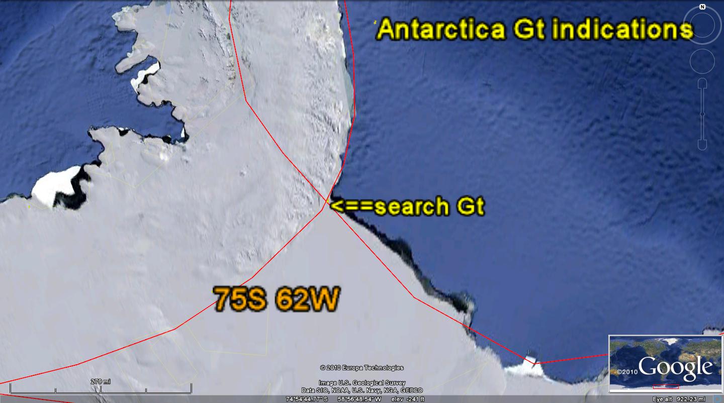
A CASE WHICH PUZZLES ME YET (AND I HAVE TO SOLVE IT AS PART OF THE PACIFIC NA QUADRANSPHERE MOVEMENTS) IS THAT OF THE NNW MOVEMENT OF THE NE PACIFIC BASIN INTO ALASKA PROPER. I EXPECT THAT THE MOVEMENT IS DUE TO THE EO STRIKE WHICH HAS ROTATED THE OLYMPIC PENINSULA AND VANCOUVER ISLAND (AT THE TERMINATION OF THE CASCADE VULCANISM AND THE BEGINNING OF A 45 DEGREE ROTATION) TO THE NW OF THIS EAST PACIFIC COASTLINE. THIS IS SHOWN BELOW, TO DETERMINE WHETHER THERE IS INDICATION OF AN ASTEROID IMPACTING THE ANTARCTIC REGION (POSSIBLY THE ELTANIN STRIKE):
 HOWEVER, THERE ARE TWO FEATURES BLOCKING ANY ANALYSIS OF THIS POSSIBLE YOUNG STRIKE: a. THE OLDER PTr (PERMIAN EXTINCTION AT THE BOUNDARY OF PERMIAN-TRIASSIC PERIODS) OBSCURES ANY LESSER TRANSFORMS; AND,
b. THERE IS NO DISTURBANCE OF THE ORIENTATION OF THE OLDER TRANSFORMS, THAT I CAN SEE. MY OVERALL CONCLUSION IS THAT THERE IS NO ASSOCIATED YOUNG ASTEROID STRIKE; THIS LEAVES THE PREVIOUS ANALYSIS OF THE VALLEY OF TEN THOUSAND SMOKES AND THE Gt EXPRESSIONS IN THE DENALI PARK (WHICH I HAVE FOUND AND SEEN, IN THE AREA NEAR THE DENALI INSTITUTE) RELATED TO CORIOLIS ROTATION OF THE ALEUTIANS.
 BASED ON MY ANALYSIS AND RE-ARRANGEMENT OF THE VARIOUS CONJECTURES IN THE LITERATURE- OF THE CORED AND DOCUMENTED ELTANIN ASTEROID STRIKE OF 2.15 M.Y.- I HAVE SOLVED PART OF THE PUZZLE OF THE DISPLACED GAKKEL RIFT ZONE (NEAR THE NORTH POL- SUPPLANTING THE LOMONOSOV RIDGE TO THE WEST). USING FAINT SHEAR LINES FROM ROTATIONS OF ANTARCTICA, I HAVE PLACED THE ANTIPODE OF GAKKEL'S OPENING, AFTER FORMING IN THE 41 M.Y. STRIKE (EO), AT 87S 122W LONGITUDE. I ANTICIPATE THAT THIS STRIKE CREATED A BULGE AT THE ARCTIC (CONCOMITANT SINKING OF PART OF ANTARCTICA) WHICH INITIATED THE ICE AGE, BY INCREASING THE ELEVATION THERE. MORE IMPORTANTLY, THE EARTH'S ORBIT ABOUT THE SUN WAS WIDENED AND IS SLOWLY RETURNING TO NORMALCY:

 THE GAKKEL RIDGE- NEAR THE NORTH POLE- WHICH IS REPORTED TO HAVE THERMAL ACTIVITY- IS SHOWN BELOW. THIS FITS WITH THE CONCLUSION MADE PREVIOUSLY THAT THE ACTIVITY CAUSING ICELAND TO REMAIN STATIONARY (WITH RESPECT TO THE MAR AND THE QUADRANSPHERE) IS DUE TO THE 41 M.Y. STRIKE OFFSETTING THE MOVEMENT CREATED BY THE 65 M.Y. KT STRIKE. EO INFLUENCE MOVES SOUTHWARD, AND KT INFLUENCE MOVES NORTHWARD- RESULTING IN ROTATION OF ICELAND, WHILE IT REMAINS ROUGHLY IN THE PREVIOUS POSITION: THIS IS ENLARGED BELOW:
To PROCEED FURTHER, WE HAVE TO CONTEND WITH THE SHEAR ZONE AT THE TOP OF THE EQUATORIAL BULGE, EB; THIS CREATES A REACTIONARY CELL, RC, WHICH DRAGS EASTWARD (AS NOTICED IN THE TRANSFORMS BELOW ICELAND). THIS STARTS AT 38N, SOMEWHAT LESS THAN 40N- WHICH IS THE MENDOCINO EXPRESSION OF TOP OF EB. THIS DIFFERENCE SHOULD BE REMEMBERED, AND USED FOR THE ATLANTIC- TO TRY LATER TO EXPLAIN THE SAHARA BULGE, WHICH IS ANTI-PODAL TO THE MARIANAS TRENCH AND POSSIBLE STRIKE IN THE INDIAN OCEAN NW OF AUSTRALIA.

THE ATLANTIC EXPRESSION OF THE QUADRANSPHERE IS DISRUPTED (IN ADDITION TO THE SHEAR AT THE TOP OF EB) BY THE FOSSIL TRACE OF THE NW PERMIAN SHOVE TOWARD APPALACHIA, BUT ALSO BY THE CHICXULUB STRIKE- WHICH HAS ELIMINATED SIMPLICITY, AS OCCURRED AT MENDOCINO. NOTICE THAT THE TRACE IS ALMOST OBSCURE. WE WILL PUT THIS FORWARD AS A TENTATIVE PATH, BELOW, BUT WHICH WILL AWAIT INPUT FROM OTHER ANALYSES IN THE ATLANTIC:

BELOW I PRESENT 2 ALTERNATIVES:
1. THE NORTH ATLANTIC SHOWS A CLEAR ROTATIONAL CELL ABOVE 38N LATITUDE, WHICH WOULD BE A REACTIONARY CELL, RC. THIS IS AT THE APPROXIMATE EQUIVALENT TO THE MENDOCINO CELL ROTATING ABOUT 40N, BUT HERE THE EFFECT IS ENTIRELY NORTH OF THE LATITUDE WHERE THE TIDAL SHOVE OF THE EQUATORIAL BULGE, EB, CAUSES THE LOWER LATITUDES TO MOVE RELATIVELY TO THE WEST.
2. THE ALTERNATIVE IS ONE NOT AS CLEARLY SHOWN AS WITH THE MENDOCINO ENTITY. FROM BERMUDA TO MADEIRA ISLANDS, THERE WOULD BE A CELL HALF OF WHICH IS ABOVE 38N AND HALF BELOW. THIS IS FAINTLY SHOWN, BUT EVIDENTLY MADE OBSCURE BY THE ROTATION OF CRUST INTO THE APPALACHIANS DURING THE END OF THE PALEOZOIC. COMPARE THE TWO:
BELOW ARE THE 2 VIEWS WITH MY INTERPRETATIONS OF THE ROTATION NEAR THE MAR IN THE ATLANTIC. IT APPEARS THAT THE YOUNGER IS THE RC ABOVE THE 38N BORDER OF EB, BY VIRTUE OF THE INCIPIENT TAIL IN THE EAST ATLANTIC. THIS CELL OVERPRINTS THE OLDER ONE CREATED BY THE PERMIAN IMPACT, NE-WARDLY TOWARDS APPALACHIA.


THE CIRCULATION AROUND THE MAR, FROM 24-52N LATITUDE IS SHOWN BELOW:

THE NORTH AMERICAN QUADRANSPHERE, QSna, is an ELLIPSE WITH GAPS. It is traced from the Aleutian Iislands via the HI-Emperor Seamount chain to Hawaii, then a gap occurs until Baja, Mexico; it can be traced to the Puerto Rico trench, at which there is another gap. From the MAR (CCW)through Iceland, it tracks to GAKKEL RIDGE, Arctic Ocean, at which THE MOVEMENT IS CW- OFFSETTING THE CCW MOVEMENT SOUTH OF ICELAND.
The movements appear to have been accelerated by 2 asteroid strikes- the KT and EO events of 65 and 41 m.y. age (MEASURED AT INFLECTIONS OF THE HI-E chain).