SUMMARY:
WHEELER PEAK AND GREAT BASIN NP ARE OF 7 M.Y. AGE, AND ARE PART OF A LARGER ANOMALY AT 41 M.Y. (SPECULATED TO BE CAUSED BY AN INCREASE OF THE EQUINOXIAL CYCLE FROM 20.5 DEGREES, TO THE PRESENT 21.5 TO 24.5 TILT OF THE POLES).


Google earth photo above shows how CANYONS ARE FORMED, when SOLAR TIDES OFFSET LUNAR TIDES. Two ARCS ARE CONVEX in opposing directions, which opens a LINEAR SLICE of the crust. This weakens the rock (with the shear along the advancing SLICE), and over TIME- HALF MILLION YEARS, IN THIS CASE- the atmospheric precipitation "finds" the weaknesses. These canyons are shown younger than the OUTWASH PLAIN to the east, and that is to be expected- since CANYONS OPEN NOTICEABLY as the sediments wash away (sedimentation follows the slightest rise, and canyons develop after a significant rise). This type of ACTION- OPENING of CANYONS in the CRUST- is RARE- DEVELOPING ONLY in the NE corners of BLOCKS of CRUSTAL-TRAPEZOIDS DEFINED by analemmas, where the RATIO of CCW/CW ARCUATE FEATURES (RISE/SINK) = 1.6, the same as the RATIO of orbit times for EARTH/VENUS. EXAMPLES easily seen on GOOGLE EARTH include GULF of MEXICO, the ALEUTIAN SPIRAL, and the CENTRAL AMERICAN CURLICUE.
INTERMEDIATE SUMMARY:
WESTWARD-MOVING EARTH TIDES are exhibited in The GREAT BASIN NP. It is youthful- less than 8 m.y. and lies within a larger 41 m.y. elliptical arrangement of the BASIN and Range Province. It exhibits actively-moving MILANKOVITCH CYCLES of 100 k.y. and younger arcuate-shearing features, easily measured on GOOGLE EARTH. ALLUVIAL FANS may be measured for AGE, and the drainages to the east may be seen to be augmented by small canyons created by opposing EARTH TIDES- allowing water to rise near the east edge of the rise. Advancement of the RANGE to the west may be measured by westward-moving ELLIPSES, moving at a separation of 40 meters per cycle, for 4000 year cycles (10 mm/Year).
The Great Basin is approximately 7 m.y. in AGE, and it is part of a larger feature- the 41 m.y. ELLIPSE within which it rotates. This is shown in the above GOOGLE EARTH view, where the CW rotation of the larger basin borders on the GREAT SALT LAKE. The Great Salt Lake, bordering the Wasatch Range shows that the Great Basin is rotating CW, since all sinks rotate similarly. Remember that RISES rotate CCW (the bordering CP), and they mesh with the adjoining SINK, CREATING ONLY MINOR HEAT and VULCANISM. The age of 41 m.y. is a major indicator of EARTH CHANGE, since this age occurs for the following:
1. The rise of the Sierras, in California;
2. The incipience of the Central American curlicue;
3. The initiation of vulcanism near Taos, NM, in the Llano Quemado- which proceeded to erupt to the west around the southern edge of CP;
4. The formation of an analemma in the Gulf of Mexico;
5. Rotation of the Great Plains, from the Mississippi River to the gap in the Rocky mountains, at the Arkansas River gorge; and,
6. Over-riding of the continent at the Olympic Mountains, WA- as evidenced by the Eocene rocks at the base of the anomaly.
A PREVIOUS BLOG THIS YEAR (SCROLL TO EARLIER SUBMISSIONS) HAS SPECULATED THAT THERE WAS A SIGNIFICANT CHANGE IN the TILT OF THE POLES AT THE 41 M.Y. AGE, BASED ON THE APPEARANCE OF THE KIMMEI SEA-MOUNT OF 41 M.Y (in the Hawaiian-Emperor seamount chain) RADIOACTIVITY-DATED AGE. NOW THIS NEW FINDING THAT THE GREAT BASIN STARTED ROTATING AT THE SAME AGE GIVES ADDITIONAL CREDENCE TO THIS SPECULATION.
LOOKING AT SMALLER DISTANCES AND TIMES, WE FIND THAT THE SOLAR TIDES ARE INVOLVED, SUCH AS TO CREATE CONVEX ARCS TO THE EAST. ALONG WITH THESE, THERE ARE STRAIGHT LINE LINEARS (NOT CURVILINEARS), WHICH OCCUR WITH INSTABILITIES OF GRAVITATIONAL WAVES. DATES CALCULATED AT OR NEAR THESE LINEARS ARE HIGHLY SUSCEPTIBLE TO LARGE ERRORS, AS WAS SHOWN FOR THOSE OCCURRING NEAR SULLIVAN KNOLL, UT, in an earlier submission.
 I HAVE FOUND THAT A LINEAR (A STRAIGHT-LINE OR TROUGH) IN THE NE CORNER OF A TRAPEZOIDAL BLOCK OF EARTH CRUST, BORDERED BY CONVEX TO THE EAST (SOLAR) AND CONVEX TO THE WEST (LUNAR)- OPPOSITELY-OCCURING ARCS ABOUT THE LINEAR ESTABLISHES A MAJOR GRAVITATIONAL SPLIT. THIS "FIXES" AN UPLIFT, WITHIN WHICH THERE DEVELOPS A CANYON OR TROUGH. THE TROUGH WILL ALLOW HEAT, ANOMALOUS WATER, OR VULCANISM TO RISE. THIS IS THE CLASSIC CANYON FORMATION. NOTICE THAT THIS OCCURS SEVERAL TIMES IN THE GREAT BASIN:
NOTICE THAT THE SINKS IN THE VALLEY TO THE EAST ARE ONLY OF 1 M.Y DURATION. THIS TIME IS AN INTERVAL, NOT PERTINENT TO THE INITIATION OF THE GREAT BASIN UPLIFT- WHICH STARTED IN MIOCENE TIME. RADIO-DATING ESTABLISHES AN AGE PRIOR TO NOW. ARCUATE ROTATIONS OCCUR, AND ARE PRESERVED, FOR AN INDETERMINATE PERIOD- SINCE TIME OF DEVELOPMENT (THIS COULD BE THE AGE). IF THEY ARE IN PROGRESS, AGE WILL BE THE SAME AS THE TIME INTERVAL. SINCE MILANKOVITCH CYCLES MAY PERSIST (IN VIEW), THEY MAY NOT YET BE ERODED FROM THEIR INITIAL LOCATION. HENCE, ONLY WHEN TWO ARCS ARE ADJACENT, CAN WE BE SURE THAT THEY FOLLOW EACH OTHER, IN TIME SEQUENCE.
WHAT WE HAVE FOUND PERTAINS TO GRAVITATIONAL WAVES, WHICH ALLOW FEATURES IN NE CORNERS OF CRUSTAL BLOCKS TO EXHIBIT AN "INSTABILITY OF THE WAVES". I SPECULATE THAT THIS OCCURS IN 3 DIMENSIONS IN THE ATMOSPHERE AND IN SPACE, WHERE INSTABILITIES PREVENT PLANETS' LOCATIONS IN THE ASTEROID, KUIPER, AND OORT BELTS. IN SHORT, THIS RELATES A NEW ACTIVITY OF GRAVITATION- WHICH BEHAVES SIMILARLY TO LIGHT (VELOCITY, WAVE NATURE, AND FREQUENCY?)
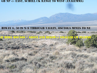
 GREAT BASIN has developed alluvial fans on the slopes to the west, and DRAINAGES to the east. These result from EARTH TIDES, where solar offsets lunar- convex to the west- and where a LINEAR SEPARATES the opposing movements to the east and opens the sediments for springs, seeps, and warm water. This allows shallow water for farms and "GOOD LIVING" along the edge of the basins. NOTICE the opposing ARCS along the drainage to the east.
 ABOVE IS A FINAL ASSESSMENT OF THE LARGER REGION ABOUT THE GREAT BASIN NP, NV: THIS PHOTO SHOWS THAT THE ANALEMMAS IN THE B&R PROVINCE ARE MORE COMPLICATED THAN THOSE IN THE COLORADO PLATEAU, CP! SINCE THE MOUNTAIN RANGE IS TILTED UP TO THE WEST (OLDER FORMATIONS ARE EXPOSED ON THE WEST SIDE OF WHEELER PEAK), THERE ARE ALLUVIAL FANS ON THE EAST SIDE AND STARK SCARPS ON THE WEST. THE DRAINAGES THEREFORE FLOW TO THE EAST, SINCE THEY CANNOT CLIMB THE GRADE TO THE WEST. THE DATE OF 7 M.Y. IS CONFIRMED FOR THE OVERALL AGE OF THE RANGE, WHICH IS A PART OF A LARGER ANOMALY, STARTING AT 41 M.Y. (I SUSPECT THIS WAS INITIATED BY A SHIFT OF THE EQUINOXIAL CYCLE FROM 20.5 TO THE PRESENT 23.5 DEGREES- OF A CYCLE OF 21.5-24.5 DEGREES.) THIS IS PART OF A 13 M.Y. MOVEMENT, WHICH PRODUCES THE RHYOLITIC EXTRUSIONS AT THE IDAHO BORDER, AND THESE MOVE EAST-WARD BECAUSE OF THE DOMINANCE OF SOLAR TIDES IN THE B&R. THERE ARE LUNAR TIDES, AND THEY ARE ON THE WEST SIDE OF RANGES (WHICH ARE CONNVEX TO THE WEST); THEY DETERMINE THE SMALLER ARCS FOUND THERE, SO THAT THERE OCCUR MOVEMENTS TO THE WEST- SUCH AS THE SIERRAS PRODUCING THE MAMMOTH HOT SPRINGS ANOMALY. THIS IS FOLLOWED BY LINEAR-PRODUCING SOLAR TIDES EACH 1-2 M.Y. AND THIS IS THE DOMINANT ENTITY IN THE B&R.
GREAT BASIN RANGES move eastward with TIME since their incipience at MIOCENE 13 m.y. AGE:
ABOVE GOOGLE PHOTO divulges that the B&R has moved eastward, as it has created further east N-S ranges each million year period. This is followed by a west-developing arcuate range in the 2 million year entity; the succession is:
1. The Sierras move westward (41 m.y. uplift with the speculated EQUINOX TRANSITION from 20.5 degrees, arcuate CONVEX to the west), which opens the immediate valley to the east- such as MAMMOTH LAKE and HOT SPRINGS. This valley is then followed by a 1 m.y. RANGE to the east (RISE within a SINK);
2. THE FOLLOWING 13 (12?) m.y. TIME INTERVAL produces a series of N-S ranges, terminating at the TRANSITION ZONE, adjacent to CP;
3. Great basin is the 7th in the series of the 13 (or 12th?) proceeding towards the CP transition zone- which terminates the MIOCENE origination of ranges and valleys within the CW rotation around the entire B&R (including the 12-13 rhyolitic extrusions at the north border- SNAKE RIVER and Yellowstone blasts); and,
4. Each million year range is followed by a 2 m.y. rotation to the west (convex west)- developing an elliptical basin. These fit within an ANALEMMA which includes the large RISE and the somewhat smaller SINK (BASIN).
ALL OF THIS IS FASHIONED BY THE GRAVITATIONAL ADJUSTMENTS OF MOONS, PLANETS, AND SUN of the EARTH’s WOBBLES, with the exception of about 4% influence from HEAT from the SUN and radioactivity, magnetic-electrical variations, and extra-solar anomalies.