Thursday, March 14, 2013

The GEOLOGY CULTURE’S contribution to EARTH SCIENCE is a VAST TERMINOLOGY, with a HALF-VAST set of THEORIES: Mantle Plumes, Hotspots, and continually-adjusted PLATES. These can be DISCARDED and replaced with the Physics of GRAVITATION:


 These must be discarded (NOT just adjusted), and REPLACED with GRAVITATIONAL ROTATING-SHEARING MOVEMENTS- which are more accurately a series of LINEAR JERKS, defining MULTI-SIDED POLYGONS:
CIRCULAR NIPPLE, from the Watchman trail, Zion NP, shows the TOP of a ROTATING UPLIFT- which is the FULCRUM of a SPIRALING RISE. This has fallen from the PINNACLE, but not before it INCURRED NORMAL FAULTING (rotations typically exhibit a SPLIT through the middle, and the BEGINNING of this is a CIRCULAR HOLE near the center:

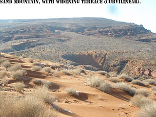
Sand hollow and Mountain is an easily-hiked PROTRUSION  and it appears benign; it is NOT, SINCE there occur DEEP BOX CANYONS- formed by EARTH WOBBLE and GRAVITATIONAL SHEAR:
When you find LOOSE SAND in an old OUTCROP, it has been sheared by the CIRCULAR SHEARING ROTATIONS:


CURVILINEAR, above, is a SERIES of LINEAR JERKS, when inspected at CLOSE RANGE:


GOOGLE EARTH Sand Mt-Hollow photo above, is not only FLESH-COLORED, but exhibits an INVERSE NIPPLE; it is SHOVING towards Ft. Pierce Wash to the South:
The CIRCULAR HOLE above is a SINK- SINKHOLE, which lies at the DRAINAGE BOTTOM, and is not filled by debris because the DEVELOPMENT is faster than EROSION! Notice the circular path of the loose sand from the Jn Jurasssic Navajo formation. It blows to the south in WINTER, AND RETURNS in the summer. Consequently, a backhoe must be kept there for grading the sand off the road. The loose sand depends ENTIRELY on the GRAVITATIONAL SHEAR:
There are deep SHEER-WALLED BOX CANYONS in the distance:
Below is a trail made by the hiking group:
Should you look CLOSELY, you will see the LINEAR JERKS- which can be measured by compass, to determine the CIRCUMFERENCE, DIAMETER, and AGE= diameter/EARTH TIDAL MOVEMENT RATE:

The TYPICAL CENTER HOLE is shown below:


LARGER ENTITIES show that LATERAL GRAVITATIONAL SHEAR-ROTATION operates on many scales: meter, km, 1000 km, and 10,000 km- the one showing the EARTH CIRCUMFERENCE of 40,000 km:

WEATHER PATTERNS follow the EARTH WOBBLE RULES, also- above. Below is the google earth view, showing that ALASKA is a YOUNGER PROTRUSION ("TIT") than the CIRCULAR ORB- which proceeded from the ORIGINAL UPLIFT of the CRATON:


At the ARCTIC SEA:


You should ask "How is that UPLIFT has a MOVEMENT RATE of 1km/m.y. (mm/year), whereas the NORMAL TIDAL SHIFT is 10.24 to 30.72 mm/yr"?
I will answer this with case HISTORIES of Canadian SHIELD (CRATON) and the Australian WESTERN CRATON:


Whereas the Canadian CIRCULAR ORB-UPLIFT is near 2 b.y., the Australian case is near 3 b.y.! This relates that Australia formed first and the NA Continent later!  This is true by GEOLOGICAL RADIOMETRICAL MEASUREMENTS, and is indicative that the SEQUENCE 4096, 3072, 2048, and later the 1024 m.y. TIME INTERVALS (according to the BINARY THEOREM) are PERIODS of GREAT CHANGE in the EARTH'S CRUST!


How can we tell these GREATLY-DIFFERENT RATES (1 vs. 20.48 mm/yr, for NA) apart? The older ORBS are circular, and leave a FAINTER TRACE due to the VAST AGE. The CRATONS are nevertheless still EXPANDING, but have been offset in the UPLIFT by EROSION. My tentative measurements indicate that UPLIFT= HALF the WIDENING. It is interesting that the CRATONS are NOT HIGHLY ELEVATED, and are also GRANITE-LIKE, due to not having been significantly influenced by LIFE PROCESSES! An interesting GPS MEASUREMENT would be to measure the vertical uplift.

Africa:

South America Amazon Basin:


The ANTIPODE to the South American DEPRESSION is the Island of Kalimantan (Borneo)- which is a RISE surrounded by LINEAR JERK ISLANDS and shallow seas:

A note about an ANTIPODE- which is the opposite side of the earth from a FEATURE: these do not have to involve the MANTLE-CORE, since the EARTH is similar to a POOL BALL. The GRAVITATIONAL WAVES creates HIGHS and LOWS around the earth- similar to RAYLEIGH WAVES. A shock wave creates LAND WAVES, and the most researched of these is the 16 m.y. BASALT WAVES of the Columbia Flood Basalts. These are not water waves, as has been speculated by GEOLOGISTS (from the spilling of an immense lake to the east), but are WAVES of EXTRUSIVES.


Shown above is the South American ORIGINAL ORB of 4096 km, which has expanded 1 km/year since GRAVITATIONAL inception- at a rate of 1 mm/year. Appraisal of the CIRCULAR CONTINENTS shows that Africa, North, and South America have risen and expanded in ALL DIRECTIONS until EROSION has offset the RISE (steady state, in engineering parlance). This results in 2 MOVEMENTS, which have to be DISTINGUISHED: Upward-expansive and SIDEWAYS-LATERAL. The Lateral occurs with EARTH TIDES (similar to oceanic tides, slower due to the MUCH GREATER VISCOSITY of the EARTH’S CRUST), and the UPLIFT, due to VERTICAL ATTRACTION of Moon and Sun. The CIRCULAR ORBS have been moved by both GRAVITATIONAL INFLUENCES, and it is only where they can be distinguished by the “round” portion that we can separate them. 
 In CANADA, the original orb is called a CRATON- similar to that in Australia; it is OLDER than all else on the continent (because it preceded all APPENDAGES, called “TITS” which are smaller and younger). It is “round” but gradually becomes ELLIPTICAL as it extends N-S with time.
 This occurs with GRAVITATIONAL LATERAL MOVEMENT (in addition to the VERTICAL ATTRACTION), and these extensions allow the differentiation to be determined. NOTICE the LARGEST ORB has later-formed APPENDAGES (PROTRUSIONS, or "TITS"), and these form a PATTERN for the entire EARTH (including the ATMOSPHERE, LOOP CURRENTS, and CRUST of the earth):

The Canadian SHIELD-CRATON is composed of several ARCUATE FEATURES- showing that it has been LATER MODIFIED, after the 2 b.y. INITIATION.
The North African CRATON has been greatly modified  so that considerable SUBJECTIVITY is exhibited! We can get added information from the KAMIL CRATER. Finding that these craters are located in CRITICAL GRAVITATIONAL TIDAL LOCATIONS (according to the BINARY THEOREM), puts a NEW INTERPRETATION on what is ACCEPTED as METEORITE CRATERS. My belief is that meteorites fall yearly  and when they strike an ALREADY-STRESSED location, they "TRIGGER" a COLLAPSE- SIMILAR to SINK-HOLES in Karst-sensitive areas. These are generally EXHIBITED in ELLIPTICALLY-FORMED LINEAR-JERKS:

KAMIL CRATER is located at an ARCUATE TIDALLY-CALCULATED fulcrum in Egypt (notice that it has created a BULGE- GREAT MEANDER- in the Nile River):

Europe is DIFFERENT from the other ORBS; it is the COUNTERPART of the RISING (think CP) CIRCULAR flat WOBBLE CYCLE- being the equivalent of the Basin and Range (tilted, irregular, faster moving, TIDALLY) which is more difficult to decipher:

Now we have a handle on the ANOMALOUS CASPIAN SEA- deepest, reverse ANALEMMA, LARGEST VOLUME, and which feeds the Karabogas EVAPORATION BASIN. It DIVIDES the Asian from the European CRUSTAL BLOCKS. We can proceed to DECIPHER the ORB of ASIA:

The INTERESTING FINDING for Asia is that it is YOUNGER than the other CIRCULAR FEATURES:
1. Asia at 1.024 b.y. was the latest CONTINENT to rise;
2. North America and Africa rose intermediately; and,
3. Australia is the OLDEST, while South America is still an ENIGMA, since it has a DEPRESSION (Amazon) instead of a rising ORB!
This yields some ideas on CONTINENTAL EVOLUTION- that Australia was directly UNDER the Moon-Sun CONJUNCTION initially; It THEREFORE  has moved in an ARC to near ANTARCTICA and later northward (NOW), creating the TONGA TRENCH with it fastest TIDAL MOVEMENT RATE! The arc should be ANALEMMA-SHAPED, creating the South Pacific Islands RISE and a SINK oppositely to the rise:


Don't forget Antarctica, where the AGE is 2,048 m.y. ALSO:


Above was a 2nd TRIAL; the first found a YOUNGER ORB, where the CIRCULAR Uplifts are STACKED!


This is DIM, because the ICE covers most of the RECORD; however, we know that Paleozoic COALS have been found- meaning that the continent was in the Temperate zone at the time of pre-256 m.y. (Mississipian to Pennsylvanian) The LITERATURE reports 3 b.y. outcrops, and I have found that the analysis yields a 3.072 b.y. ORB. This all developed before the GREAT UNCONFORMITY of 1.024 b.y., so that the CONTINENTAL MASSES were still EXPANDING in all directions, simultaneously with EARTH TIDAL MOVEMENTS of at least 10.24 km/m.y.!

 Along the way I found a MISSED 1024 km DIVIDER in the Atlantic- west of the MAR, and this PROLONGS my WORK:


STAY TUNED, for more EXCITING developments; I have NO IDEA where this is leading!


Sunday, March 10, 2013

Linear Mountain Ranges: What forms them, and Why are ARCHIPELAGOS associated with them?


Hiking a LARGE SCALE mountain linear is difficult; let’s present one that can be hiked and ANALYZED, LOCALLY. The DOUBLE Virgin River BEND is such an INCIPIENT DEVELOPMENT, and can be explored completely- mostly by auto:

Notice several FEATURES which will be the KEYS to understanding the LINEAR Mountain Range DEVELOPMENT:
1. The ANTICLINE along the Virgin river is essentially LINEAR- ignoring subsequent SMALL MEANDERS and Protrusions;
2. The anticline lies WITHIN a POLYGON- 8 sides in this case, making it an OCTAGON with eight 45 degree TURNS;  


3. A young VOLCANO (LEEDS- 60 k.y.) lies at the FULCRUM of the 45 degree turn;
4. The SHARP TURN to the left “kicks up” Red Mountain, similarly to gravels being kicked up on the right side after a SHARP left turn in your auto (this is from GRAVITATIONAL ENERGY- moving the CRUST LATERALLY); and,
4. There occur BASINS on either side- the highest in elevation being on the inside of the polygon. This anticline is SPREADING, THRUSTING, and covering more ground as time ensues. You can CALCULATE its AGE by using the EARTH TIDAL RATE and the CREST-TO-CREST WIDTH: AGE= width/24.1 mm/yr.- about 82,988 years for Quail Lake.


Above is a CAMERA VIEW, taken from the west scarp- which allows APPRAISAL BELOW of the ANTICLINAL DYNAMICS:
The HISTORY allows the various MOVEMENT RATES to be calculated (1+ degrees/10 year- similar to those found for d/k.y. and d/m.y.):

The best ANALEMMA yet, was found nearby, in the Triassic Shinarump sandstone:

Is is FETUS-SHAPED, SIMILAR to the STONEMAN Lake ANALEMMA:


A hike above the village of Harrisburg- as shown on the TRAIL MAP 2 photos down- yields INTERESTING DISCOLORATIONS from exotic MINERALIZATIONS (probably from SOLUBILITY CHANGES of Iron Fe and Manganese Mn- which are GEO-CHEMICALLY-ASSOCIATED):
TRAIL is steep, but well-marked:


 Now notice the SIMILARITIES with a FEATURE you can drive, but which is so large that you will not be able to hike or confirm- the SIERRAS, CA and the associated CENTRAL VALLEY:


The SIERRAS have the following SIMILARITIES:
1. They are a LINEAR- which orients NW-SE, and which has Mammoth Hot springs and Volcano on the extreme SE periphery;
2. Mt Whitney is the "POP UP" at the southern edge;
2. The POLYGON is to the east- where there occurs a BASIN higher in elevation than CENTRAL VALLEY;
3. Central valley is the BASIN between the COAST RANGE (lower) and the Sierras (higher)- similar to the  Quail Lake depression; and,
4. The entity can be explored by measuring the ASSOCIATED POLYGON- which is in NV- the Basin and Range Province!
The SCALING FACTOR is 40:1- 800 km for the sierras, and 20 km for the Virgin LINEAR SEGMENT. We will present other LINEAR RANGES, where the SCALING may be analyzed for GRAVITATIONAL TIDES MULTIPLIERS. The AGE MULTIPLIER for Sierras/Quail anticline= 8.6 m.y./82,988 years= 103.63. This is REMARKABLY NEAR 102.4 (1.2% variation)- which would be predicted by the BINARY THEOREM. Remember that the JUPITER MASS RATIO for all Solar bodies, except the SUN is 2.5, and this RATIO of 103.6/40 is near 2.5. What this amounts to is that the PERPENDICULAR (orthogonal) linears of Sierras NW-SE and Quail NE-SW are 2.5 to one, and that the GRAVITATIONAL LATERAL MOVEMENTS are derived from the influence of Jupiter (which is inferior to Venus, with its ORBIT RATIO of 1.62). PRELIMINARILY, the ratios proceed in the following SEQUENCE:
Mercury: 1.2- 1.35, Venus: 1.62, Mars: 2.0, Jupiter: 2.5 etc.- each ratio being approximately 1.25 x previous ratio. There may be a MORE ACCURATE SERIES: 1.28, 1.6, 2.0, 2.5, 3.125 (Saturn), 3.9 (Uranus), 4.88 (Neptune). These ratios may be EXPERIMENTALLY found from the analysis of POLYGON ORTHOGONALS:


Viewing the Sierras LINEAR- to determine whether there is an INFLECTION in the trace (as there occcurs for the San Francisco Bay split), we find that there could be an EXPANSION:

There is a 41 km inflection; this is a MINOR ROTATION, but one which allow the SUTTER Buttes ENIGMA to be incorporated: it hints at an INTERFERENCE from Mercury's GRAVITATIONAL FORCE:


Atlas Mts. below in N. Africa, is a MARGINAL CASE, but it lies along the 36 N parallel, and this may prove to be an important factor (Owen Stanley Range in New Guinea, lies along the Equator and is oriented E-W):
The case of IRIAN BARAT (west Irian, in Bahasa Indonesia) or New Guinea- the old name- is EXPANDED, BELOW:

Since these POLYGONS occur on many scales, we can further INVESTIGATE them in the field, by viewing them on the NW side of the Quail ANTICLINE:

The PRINCIPAL INTENT is to determine the PERCENTAGE of NON-RECTANGLES (multi-sided POLYGONS, with more than 4 sides); this will allow an appraisal of the use of linear "JERKS" as compared to CURVILINEAR ARCS! It is just a few percent of all MULTI-SIDED DISPLAYS; mostly they are the ORTHOGONALLY-FRACTURED HORIZONTAL BEDDING (rectangles).
I made a COUNT from a NW-FACING slope of the Quail ANTICLINE (SE limb), and there are more than 100 separate POLYGONS- mostly RECTANGLES. These have 2 ARCS, 12 with 5 or more segments, and the rest RECTANGLES. This is 1/8th NON-RECTANGLES! I'll devise a TEST to determine whether a PARTICULAR RATIO "belongs" to a separate PLANET. e.g. .125 to Jupiter (12 years for an ORBIT around the sun).


 These common stratigraphic layers are the result of a sequence of BASINS-RISES, which occur due to GRAVITATIONAL creation of SINKS-MOUNDS (if you look with a view of TRENDS, you will see another ANALEMMA- figure 8, with the LIGHT-COLORED ROCKS):

Compare these with those foud in MAN-MADE ASPHALT (in a highly-stressed spot- the Lake dam broke in the 1990 period). The COUNT of NON-RECTANGLES is still about 1/8th, but the DECAGON PROPORTION is LARGER:


Hills on the NORTH SIDE of Quail Lake are loaded with INFORMATION; they exhibit PICTURE STONE whenever there is ROTATIONAL SHEAR:
PATINA due to Manganese sometimes gives way to GOLD-COLORED SHEEN! This area is serviced by 4WD roads- which lead to impressive views of Quail Lake:


We found the best-developed ANALEMMA I have seen; it is complete- showing the FIGURE 8 on all shearing-rotating sides:

THIS is SIMILAR to the FETUS-SHAPE of Lake Stoneman, AZ ANALEMMA (although ORTHOGONAL)- shown below:


The SCALE FACTOR for these 2 features is approximately 2 km/.8 m= 2500:1! Should the Stoneman COLLAPSE FEATURE require 60,000 years for development, the sandstone development would be near 20 years- not counting the REVERSAL in TIDAL MOVEMENT RATES. This would triple the time required, but this still is a SHORT-TERM EFFECT!

A complete ANALEMMA is related to the ANNUAL PATH of the SUN, relative to the EARTH'S POSITION:


 Here's another, which GEOLOGISTS are not able to fathom, but which they agree is fairly YOUNG: the Grand Canyon POLYGON which splits the Kaibab UPLIFT, and which has connected by STREAM CAPTURE in the last 2 m.y.:


There is UNCERTAINTY about the dating, but it is near the 1-2 m.y. TIME INTERVAL. Similarly to Quail ANTICLINE (a younger rise), it is splitting along the Kaibab uplift axis, and the PROGRESSION is as shown above.

ASSOCIATION of LINEAR Mountain Ranges and ARCHIPELAGOS
 The easiest start with this CORRELATION is with my ‘ol STOMPING GROUND' of Indonesia (3 years in the OIL “bidness” there). I visited the important islands of Bali, Java, Kalimantan (Borneo), and Sumatra; this set of islands becomes progressively smaller to the east, and that should tell you  that the timed movement is in that direction. Now we understand that the ROTATION is around the FULCRUM of the RISING SPRATLEY ISLANDS. Each island represents a LINEAR “JERK”, and this accounts for the regular CATASTROPHIC QUAKES!


This occurs with Florida also (a "TIT" off the CIRCULAR PORTION of Qsna), where the elongated part of the state will become a MOUNTAIN RANGE in sufficient time! Now it is just a small RISE- 230 feet maximum elevation, as I remember from my USAF DAYS there at MacDill AFB. The GULF STREAM LINEAR divides the Okeechobee SINK from the BAHAMAS RISE:


This is an ARCHIPELAGO, but recognized as a "string of KEYS". It progresses from the LINEAR, just as INDONESIA (ARCHIPELAGO) rises to the SE (Timor is the YOUNGEST-SMALLEST):

How does this incorporate the QUAIL (VIRGIN) ANTICLINE? The anticline is a younger-smaller feature, which is also RISING  SPLITTING through the middle, and an INCIPIENT MOUNTAIN RANGE (requiring a few more m.y. for RECOGNITION):


BELOW are ANALYSES and drafts not published, which NOW should INCORPORATE the important POLYGON LINEAR SHEARING (found subsequently). This will be UPDATED and revised as more cases are developed:


Below are the steps in progression of Large Features, with Geologic Time of appearance:
1. Starting with the Laramide Revolution, LR, which probably is related to the major EVENT off Yucatan. The whole Western USA reacted-not only in the short term, but on the scale of tens of millions of years. The Rocky mountains continued to rise as part of a hemisphere phenomenon, stretching from Alaska to the southern part of south America.This is our base of reference, and we will assume that features previous to the LR have been offset or modified. We will try to relate this sequence to that which happened post-Permian off Australia in the reaction to the Paleozoic extinction (a correlation will be made along-side the important steps, for the SE Asia and Australia area).
2. The Colorado Plateau, CP, began to rise at 41 m.y (as shown by the radiometric AGE of craters in Llano Quemado (burnt plain, in Spanish), near Taos, NM, and continues, accentuated by the San Juan uplift. This will be presented- AT THE END OF THIS BLOG- in relation to that which is occurring on a small-scale, for the Sand Mountain (also an uplift) in the Hurricane ,Utah region. Refer to the rise of Australia, and the development of the East Indies after the Bedout, or similar EVENT;
3. The termination of the Laramide is noted by the isolation of the region, by inner drainage lakes in the Eocene, and this marks the end of the initial WESTERN USA compression stress phase (although uplift continues and compression is the normal stress in CP today). Australia has risen sufficiently to create Coriolis rotation- which is CW, with rising-in the southern hemisphere;
4. CP became sufficiently elevated to create CCW rotation, and the region is made distinct by the Wasatch Line, which is a demarcation between a rising area- CP- and a sink- B&R to the west.


Sierras act as a vertically-rotating semi-cylinder, with CCW SPIN looking NW.The Sierra Range is entirely located in California, and essentially parallels the CA-NV border, separated from the line by the Death Valley NP. It is also bounded on the SW by the Central Valley, on the SE by the Garlock fault (which traces almost eastward), and by the Cascades on the NW. Mount Lassen active volcano defines the 40N latitude above which there is subduction and below which there are no active volcanoes. The Garlock fault location shows that this results from the movement of the Sierra-Central Valley system moving westward. It is my conclusion that the system is being shoved by the tidal force of the Moon to the west relative to surrounding lowlands. Below is a diagram of the S-CV system as it appears from space:

The first observation is that the Coriolis cells exhibit sharp valleys and shear features on the east side, but not on the west.
This is normal for all cells analyzed in the USA, where uplift, vulcanism, and higher elevations occur.


THE SOUTH SIDE OF THE SIERRAS ARE SHOWN- WHERE THE ACTION OF MAMMOTH HOT SPRINGS, E-W FAULTING, AND GREAT EARTHQUAKES ARE EXHIBITED:
ONE DIFFICULTY THAT MUST BE OVERCOME IS THAT OF THE ORIENTATION OF THE SIERRAS, VERSUS THAT OF THE LARAMIDE, WHEN IT WAS INITIATED. THE LARAMIDE MOVED EASTERLY OR POSSIBLY ENE, WHILE THE SIERRAS DO NOT ORIENT PERPENDICULAR TO THAT. EITHER THE SIERRAS HAVE ROTATED (WHICH, I THINK, HAVE NOT MOVED SUFFICIENTLY) OR THE CHAIN HAS BEEN INFLUENCED BY ANOTHER ENTITY. THERE ARE SOME FAINT TRANSFORMS IN THE OFFSHORE CA, WHICH INDICATE THAT THERE WAS AN ORIGINAL ENE MOVEMENT, AND THAT WOULD SOLVE THE PROBLEM- THE COMPRESSION WOULD HAVE INITIATED THE CHAIN, AND IF IT REMAINED TO THIS DAY (EXCEPT FOR MINOR ROTATIONS) THE CHAIN AND THE COASTLINE WOULD HAVE THE ORIGINAL ORIENTATION.

Assuming that the Sierras have rotated CCW (as shown by the larger distance along-Garlock fault- L.A. coast compared to Mendocino movement on the south side of the fault), then the transform oriented ENE toward the Coloma River, CA will approximate a perpendicular indication to the Sierras. This would agree with the general movement of the Laramide to the ENE, creating the orientation of the Sierras in their present configuration (allowing for some CCW rotation since their inception.
ASSUMING THAT THE AMERICAN, LAST, AND COLOMA RIVERS YIELD TRACES, WHICH WERE CREATED PRE- AND POST-TERTIARY TIMES, THE ROTATION OF THE SIERRAS MAY BE SEEN AS apprximately 10 DEGREES CCW. THIS IS SIGNIFICANT, BUT INDICATES THAT THE LARAMIDE ORIENTATION OF THE CHAIN IS CLOSE TO THE ORIGINAL AT 65 M.Y. AND THAT THE ROTATION HAS PROCEEDED BY CORIOLIS ACTION ON THE WHOLE RANGE. WE NOW MUST DETERMINE WHETHER THE ACTION OCCURRED AT THE SAME TIME AS THE ROCKY MT. SHOVE- BUT DISPLACED BY MORE THAN 1000 KM. THIS SEEMS UNLIKELY, BUT IT MAY BE THAT SIMULTANEOUS SHOVES TO THE EAST OCCURRED (THIS ELIMINATES THE NEVADAN AND SEVIER OROGENIES FROM CONSIDERATION AS BEING PREPARATORY TO THE LARAMIDE SHOVE TO THE EAST- AT A LATER TIME- SINCE THE KT EVENT REPRESENTS A MAJOR DISCONTINUITY IN THE PROGRESSION). WHY AM I SELECTING THE AMERICAN RIVER AS THE YOUNGEST AND THEREFOR THE ONE INDICATING PRESENT REFERENCE? BECAUSE THE AMERICAN IS ORTHOGONAL TO THE PRESENT SIERRAS, AND THE COLOMA IS NOT, ADDITIONALLY, THE COLOMA TRACE IN THE PACIFIC BASIN IS THE FAINTEST. Looking again at the Mendocino location, we see why the part south of the cape moves westward, while the part north moves eastward (called SUBDUCTION by geologists):