SUMMARY: EARTH
TIDES are maximized in the .2 to 40.2N (Mendocino, CA) latitudes; this is the zone of the additive
Moon + Sun created Equatorial BULGE (23.4375 Tropics and 5.145 degrees tilt from the ECLIPTIC for the moon = 28.58d)+ the EXTRA 11.58 degrees for the MAJOR PLANETS. The tropics are above the ECLIPTIC at some time of the year, while the EQUATOR is never above the ecliptic! At larger latitudes, the zone of 40.16 to 47.17 (from 7.01 degrees for Mercury) yields
the VERTICALLY-ROTATING Cascade extrusions. Above 64N, the EARTH TIDES gradually
reduce to ZERO at the Arctic Ocean (17 degrees for Pluto, and it MUST
RE-INSTATED). Further north, there is MOVEMENT produced by PERIODIC 41 m.y.
SHIFTS (as with Lomonotov to Gakkel RIDGES). The result is ROTATION-SHEAR, with
the slices at 74N in the NW Passage ARC. Other results include the almost-stagnant
CRATONS, and the N-S extending Qsna ELLIPSE!

Above is a first TRIAL, for the somewhat circular ARCTIC OCEAN, above 66N latitude- which inverted is 24S of the North Pole; this is 1/7.5th of the 180 degree HEMISPHERE. The LATERAL GRAVITATIONAL SHEAR-ROTATION has been found to relate to the 180 degree latitude system, where FRACTIONS of 180 are important for finding DYNAMIC ANOMALIES: 45N, or a fourth, EXHIBITS LARGE LAKES throughout the world; other lakes, such as Nicaragua, are at other fractions: 12N= one thirtieth, zeroN (Equator) has Lake Victoria and the Amazon Basin, and the one most easily investigated is that of Lake Okechobee, FL at 24N- a fifteenth.

A shift of 90 degrees is EXHIBITED at the Gulf stream- north Meridian separating the Bahamas and Lake Okechobee. This is an important COORDINATE SET, for the globe, since it occurs at the INTERSECTION of 1/15th N-S, and 1/4th E-W of 360 degrees:

Back to the Arctic:
Can this INVERSION of the LATITUDE SCALE stand up under scrutiny?


LINEAR MEASUREMENT (not ARC analysis) indicates that LATERAL GRAVITATION MOVEMENTS are still in efect at 68N latitude:

But NOT at 74N Latitude!

I have isolated 41 (the time of the LAST MAJOR POLAR 400 km SHIFTS- 40.96 m.y.?) and 100 m.y. WAVES, which are NOT QUITE CONCENTRIC with the 66N and 72N latitude rings; these represent 24 and 18 latitude degrees from the north pole, and I will "ferret out" the relationship:

Below is the Gakkel-Lomonotov RIDGES 400 km average shift near the NORTH POLE (an old analysis, which must be UPDATED!):

ABOVE ARCS are NOT CORRECT, since there is NO LATERAL MOVEMENT, DUE to ECLIPTIC DEVIATIONS in the Arctic Ocean!

The SLICE associated with the 40 m.y. (400 km) POLAR SHIFT is shown below:

Compare this with the ANTARCTIC 4096 km diameter continental RISE:

Look 4 photos below, to see the BASEMENT ROCKS:

TONGA TRENCH is almost aligned N-S with the South Pole. Of course, any N-S LINEAR will arrive at the Poles!


ACOUSTIC-seismic MEASUREMENTS are able to reach the BASEMENT- which is not continuously above sea level! But there does occur an ANGLED LINEAR with length of 4096 km, which agrees that ANTARCTICA has expanded with 4096 m.y. elapsed TIME, SIMILARLY to North and South America, Australia, and Africa west of the RIFT VALLEY (1 mm/yr LATERALLY, with an eroded UPLIFT as yet unknown):

There is a 15 degree shift above, in the UPLIFT; I am not able to measure this on Google Earth, since the area is mostly covered with ice. The Trans-Antarctica Mountains bear further investigation- since they have OUTCROPS! The mountains are shown in BLUE below:
EXPANDED, and I promulgate NO CONCLUSIONS about the Southern Hemisphere, since ROTATIONS are apparent:
Transantarctic Mountains are ARCUATE:
Back to the arctic:
The 74N latitude circle is only 16 degrees
south of the NORTH pole, and this does NOT FIT the FRACTIONAL 180 degree relationship
(180/16= an irregular number: 11.25= 45/4)! However, it does EXHIBIT 16 x 60 nautical miles
x 1.85185185 km/nm= 1777.777+, the ratio of 16,000/9! Further, the path of the
74N ring traverses an OPEN WATER TROUGH in the fractionated islands in the
Arctic!

This finding hints that the 16,000km LINEAR is the LOCUS of something of value, and it would extend over a 9 x 16= 144 degree latitude span (on BOTH SIDES OF THE NORTH POLE- 72d each). This is 1/1.25th of the 180 degree hemisphere (also 40% of the 40,000km circumference).

This finding hints that the 16,000km LINEAR is the LOCUS of something of value, and it would extend over a 9 x 16= 144 degree latitude span (on BOTH SIDES OF THE NORTH POLE- 72d each). This is 1/1.25th of the 180 degree hemisphere (also 40% of the 40,000km circumference).
The LARGEST DIAMETER of the Arctic, including
TERRACES, is 4444km- which is very subjective (4444/111.11= 40 degrees of Latitude, from 20 degreees on either side of the Pole!). TRACING from Diomede DIVIDER, it
is 5364- a ratio of 1.2 relative to the INDICATED DEEP WATER BOUNDARY. This is
not of value, since the Arctic CANNOT be considered CIRCULAR, from the present
viewpoint!
There is a DEEP BASIN and a MORE SHALLOW one,
with a ratio of DIAMETERS of 1.024- measuring through the visual center of
both. The CALCULATED AGE is 123 m.y- which is three 41 m.y. POLAR SHIFT CYCLES!
This indicates that 3 ARCS can be expected to be exhibited, which is the case.


The 3 separate ARCS are shown in different colors; the youngest will be the shortest arc:

NOTE:
Altogether, there are never presented STRICT STRAIGHT line LINEARS, except for
longitude lines (meridians) and the EQUATOR. All other lines are CURVILINEARS!
It appears that the ARCTIC was dry land at
some TIME, after the 4096 m.y.initiation, and it has opened first as a hole in the crust, and then as a SLICE (which still exists west of Greenland). This contrasts with
Antarctica- which has expanded as a RISE continually since the INITIAL VERTICAL
GRAVITATIONAL RISE 4096 m.y. ago!
The 16,000 km segment indicated by the 74N
LATITUDE RING extends 8000 km in either direction to the south of the NORTH
POLE, and it terminates SOUTHWARD at 18N 90W; this 90-72= 18N location lies on the NUMBER
four 1777.77+ segment of Qsna from Mendocino, CA.
NOTE: 9 x 1777.77+ ( 9segments) = 16,000, half of which determines this location. It is near the CHICXULUB EVENT at the Yucatan, Mexico peninsula (You can save some calculations, by memorizing 1 degree of latitude= 111.11 km). Strangely, the 8000k south termination of the indicated ANOMALY lies NEAR the same MERIDIAN as the MAYAN TIKAL most sacred site. The Mayan mathematicians must have concentrated on this LOXODROME (MERIDIAN) as indicated by the alignment with the Chicxulub event. They understood the position from the relation of the Earth/Venus ORBITAL RATIO= 1.625, as measured by alignments in fissures in STATIONARY ROCK FORMATIONS!
NOTE: 9 x 1777.77+ ( 9segments) = 16,000, half of which determines this location. It is near the CHICXULUB EVENT at the Yucatan, Mexico peninsula (You can save some calculations, by memorizing 1 degree of latitude= 111.11 km). Strangely, the 8000k south termination of the indicated ANOMALY lies NEAR the same MERIDIAN as the MAYAN TIKAL most sacred site. The Mayan mathematicians must have concentrated on this LOXODROME (MERIDIAN) as indicated by the alignment with the Chicxulub event. They understood the position from the relation of the Earth/Venus ORBITAL RATIO= 1.625, as measured by alignments in fissures in STATIONARY ROCK FORMATIONS!

LOCATION of the Tikal Mayan site found by
Wikipedia: 17 13’18.84”N 89 37’22.08”W, near Peten, Guatemala Hiway 3. This is
40.15 km east of the 90W meridian. My FINDING that the NATURAL DIVIDER is the
Prime Meridian, at 169 40’W is closer to Tikal in FRACTIONAL 360 ratios, is the
BEST REFERENCE. 89 40’ is 80 degrees East of this Diomede divider. This divider
not only separates the Asian from the American continents, but it fulfills the
division of the entire earth into 1/1.6 SEGMENTS. 360/80= 4.5- a natural Ratio
of INTEGERS (9/2).

Notice that I "lucked out" in choosing the TRENCH south of Cuba as the fourth 1777km segment. It lies athwart the N-S line from the North Pole and the 72N start (90-72= 18N anomalous Arctic circle) and 16N latitude termination in Guatemala:

I temporarily forgot that 90W longitude- referenced to Greenwich, England- means NOTHING on the NATURAL SCALE of EVENTS! The PRIME NATURAL MERIDIAN occurs at 169 40'W at the CONTINENTAL DIVIDER (Diomede Islands, between Alaska and Siberia)!

Tikal, which I visited 40 years ago, is now accessed by Hiway 3, but in my time, we flew in to the restored MONUMENT and stalled in a return bus ride on a Karst scarp on the way out. I found that we would never reach Flores- where a C-47 was waiting for us, and on the 3rd STALL OUT, I investigated the problem. It was a bare SPARK PLUG WIRE, which would be drowned by the spraying radiator on the climb up a scarp. I asked the other participants on the bus "does anyone have BAND-AIDS" They were AGHAST, but supplied several of the necessary bandages for the bare wires. We soon were on the way- unencumbered by stalls- and caught the waiting plane (which was filled with chickens, goats, and some natives). The plane crashed a few month later, after we arrived in Flores!

Above is an EXCELLENT EXAMPLE of the ROTATING PRECESSIONAL-AXIAL CYCLES understood by the Mayan mathematicians! It justifies the 40.96 k.y. instead of the Milankovotch 41 k.y.
LOGIC BEHIND the Qsna 1777.7 SEGMENTS is determined by the 1777.7/111.1 km/degree of Latitude, where this equals 16 degrees N-S. Starting at 40N terminates at 24 or 66N, near the TROPIC of CANCER or Great Slave Lake. This zone is that of INFLUENCE of the 7 planets (but NOT the Moon, for the UPPER SEGMENT!). Shown in Baja Peninsula is the DISRUPTION created by the Earth and Moon together:

How does this elucidate the relation to the
INVERTED ARC at the 72N latitude? It relates that the 1777+km series around the
NA ellipse lies NEAR the intersection of the N-S MERIDIAN through 74N and the POLE,
and that it defines the SOUTHERN 1777 SEGMENT! This yields confidence that we
are on the right track of the 74N 16,000 km ellipse, and that SEARCH must be
made in the ARCTIC for the INFLUENCE of the POLAR WOBBLE, SHIFT, TILT CHANGE or
other INSTABILITY.

I will DOWNLOAD this again, to improve the PRECISION:

What have we PROVEN? The POLAR BASIN MOVEMENTS are NOT derived from solar system masses (planets or others- which lie ABOVE the ECLIPTIC at some time of the year, aligned with the earth zone between 23.5N and 23.5S, and the 5 degree MOON + 11.5 degree LARGE PLANETS + 7 Mercury + 17 Pluto), but are instigated by the PERIODIC INSTABILITY of the earth at EACH 41 m.y. increment of time! Three of these are shown on the above photo- involving 123 m.y. (122.88 m.y. by BINARY THEOREM), and these fade with earlier PAST TIME INTERVALS. I will magnify to determine whether earlier HISTORY can be determined. The earth and LARGE SOLAR MASSES lie along the ECLIPTIC- which is not above the earth's poles MOST of the year, but occur ALONGSIDE (on the PLANE of the ecliptic)! Part of each year ALL PLANETS, MOON, and the Earth protrude above the ecliptic for some TIME INTERVAL! This yields the YEARLY FRACTION which scribes ANOMALIES onto the latitude arcs. ECLIPTIC DEVIATIONS or degrees of slant from the ecliptic plane are equivalent to Latitude degrees.

ENLARGED to show LINEAR SLICE west of Greenland:

Below indicates the 3 separate 41 m.y. CYCLES:


SOLVING the EARTH ZONES where there is MINIMUM or NO EARTH TIDES requires that we involve the EQUATOR- particularly for the Galapagos Islands.
The zone .4N to .4S is a ZONE of NO EARTH or Oceanic TIDES, where the movement is E-W for the TONGUE EXTENDING along the Equator through the Galapagos Islands. This is a GRAVITATIONAL TROUGH, which has no N-S, but exhibits E-W MOVEMENTS! This results in SEVERAL PHENOMENA:
1. A narrow zone of NO UPLIFT, except for the ENCROACHING WEDGE from South America;
2. PROTRUSION of volcanos- which offset the sink;
3. El Nino moves W-E, through the trough via westward winds (ABNORMALLY WARM with abnormal winds); and,
4. A WEDGE develops to offset the South Pacific Islands BULGE (yielding a slight PEAR-SHAPED EARTH).
Equatorial tongue, Galapagos:

Notice that ONLY SEA MOUNTS occur in the zone of no tides; Grids occur outside of this zone, and the LARGER VIEW shows the WEDGE associated with these, North of the equator:

The wedge lies ABOVE the EQUATOR (NORTH SIDE), since there is a SMALL PACIFIC BULGE to the south; this yields a PEAR-SHAPED EARTH, with UPLIFT of South Pacific Islands! The El Nino OSCILLATION RESULTS from this E-W dynamic zone (stagnant in the N-S ORIENTATIONS). Warmer water is able to move W-E over a MULTI-YEAR CYCLE, arriving at the same latitude at Christmas- El Nino is the Christ child in Spanish- (Peru) to be noticed by fishermen, because of the SHUTDOWN of the catch!
The ZONE between 45N and 60N is another zone of NO GRIDS- indicating that there is movement by a different MECHANISM:
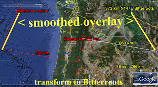
TRANSFORM at above Mendocino, CA, is shown in detail belw:

ABSENCE of transforms indicates that there are NO REGULAR EARTH TIDES from the moon; the SUN'S other solar masses operate in this zone. This occurs because the Moon exerts its GRAVITATIONAL ROTATION south of the 40N transform. OTHER MINOR SOLAR MASSES, NOT the Moon is dominant from 40.4N to 47N (Olympic Mountains- Mt. Olympus), and creates VERTICAL ROTATION as compared to MAINLY HORIZONTAL south of 40N! This can be viewed at the Olympic Mountains, WA:


Cascade Montains EXTRUSIONS occur south of this CRITICAL LOCATION; the ROTATION FULCRUM (Mt Olympus) is the divider between the vertical rotation SOUTH- Cascade volcanos- and the SPREADING-EXTENSION found north of WA State, above!
Mendicino TRANSFORM is the divider between the WESTWARD EARTH TIDES and the VERTICALLY-ROTATING (vulcanism-producing) eastward movements:

The 16 m.y. Columbia flood basalts remain in the SOLAR MASSES ECLIPTIC TIDAL INFLUENCE at 45N (23.5+ 5, for moon, + 11.5, for MAJOR PLANETS= 40N). This requires either 7+ degree Mars, or 17d Pluto to create VERTICAL UPLIFT and LATERAL ROTATION further north, and in the NW Pacific:

Expanded, at 45N Latitude, shows that the ECLIPTIC INFLUENCE is still dominant at this Latitude:

NOTE about TIDES of all
TYPES:
Vertical GRAVITATIONAL LIFT is effected by solar masses whenever
they TEMPORARILY OCCUR ABOVE a crustal segment (a portion of the earth's curved surface, lying below an ECLIPTIC PLANE). This relates to the earth which is between
40.5N and .5N for the western hemisphere, since the MOON appears in the 23.5
degree TROPICS (Sun’s cycle), and the MAJOR PLANETS occur in a TOTAL 11.58 degree spread; maximum
latitudinal spread occurs with Pluto, with a TILT of +17= 40.5N latitude, and Mercury with 7 degrees more. MOST GRAVITATIONAL ULIFT occurs at LESS THAN 40.5 (23.5 Earth tropics + 5 moon ecliptic angle + other large planets 11.5 degree combination of angular deviations from the ECLIPTIC). Addition of Mars at 7 and pluto at 17 = 66N latitude (Great Slave Lake), for the
elliptical segment from the NORTH POLE to 12N (Guatemala’s Loxodrome). North of
this 72N latitude, there occurs NO LATERAL MOVEMENT from gravitation, since no
solar masses' ECLIPTIC PLANES lie this far NORTH! MOVEMENTS above 72N require a
different IMPETUS, since this portion of the EARTH lies above known Ecliptic
DEVIATIONS.
Below is a TABULATION of Planetary ECLIPTIC PLANES:
Mercury: 7.01 degrees
Venus: 3.39 degrees:
Mars: 1.85: Jupiter: 1.31
degrees: Saturn: 2.49 degrees; Uranus: .77 degrees; Neptune: 1.77; Pluto: 17;
Eris: 44 degrees; and Asteroid Pallas: 34 degrees.
NOTICE that Mercury, Pluto,
and Venus have SIGNIFICANT TILTS away from the ECLIPTIC and sufficient mass, to effect
EARTH CRUSTAL ROTATIONS-SHEARING MOVEMENTS!
ADDING the minor totals for
the LARGE PLANETS (excepting Mercury and Pluto) yields 11.58 degrees away from
the ecliptic- which is sufficient to account for the N-S Latitudes from 28.5
degrees: Sun 23.5 tropics + Moon 5 degrees (deviation from the Earth’s ECLIPTIC
DISPLAY) to 40.5N latitude- the northernmost TRANSFORM (Mendocino, CA).
ADDING the 7.01 degrees for
Mercury’s deviation yields: 47.5N latitude for the CASCADE interval north
boundary. This is on the Canadian border- where the northern-most VOLCANO
occurs. There is a small ERROR here, where the 800 km Cascade Chain is equivalent to 7.2 degrees, or 47.7N- with Mt Baker near 49N:

Adding 17 degrees for Pluto
yields 64.5N latitude (between Great Bear and Great Slave Lake). This TERMINATES the ZONE of uplift,
and further LATERAL ROTATION proceeds a distance according to the EROSIONAL
TILT from vertical.


IMPLICATIONS of the
discovery of ECLIPTIC Deviations creating NORTH-SOUTH UPLIFT, lines of
EXTRUSIONS, the EQUATORIAL BULGE, vertically rotating SINKS- RISES, and TRANSFORMS:
1. The 7.01 degree Mercury CYCLE (7.2, with 2.6% error), creates ocean transforms spaced 800 km apart. This is regular in the North Pacific, and exhibits alternate- each 7.2 latitude degrees- vertical subduction (VOLCANOS) and E-W lateral faulting along coastlines; These ECLIPTIC DEVIATIONS are all inter-connected, and a better COMBINATION for the 7.2d-800km transform spacing is Jupiter’s 1.31 + Saturn’s 2.49 + Venus’s 3.39d = 7.19, with small errors of .1d. This is more accurate than Mercury’s 7.01d ecliptic angle.
It seems COUNTER-INTUITIVE that these
Planets with different ORBITS and MASSES would influence the EARTH CRUSTAL SHEAR-UPLIFT,
but part of the mathematical connection is the relation of UPLIFT (tan angle x
distance) to the angle in radians. Small angles exhibit: Tan = sine angle= angle,
so that the uplift at borders is proportional to the ECLIPTIC ANGULAR
DEVIATION. The distances are GRAVITATIONALLY-ADJUSTED, so that:
UPLIFT= ecliptic angle x linear mountain chain length= LATITUDE change x a constant= interval time x 50’/m.y. x 111.111km/degree- EROSION. An example is that of the COASTAL RANGE, where it rotates near 1 degree CCW, and has a length of 300 km, or 2.7 degrees of latitude change in a (180-152= 28degrees) SSW direction for an AGE of approximately 28 m.y.-Miocene:

2.
The 800 km LINEARS are two 400 km (3.6
degrees of latitude) segments- which indicate two 41 m.y. POLAR SHIFT CYCLES
(this is 1000 x Milankovitch’s 41 k.y. AXIAL cycles);
3.
The EQUINOXIAL 23.5 degree POLAR
TILT, plus the MAJOR PLANETS’ ecliptic deviations of Venus, Mars, Jupiter, Saturn, Uranus, and
Neptune yields a total ANGULAR DEVIATION of 11.58 degrees + 23.5 + 5 degrees
for the Moon= 40+N degrees latitude. This accounts for the most northerly
Mendocino TRANSFORM at 40+N latitude; this is a GRAVITATIONAL BULGE- NOT a
centrifugal force entity! This is CONFIRMED from Planetary data, where Jupiter with 60 or more moons and MAXIMUM BULGE contrasts with Venus (with no moons), which has NO BULGE!
4.
The Planets on both ends of the Solar
System's large masses (Mercury and Pluto) have large ECLIPTIC ANGULAR DEVIATIONS:
7 and 17 degrees. This indicates that GRAVITATION exhibits ACCENTUATIONS at
intervals. Asteroids (plus Kuiper, OORT clouds) are other anomalous intervals, similar to 2 dimensional
FORBIDDEN ZONES between oppositely moving ARCS in the EARTH’S CRUST; and,
5. The 17 degree Pluto ecliptic angular deviation indicating 57N total deviation (17 degree Pluto deviation occurring before 7d Mercury) from the Equator exists at an INFLECTION offshore Alaska, as shown below:
There exists an ANOMALY- an INFLECTION- at the 57N (40N + 17 for Pluto) latitude offshore Alaska, and this is a possible ALTERNATIVE for the initiation of the GRAVITATIONAL LATERAL DEVIATION from Mendocino's first TRANSFORM SOUTH of this location:

LARGER VIEW, including Mt. St. Elias:

The
IMMEDIATE analysis of the 7 degree Mercury ecliptic departure, (before Pluto, is
that the line of Cascade volcanos (7.2 degrees= 800km LINEAR north) departs from the 40N latitude at the Mendocino TRANSFORM- occurring south of Pluto's INFLUENCE. An ALTERNATIVE
is that there is a double path, with one trending towards Alaska-Denali- which
is also a chain of volcanos! This case places the 7 degree Mercury (last- NORTHWARD after
Pluto) north of the 17 degree Pluto case, for the 64N latitude. Both
possibilities are likely!

This 64N latitude is the TERMINATION of the influence of the LARGE PLANETS' ECLIPTIC ANGULAR DEVIATIONS (23.5, earth + 5, moon + 11.5 degrees for LARGE PLANETS, + Pluto 17, + Mercury 7= 64degrees). North of this latitude, the LATERAL MOVEMENTS taper to zero at the Arctic Ocean! Polar SHIFTS of 400 km, or 3.6 degrees, occur each 41 m.y. after that- in the Arctic Ocean! The Islands EXTEND (N-S away from the parallel) north of this latitude- which is 16S of the NORTH POLE:

CRITIQUE:
I have found that a
degree of tilt ABOVE the ECLIPTIC is equivalent to a degree of EARTH LATITUDE, for SHEARING MOVEMENTS of the solar masses!
This is ARC in both cases, and could be in RADIANS or any consistent units.
Most of the time, SOLAR SYSTEM masses lie along the ECLIPTIC PLANE, but when they
Exhibit a shift above the plane- as with the Moon’s 5+ degree slanted orbit,
they exert ADDED GRAVITATIONAL ATTRACTION-UPLIFT! Earth has 23.5 degrees of
tilt from the equinoxes, and part of the year, part of the GLOBE is protruded. The COMBINED EFFECT
of all these: 23.5 + 5 + 11.5 for the MAJOR Planets (Venus, Mars, Jupiter,
Saturn, Neptune, and Uranus) is 40 degrees of LATITUDE for the northern border
of the EQUATORIAL BULGE-Mendocino, CA transform (earth bulges due to added
vertical attraction).
There are other SIGNIFICANT SOLAR BODIES: Mercury
and Pluto, with 7.01 and 17 degree tilt above the ecliptic. The N-S ARC
associated with 7.2 (2.6% variation, with a ratio of 1.027, recalling that my
BASE is 1.024) is 800 km (1/50th of the 40,000 km circumference), or
7.2N latitude degrees. This is the SEPARATION of the Mendocino transform (40.3N
actual) from the NEXT to the south, as well as others along the American coast,
for 7.2 degrees each (1/50th of 360 degree circle).
The matter of interest
to me is that I expected the CASCADES to protrude for 800 km, but Google Earth
CORRECTED ME! It was Mt. Olympus, of the Washington State Olympics, which I
already had categorized as an ANGULAR FULCRUM. It occurs at 47d 48’N- which is
47.8, yielding a total LATITUDE CHANGE from Mendocino of 7.5 latitude degrees!
This results from Mercury, with its added VERTICAL ROTATION along the Cascades
from Mt. Lassen to Mt. Olympus: 40.3 (as close as I can get on the Mendocino Cape jutting
into the Pacific) + 7.01= 47.34. That’s good for ENGINEERING ERRORS (1%)!

I found a small
discrepancy in the CALCULATED vs. Google Earth position of the Mendocino
Transform. The approximated 40N latitude did NOT match the expected, since I
had used 5 degree deviation for Moon’s ECLIPTIC ANGLE. Wikipedia listed this angle
at 5.145 degree, and this addition met the Google Earth location CLOSER: 40.16N.
This gives ENTHUSIASM for NASA’S measurements vis-à-vis others!
There is a REGULAR ROTATION of the Coastal LINEAR Montain ranges, where the youngest 800k at NW-SE, is followed by 1600km Owen Stanley Mt. at the Equator:

The ROTATION exhibits 109 degrees, from the original N-S, and this is a change of 43d from the Coastal Range, CA. This indicates almost 45 degree rotation in 800/111.111= 7.2 degree Latitude, or in 40.96 m.y., or a rate of 1.05 km/m.y. (mm.yr).
