SUMMARY:
Critical Meridians, referenced to the Natural Prime (169.6W Longitude, 170W for quick use, since the ERROR is .4 degrees at most),that are simple FRACTIONS of 180 degrees, locate Anomalies on the Earth's Crust, when accessed in conjunction with Latitudes that are simple fractions of 90 degrees. For example, Lake Nicaragua at 12N 85.6W is 2 fifteenths of 90 degrees, and 84E of Prime. Whidbey Island is north of Mt. Olympus, and is in another Reference System: the Analemma departure at the JdF Strait at 48N 124.6W, or 45E of Prime. W.I. can be related to the 1/1000th of the distance for the Continental System, and using 124.745W in the 2.16 degree (M/S), rather than the 180 degree system, yields FRACTIONS of a quarter (.54d), sixth (.36d), ninth (.24d), twelfth (.16d), thirtieth (.072d), and thirty-sixth (.06d). Anomalies are found along these displacements from the 124.745W Longitude (eastward), and they are Oriented E-W, rather than N-S, as is the case for the Southern portion of the North American Analemma.
Prime NATURAL Meridian, at 169.6W Longitude is shown below:

COLOR CODE is as follows: red, for COMPRESSION or Rising; blue for EXTENSION or Sinking; black for FACTUAL Information; Pink for scenarios; yellow for location or OUTCROPS; green for measurement, and white for N-S linears.
INTRODUCTION to the "Hole-SLICE" phenomenon, for the LARGEST at the Arctic Ocean, through the Chukchi Plateau RISE:

Above slice (RED) Line is a CALCULATED LINEAR, tracing 1200 km/9 degrees from N-S. It is a multiple of the base 400 km (equivalent to 3.6 degrees at 1/100th of the Global CIRCLE). The trace to Chukchi is shown below:

Since I would expect the 7.2 degrees for 2 cycles to agree with the linear, I will re-trace to 7.2 degrees from north:

The 7.2 trace indicates that it is OLDER, and the view is EXPANDED below. the ARC is moving EASTWARD (retrograde,with Pluto indicated; look for U at .77d or N/U at 2.29 ratio):

Below is the "HOLE" BISECTED by the SLICE through the Arctic Ocean:

Other CASE Histories may be seen on: www.quadransphere.blogspot.com
Lake Nicaragua is the ANOMALY mentioned in the SUMMARY. Notice that the ORIENTATION is the same as Hancock Lake, which is on the 1/1000 Scale:


ENLARGED:

The Most SIGNIFICANT Meridian is 90.6W (79E of Prime, but use 90W and 80E of Prime, for quick calculations), which is the Mouth of the Mississippi River, and which DIVIDES North America along a N-S line through Chixculub, New Madrid 1812 Great Quake LOCATION, Clintonville, WI "Bangs" of 2011, Hudson Bay, and with Mathematically-astute Mayans, the Tikal Most Sacred Temple!

Tikal:

Hudson Bay illustrates an IMPORTANT Finding, that Critical Meridians are dynamic event DIVIDERS of the 360 degree Earth, and that they create SLICES, N-S, beginning with a "HOLE" which in this case is the "round" Bay (there are 2 circles, for both 80W, James, and Hudson, 90W):

ORTHOGONALLY, with James Bay at 80W:


You may ask: "why do you switch from 169.6W Meridians to EVEN-NUMBERED Longitudes?" The ANSWER is shown for Greenwich England, where the Political selection was made with PRESCIENCE, putting the Bronze bar SLOTTED directly South of a GREAT MEANDER in the Thames River, such that there is only a small km DIFFERENCE between the Prime Meridian and the Meander Center Line (which is a NATURAL FEATURE, "jiving" with the Natural Prime at the Diomedes Islands at 169.6W Longitude, very close to 170W):

The OMNI-PRESENT "HOLE" which develops a SLICE with Time is shown for the following cases:

NOTICE the Vertical SLICE in the HALF meter DIAMETER Hole found in the bottom of a Wash in Sand Hollow, UTAH. It is round, shows spiralling traces, and has a change of color at the Slice. This hole is in the bottom of the wash, but does NOT FILL with erosional products, eventually emerging in Springs, which are now covered by Sand Hollow Lake (there were Springs, called Dixie Springs):

Above SINK HOLE is exhibited in the LOOSE SAND CANYON below:


Above Sand Mountain CIRCULAR Mesa exhibits a widening TERRACE, which is the SLICE, in above photo! You may want to MEMORIZE this, since Geologists would toss this off, as a Gully and contributing OUTWASH Plain!

Circular RISES, as above, also exhibit slices, which may be hiked in the field along FRACTURES.

Many valleys are CIRCULAR, and fit the sliced "HOLE" phenomenon! Below is a miniscule sample of a round cemented rock:

The Virgin Valley from the Hurricane Fault to the foothills of Beaver Dam Mountains is somewhat CIRCULAR;

SINKHOLES occur along SCARPS, such as the Virgin Mtns.

Digital photo of above SINKHOLE:

Hand held samples are easily found, which exhibit the hole-slice phenomenon:

OPPOSITE side, exposing the faint "HOLE" illustrates the PRINCIPLE of the association of holes and SLICES:

Increasing example SIZE is exhibited by the fall of a pinnacle from the Peak, along the Watchman Trail:

Watchman looks down on the Zion NP, Utah, and is located south of the trail with the CIRCULAR mesa top, ABOVE, with the DIAGONAL Slice. A VITAL piece of information is shown above, with the non-perpendicular angle of the slice (near 72 degrees from horizontal):

Google Earth photo of fractured Anticline;

These were hiked on the side of the anticline:

SLICE below occurs in a loose rock sample, which has been squeezed:


Anticlinal SCARP exhibits vertical Slices:

Next, I will resolve the case of Whidbey Island, which is a separate Block of Crust with shallow GRAVITATIONAL attraction (NO hot springs, since the vertical rotation is shallow); it is being SHEARED by the ROTATION of the Olympic Peninsula, and I expect that the new REFERENCE is the Mouth of San Juan de Fuca, JdF:

More ACCURATELY:

Crescent Lake is another ARCUATE Lake, which I will explore soon; it is shown at the East shore, where there are Vertical beds, and I will produce photos.

Above is a SCARP and Vertical strata, which I will photograph, including the approach, below:

Since Crescent lake is EPONYMOUS with its namesake ARC, it is a "giveaway" that it is subject to LOCAL, NOT regional ROTATION:

Above is the SILTED area, shich exhibits Vertical STRATA, and below is the ENLARGEMENT with the DIVIDER, at an angle of 60 to 72 degrees; this can be mathematically ANALYZED with: {(180- Longitude - 1)/(longitude- 1)} to yield the ratio appearing equal to the Moon/Sun ratio of 2.16 approximately. I am "homing in" on the CORRECT MAGNITUDE with these calculations, and finding that this ratio is PERTINENT for the Olympic Moutains to the Northern half of Whidbey Island (ROTATION is CCW about Mt. Olympus or the JdF turn at the Mount at 48N:

This will be compared to the Meridian passing through Ala SPIT, south to the "Hole" of Lake Hancock. REALIZE that the Rotation is in REFERENCE to the Olympic Peninsula, and NOT to W.I., which is being "shaved" by the shearing:


Hancock Lake, above, has an UNCONFORMITY and thrust FAULTS to the south, and this wall of PLEISTOCENE Sedimentaty PreStone exhibits sheared traces year-by-year (showing that the shear is along a VERTICAL ARC, with a thickness of a few centimeters horizontally)

LARGER VIEW shows the relation of the Hancock THRUST to the OLDER Faulting to the NW, at Pacific University swale:

Return to Ala SPIT:

Hancock Lake is connected to the Sound, eliminating a Cranberry Bog (fresh water) that was developed in the 20th Century, invaded by storms in 1913 and 1934- a 21 year cycle:

Longitudianl DIFFERENCE is 2.12968 degrees, and this is near the 2.16 ratio of M/S! I will shift the REFERENCE to find a difference of 2.159, the most accurate ratio I have found for M/S. This is for the JdF 124.745W Longitude, which is shown below:

Wider view:

Above Longitude, tentatively, will be used for the Meridian Local Whidbey Ala SPIT REFERENCE. The change of Longitude is 2.159 degrees, from Ala SPIT to the JdF right-angle SHIFT! I will use the Natural Prime at 124.745W as the Meridian for distances and angular shifts for Ala Spit. This should involve a Block of Crust which is 1/1000th of the Western Hemisphere (40 km, compared to 20,000 km N-S)- the Whidbey Island UPPER Half, from Ala spit to Hancock Lake (that portion of the island analyzed):

Ala SPIT to Hancock Lake 122.58615W Meridian:

Hancock lake on the 122.58615W Meridian:

What has been shown, is the New REFERENCE for Whidbey Island (160 km to the WEST, compared to the 32 km distance ORTHOGONALLY). This western distance is 160 km to the Olympia Peninsula NW tip- a 5 to 1 ratio:

This allows an analysis of Whidbey Island, North HALF, as to how it "FITS" the HOLE-SLICE phenomenon, where Hancock Lake is the hole sliced by the Ala Spit Meridian. We will search for anomalies along this PATH:

The first ANOMALY exhibits a SINUSOIDAL Siltation at Holmes Harbor seafloor, near Race Road, Shangra La Shores:

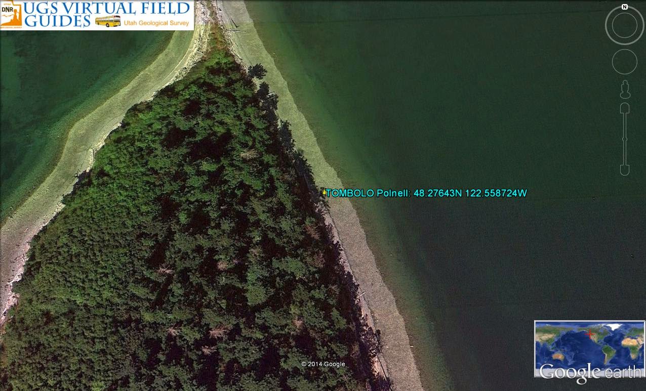
Crecsent Harbor has a TOMBOLO to the east, calculating 192 k.y. to form, COMPARED to 264 k.y. for FORMATION of the Bay:

Tombolo has a CAVE on the east side, with iron SLICKENSIDES (hardened sufficiently for soft sediments to survive), and it has an AGE for a time interval during an Interglacial interlude:
Rotating:

INDENT on the NE side exhibits an E-W cave, with Iron STAINS:


Meridian from Hancock reveals the CENTERLINE of Crescent Harbor, of 264 k.y. AGE:

Continuing to Ala SPIT, for the error of the display:


You should inquire how I find that there are two MOVEMENTS, OPPOSING each other, which should create BUCKLING! True, and this accounts for the Mima Mounds on the west side of waterways (which alternately BUCKLE and Sink, creating sinusoidal WAVES).
As I found before, the Lateral Tidal Rate is reduced by the Expenditure of the ENERGY of Tidal Attraction, which is used to produce UPLIFT! This 3.8 mm/year LATERAL movement should be compared to that of Zion NP, where I found a much reduced rate for the 2 m.y. UPLIFT!

Zion NP, which is a 2-4 m.y. UPLIFT, has sheer walls suitable for Rock Climbers, and displays the Jurassic Navaho formation with some underlying 220 m.y. time of deposittion Triassic Kayenta Rocks. The 8000 foot elevation and current sloughing of the sandstone (blocking the Virgin River in my stay at nearby Hurricane) indicates that it is still RISING! Calculated uplift RATE yields a REDUCED Lateral Movement, which is 3-5 mm/year, as shown below:

Entrance to the Zion NP Canyon, which is a dead end road, has rapid EROSION and rock fall:

Back to Whidbey Island, to determine how the UPLIFT for the island with AGE less than 1 m.y. has SIMILITUDE with Zion of twice the age. Further, the maximum elevation on W.I. is 531 feet, west of Silver Lake, and exhibits the swampy lake near the highest point!

ENLARGING, to view Silver Creek drainage to SE:

Near Mariner's Cove, the island is EXPANDING to the SE, and the seepage is found there, as well as an ANALEMMA at the boat slip:

Bringing this up on another UNENCUMBERED computer, look at the Mariner's Cove hike OFFSHORE yellowish Linear shown in yellow above, and BLUE below:

The almost-eastward LINEAR has a compass ANGLE of 93.74 degrees, CALCULATING (90- 49+)/49+= 1/1.211 ratio (N/U-J); {72-49+}/49+= 2.17 M/Sun; [180- 123+]/123+= 1/2.186, which are almost identical, indicating that Whidbey Island is in a CRITICAL Location, and that the 72 degree EQUATON applies to small angular DEPARTURES from the Compass Cardinal Angles (placing the northern part of the island in an UNIQUE location)!
I should differentiate between ARTIFICIAL and Natural terraces and sinks, but I believe that the boat slip followed the Natural CONTOURS:

I will hike this again, and interested parties should E-Mail me at overtonharold@yahoo.com
For CONVENIENCE, I will use the 2.16 degree Longitude difference, between Ala SPIT and the JdF mouth, as the Meridianal CHANGE Reference, and it may be sub-divided into 6 segments:
1. The one sixth, or .36 degrees (1/1000th of 360 degree circle) will exhibit a N-S Meridian, along which there should be Geographical ANOMALIES;
2. There should be 6 of these Critical Meridians, which will be traced from North to South, to DISCLOSE features of interest;
3. This sub-division will pertain to the North end of Whidbey Island, north of Hancock Lake, and,
4. The SHIFT at JdF represents the REFERENCE of the W.I. Crustal Block, and the Location N-S is a Meridian, similar to the Prime NATURAL Meridian at 169.6W, for the 1000 x SCALE!
The first .36 degree west Meridian from Ala Spit is shown below;

Protection Island, above, and the Kettles, below are isolated with this .36 degree FRACTION of the 360 degree circle (1/1000); this calls for an investigation of the INVERSE of the Mounds- KETTLES, and how they are determined by the CONJUNCTION of 2 Solar masses (the opposite of Opposition)!

The Kettles is a well-hiked set of trails, but you cannot see anything for the undergrowth and the trees!

EXPANDING to search the swampy end of Penn Cove:

Kennedy Lagoon, west of Penn Cove, is 9 feet above sealevel, and is spring fed; it is extending to allow the springs to flow. This allows SINKING at intervals (kettles), though it must be RISING, to maintain the high water level! This is CHATTER, where alternate sinusoidal sinking, rising create a sine wave on the surface!
CONCLUSIONS:
1. Whidbey Island is a SEPARATE BLOCK of Crust, and it portrays MOVEMENTS on a small scale, which are similar to those on Continents on a LARGE SCALE (x 1000);
2. The scale is 1/1000 of the Hemisphere's scale of 20,000 km, or 20 km for the half of the Island;
3. REFERENCE of JdF mouth 124.745W longitude is the extent of the ROTATION of the Crustal PORTION about W.I.; and.
4. DIVISIONS of the 2.16 degrees of Longitude, to the JdF turn are: thirds (72d), fourths (54d), sixths (36d) or twelths (16d), and halves (10.8d) yielding ANOMALIES at.03, .04, 06, ,09,, .18 or .36 degrees increments west of Ala SPIT.
Below is the INTERSECTION with LOPEZ Island:
Half the Longitudinal change at .36 degrees west of Ala, at .18 degrees, is another FRACTION of the 360 degree circle (360/2000, or 180/1000), which has ANOMALIES along the N-S PATH:

SIMILITUDE indicates that the ratio, or 2.16 degrees, be used for the M/Sun ratio, since it keeps "cropping up" in the Whidbey Island separate Block of Crust, and since the NUMBER may be sub-divided in 6 parts of .36 degrees, or into 12 parts of .18 degrees each!

Let's look at 2.16/4= .54 degrees east of the JdF turn, which is equivalent to the Mississippi River at a 90 degree shift on the Hemispherical scale (a quarter of the circle from the Prime Natural Diomedes Meridian):

Above Meridian, a quarter of the degrees from JdF to A la SPIT, lies on a small drainage, un-named, in the Quinalt RESERVATION, and suggests that the ORIENTATION has turned 90 degrees, relative to the N-S Mississippi River drainage (as has the JdF strait). This drainage is MARGINAL, compared to the Mississippi on the Continental x1000 SCALE!
ENLARGING:

Searching North along this Meridian:

Hoh River is also on an E-W Drainage, at 47.88N, calculating 1.19 ratio (90-48.88)/48.88, which will be tested for the difference between Saturn at 2.494d Inclination, and Jupiter, at 1.304, with a DIFFERENCE of 1.19 degrees. This SUBTRACTION is a test, since I have found ratios and Inclination angles as PERTINENT, BUT NOT differences!
CONCLUSIONS:
1. The Whidbey Island Sphere of Influence, from Ala Spit to the JdF turn, is similar to the Rotation of the Continent, with a 1/1000 comparison ratio:
2. A quarter of the 2.16 degree difference, between JdF and Ala Spit, 2.16/4= .54 degrees, is shown as a MERIDIAN disclosing River DRAINAGES of Hoh and another river which trace E-W;
3. SIMILITUDE of the Continent's 360 degrees/1000= .36 degrees yields ANOMALIES which are similar, but which have rotated 90 degrees (ORTHOGONALS); and,
4. The north Half of the Island can be considered a 1/1000th CARICATURE of the Hemisphere, where twelths, sixth, and quarters of the 360 or 2.16 degrsees reveal ANOMALIES of great interest.

This has been found on the Continental SCALE, at the Caribbean- a semi-circle of RISES at 15 to 30 degree angles from a FOCUS (shown below):

ENLARGING:

Windward Islands:

Finding the FOCUS of the ROTATION of the Islands allows a more accurate measurement of the Angles of shift between the EXTRUSIONS. You may wonder how Volcanoes "fit"in this analysis, which heretofore was in SEDIMENTARY ROCKS. The PRIMARY DIFFERENCE BETWEEN THE TWO CASES (Igneous vs Sedimentary) is that of GRAVITATIONAL UPLIFT, which reaches downward according to the Mass/separation squared of the Solar Body creating the ATTRACTION! Whidbey Island on the 1/1000 scale, has asteroids or planetoids at such distance that they LIFT only a SHALLOW portion of the Crust. The Moon, Venus, and the Sun attract with such FORCE as to cause rotation down to the MANTLE and allow Hot BASALT to emerge (by lifting the Crust):

RE-WORKING, the Volcanic extrusions (islands) do NOT exhibit multiples of 15 degrees, which I previously thought! Another rule has established the relationship, and it is that there is NO repetition of Inclination Angles from the Ecliptic Plane, between the various Planets, Planetoids, Asteroids, and Comets! They are distinctly different, but some are CLOSE, as with the Moon's 5.145d, compared to Asteroid Hygeia with 5.105d proper:

The SALVATION, for use of Inclination Angles, is in the observation that the Various CATEGORIES:
1. Planets work on the largest SCALE of 1;
2. Planetoids and Asteroids work on a 1/10, 1/100? or 1/1000 scale;
3. Comets work on an unknown scale, and there are NO DATA to establish the relation.
I am going to PARK a Google Photo of Wollangombe Crater, in Australia, which is INCOMPLETE (because of a lack of data for the crater), hoping that my ANALYSIS of the Propinquity will be valuable, whenevever more data are available. It is at LOCATION 33.481S 150.3179016E:

Above analysis will test my "mettle", since it works with rules ESTABLISHED from myriads of other cases. Notice that the AGE is calculated to be 400 k.y., and this is the first test for a FEATURE, suspected to be a Meteor Crater (with considerable DOUBT by field workers). My analysis of the various SIMILARITIES with Non-Craters tells me that this is the USUAL SUSPECT of a Gravitational "Hole"! I have drawn the SLICE from indications of an ALMOST N-S linear, and since I am unfamiliar with the RULES of the Southern Hemisphere, this will divulge something of VALUE (even if I am wrong)!

Photos:

The REASON I am spending effort on this feature is GENERAL to categorization of them by Geologists (as Meteor Craters), in their zest to find their relation to Hydrocarbon DEPOSITS! My work finds that some are GRAVITATIONAL rotational EXPANDING arcs, which create WAVES of rims as TIME proceeds.

File photos show what I was not able to bring up on Google Earth:

A key to understanding these features is the ELLIPTICAL arrangement of 6 or 12 mounds, LATERALLY:

Testing the Moon's 1.543 degree angle with the Equatorial Plane, where:
(180- 2.543d)/2.543= 69.7825W Longitude, the N-S Meridian is shown below for Lake Titicaca:

I expected that the Lake would be at 15N 69.6W, but it is shown at 16N 69,7285, indicating that the Prime Natural Meridian may be between 169.6 and 170W Longitude:

ANOMALIES are sparse along the 1.543 degree line from the Equatorial Plane. TICS are spaced 1 km apart near Cape Cod Bay, indicating 61.57 k.y. Time of FORMATION:

There is a Major INFLECTION in the Amazon, shown below:

It appears that the Angle to the Equatorial Plane, of the Moon's ROCKING is NOT an important indicator of Crustal Anomalies!
Moon DATA are categorized as follows:
1. Perigee to Apogee: 367,600 to 405,400 km, with MEAN of 385,000 km;
2.Obliquity= 6.58 degrees, Eccentricity= .0549; Obliquity= 6.688 degrees;
3. Declination= 23.29'+ 5.9'= 28.333 degrees;
4. Siderial month= 27.321661 days; Synodic= 29.530589; Visual= 27.55455;
5. Recession, apsides at 8.8504 years; Precession at nodes 18.5996 years.
ALL of these angles and ratios may be scribed on N-S Meridians to find SIGNIFICANT Anomalies.

To Be continued!