
SUMMARY, for Earth Dynamics and its ARCUATE FEATURES
EAST Pacific basin TRANSFORMS are separated by 7.2 latitude degrees, and represent CIRCUMFERENCE TRACES ON THE EARTH. Multiplied by 50, the separations "ALSO" calculate to be 40k km. Milankovitch 41k circular shear features (ARCUATE FRACTURE PATTERNS) in both Paleozoic limestones and Mesozoic sandstones also have a ratio of 50:1 for diameter/orthogonal spacing of circular features in rock outcrops. Ratios for other shear circles vary in magnitude from 10:1 to 1000:1, according to their age and type of rotation. The RATIO, so far, pertains to features which have been formed during the period since 2.15 m.y. or the Eltanin asteroid strike, since age/50= 43k (approximately equal to the 41k year AXIAL CYCLE of the earth in its progression of tilt from 21.5-24.5 degrees- THE LATITUDE NORTH OR SOUTH, OF THE TROPICS OF CANCER AND CAPRICORN).
The axial may be distinguished from the ELLIPTICITY cycle, by use of measured RADII on GOOGLE EARTH. Whenever a quarter circle FRACTURE OR SHEAR ARCUATE PATTERN is measured for its radius, and two orthogonal measurements differ from each other by more than 10% (error of the process of viewing and measuring the radii of an arc), the arc is part of an ellipse. Using ELLIPTICITY= 1st radius/2nd radius at right angles, this indicates an ellipse, for E> 1.2.
A quick calculation finds that the arrangement of the major transforms in the Pacific Ocean basin, inflections between these major parallel features, and their curvilinear portraits of shear are arranged in geometric patterns.
1. There are 7.2 degrees of Latitude between major transforms:
7.2 x 60 nm/degree x 1.85 km/nm x 50 (ratio of diameter to tangential GRID spacing)= 40,000 km, which is the circumference of a spherical earth; BELOW ARE Transforms in the north Pacific each 7 degrees of Latitude (MORE ACCURATELY, 7.2, AFTER TAKING THE AVERAGE):
2. The distance between Mendocino 40N Latitude and the Kimmei Emperor seamount is 5555 km, and this is the circumference/7.2;

3. The AGE of Kimmei seamount has been radio-dated at 40-41 m.y. and this is in the 5, 10, 20, 40 m.y. series of asteroid strikes arranged by A SERIES 5N= (N= 1, 2, ETC), 2x previous number, N. Another series arrangement of strikes is in the binary system of 2, 4, 8, 16, 32 (EO boundary), 64 (KT), 128, 256 (PTr), 512 m.y. (MID-CAMBRIAN); note the CORRELATION WITH FOSSIL EXTINCTIONS (CHANGE IN HEIGHT OF Y COORDINATE MAGNITUDE) WHICH ARE RELATED TO ASTEROID STRIKES:
These have harmonics with Milankovitch cycles of 41, 25, and 100 k.years, and the associated rotations occur AS SHEAR LINES OR FRACTURE ARCS in CRUSTAL ROCKS;
NOTE THE RATIO OF EXTENSIONS OF A SHEAR CIRCLE TO ITS DIAMETER. THIS IS 50:1 FOR ARCUATE FEATURES WHICH ARE NOT CORIOLIS ROTATIONS (THOSE WITH AN OBVIOUS SCARP OR CENTERLINE FAULT):
 RE-MEASURING THE ARCUATE FEATURE ADJACENT TO THE HURRICANE FAULT, AND TO A CRATER WHICH HAS PRODUCED THE ROTATION (DUE TO SPIRALING OF MAGMA CCW AND SHRINKING AND COOLING CW) WE GET THE SAME AVERAGE RESULTS;
4. Grid spacing tracing N-S at the Kimmei seamount rotation to trace toward the Hawaiian Islands is 32 km along a 3 degree Longitude arc which is 1000 km in extent. Using the sin of 2 degrees 52’ = .05 yields a half circumference to a rotation south of South Africa:
1000 km/.05= 20,000 km;
5. The ratio of Milankovitch circular wobbles and cyclical shear oscillations found in limestone and other Crustal rocks is 50:1 for the ratio of diameter to tangential GRID SPACING. This is in the 41,000 year axial cycle, which is a 50 divisor of the Eltanin asteroid strike time of 2.15 m.y. age; and,
6. The trace of the entire HI-E seamount chain is a very rough (subject to many events) circular configuration, yielding a QUADRANSPHERE. Its diameter is 10,000 km, which is a quarter of the 40k km circumference- reaching the MAR at a Latitude where there is an inflection from westward to eastward shear along transforms in The Atlantic Ocean basin.

 THE QUADRANSPHERE WESTERN TRACE IS EASILY SPOTTED IN THE EASTERN PACIFIC- WHERE ITS ROTATION AND SHEAR HAS CREATED THE HAWAIIAN-EMPEROR SEAMOUNT CHAIN. ITS TRACE NORTH OF THE ALEUTIAN ISLANDS, ALASKA IS MORE DIFFICULT TO SEE, BUT NOW WITH THIS FINDING, IT CAN BE TRACED TOWARD THE GAKKEL UNDERSEA RIDGE, WHERE IT HAS BEEN DISPLACED FROM THE LOMONOTOV RIDGE BY THE STRIKE OCCURRING AT THE EO BOUNDARY (REVERSING THE PREVIOUS MOVEMENT NORTH OF ICELAND).
SHEAR RATE CALCULATIONS FOR LATERAL MILANKOVITCH ROTATIONS
The Milankovitch cycles of 23 (25?)k, 41k, and 100k years have been clearly identified for Paleozoic limestones. What about Mesozoic sandstones? It would be expected that the easily rearranged grains would eliminate traces of fractures, and the features would be difficult to find. NOT SO, as shown for the Sand Mountain monocline near Washington City, UT and its adjacent (tangential) N-S fault- which produces the Green Springs and “boiler” warm emissions (77F). There occur at least 3 concentric (APPROXIMATELY, IRREGULAR) fracture and fault pattern circular features on the mountain and its accompanying Sand Hollow reservoir and sink. These are shown below, for 2 separate trials:
 FIELD DIGITAL PHOTO SHOWS THE ARCUATE FEATURES (MILANKOVITCH ROTATIONS) EXCELLENTLY:


I have used 1 mm/year as an average for determining the rate of shear of lateral faulting. This has been checked from analyzed movements, to yield an approximate RATE OF LATERAL SHEAR (THIS WILL BE DETERMINED BY CALCULATIONS AND MEASURED AGES OF KNOWN EXTRUSIONS TO BE 2 CM/YEAR- BUT THIS IS "JUMPING THE GUN". This set of photos may now be used to “home in” on a more precise rate. Not yet known is whether the rate of movement along the 3 cyclical features is similar, but we may expect that the 3 cycles are in harmony with each other (EXCEPT FOR CONFLICTS- WHERE THERE OCCURS VULCANISM, DUE TO BRITTLE FRICTION). This would yield multiples which were either 1x, or ones which are in a HARMONIC RELATION. We will attempt to use the relative sizes or diameters to calculate at least one rate of lateral shear. Either the radius, diameter, or circumference is suitable, since they are in a constant relation to each other.
The following photo shows that the ratio of 100: 40: 25 Milankovitch cycles is not 4:2.5:1, as would be expected for a linear relationship. The ratio of radii is 10:5: 1, and this denotes that either there are intermediate shear circles (as is probable, from the photo), or that the shear rates cannot yet be calculated.
WE WILL TENATIVELY RESORT TO THE BINARY RELATION ANALYSIS. THE EXPECTED RATIOS OF THE THREE CYCLES SHOULD PRODUCE 100/40/25, OR (20/5):(8/5):(5/5). THE PHOTO EXHIBITS ARCS WITH RATIOS OF (20/2):(4/2):(2/2). THIS IS THE BINARY RELATION, WHERE THE PROGRESSON IS 5X 1/2, 1/4, 1/8 (A MORE COMPLICATED RELATIONSHIP, BUT STILL AN HARMONIC ONE). NOW, WHAT CAN BE CALCULATED, FOR SHEAR RATE? WE'LL VIEW INTERMEDIATE CYCLES, TO FIND IF THERE ARE OTHERS WHICH ARE NOT LISTED BY MILANKOVITCH:

ANALYZING SMALL ROTATIONS NEAR THE HURRICANE FAULT, Hf, THERE OCCUR ARCUATE FEATURES DOWN TO 200 METERS IN DIAMETER. I SUSPECT THAT ONE OF THESE WILL SHED LIGHT ON THE SUSPECTED STRIKE AT 12,900 YEARS AGE. BUT WE HAVE SALVAGED THE MILANKOVITCH RATIOS OF 100:40:25, WITHOUT USING OTHER BINARY MULTIPLES:

Long Island, NY and Uintas Mountains Orient E-W, at 40N Latitude
The Wasatch LINE is separated from the Emperor Seamount to the west (171 51‘29“E) and from the PTr anomalous rotation to the east (51 51.5W) by exactly 60 degrees of Longitude. This is 1/6th of the circumference of the EARTH, and indicates that thirds, sixths, and halves are important to the structural history and geometry of the globe. Whereas the PTr strike and extinctions are 4x older than the Mesozoic KT extinction and asteroid strike, they both relate to the 40N Latitude bulge termination- which I name the EQUATORIAL BULGE. My assessment, tentatively, is that the globe spin and wobbles due to AXIAL, ELLIPTICITY, AND PRECESSION proceed regularly at approximately 1 mm/.year, but they are marked by asteroid strikes, which result in “lurching or RIPPING” of the crust along latitude lines. THIS indicates an acceleration of what would have proceeded more slowly otherwise.
 THERE ARE SOME ERRORS ON THE PHOTO: THE 120 DEGREES DIFFERENCE IN LONGITUDE PERTAINS TO THE PTr TO EAST SIDE OF THE GREAT KIMMEI ROTATION, AND I WILL CORRECT THIS SUBSEQUENTLY. THE CONCLUSION THAT THERE ARE 60 DEGREES BETWEEN SIGNIFICANT EVENTS IS CORRECT, BUT THERE MUST BE A CAREFUL DELINEATION OF THE TYPE OF EVENTS:
 The large rotation adjacent to Kimmei seamount of 40-41 m.y. age is 800 km in diameter and has 30km GRID SPACINGS adjacent (tangentially) to the rotation (CW). Additionally, there are N-S lineaments which are fainter to the west and sharper to the east, inside the great arcuate feature. There is a slight shift of the lineaments to the NNE, as time progresses, considering that I am correct in the faintness correlations. This is all similar to the pattern of the B&R rotation and its presentation of a new N-S mountain range each million years. The time has been measured at the rhyolitic extrusions at the north of the Basin and Range, as each range protrudes and causes a shift to the west as time passes (EARTH TIDES MOVE ALL PROTRUSIONS WESTWARD DAILY ACCORDING TO THEIR HEIGHT). The B&R pattern is shown below, to show the similarities:
  THE GRID SPACING FOR THE MOUNTAIN RANGES IS ABOUT 30 KM- SIMILAR TO THE KIMMEI ROTATION LINEARS. HOWEVER, THE ANGLE OF DIVERSION IS INVERTED, AND WE MUST CONSIDER THE POSSIBILITY THAT THE FEATURE IS A MIRROR IMAGE OF THE 40-41 M.Y. STRIKE. THIS MIGHT BE FURTHER INVESTIGATED BY FINDING THE OLDEST AGE OF THE B&R RANGES OR EXTRUSIONS:
  TENTATIVELY, THERE IS NOW A CHANCE TO MEASURE THE RATE OF SHEAR AND ROTATION OF THESE GREAT CELLS. RECALL THAT THERE IS A MEASURED MILLION YEAR AGE DIFFERENCE BETWEEN THE INDIVIDUAL 13 EXTRUSIONS ALONG THE YELLOWSTONE RHYOLITIC TRACK (13.6 M.Y. TOTAL AGE SINCE INCIPIENCE AT THE OR, NV, AND ID STATE JUNCTION). THIS MEANS THAT THE CIRCULAR TRAVEL IS 800 KM X PI= 2513 K.M. FOR A COMPLETE CYCLE (ACCORDING TO THE KIMMEI ROTATION). DIVIDING BY 13.6 M.Y.= 18.5 CM/YEAR, WITH A LOWER LIMIT OF 2513KM/40 M.Y.= 6.3 CM/YEAR. THIS MAY BE COMPARED WITH THE AVERAGE RATE ALONG THE HI-EMPEROR SEAMOUNT TRACK OF 8.6 CM/YEAR, TO INDICATE THAT THE LOWER LIMIT IS MORE LIKELY CORRECT. THIS MEANS THAT THE B&R CHAINS HAVE BEEN RISING SINCE EO TIME OF 40 M.Y., AND THAT THE RESULTING OLDEST EXTRUSIONS MAY BE SEARCHED FOR CONFIRMATION.
FURTHER ANALYSIS DETERMINES THAT THE KIMMEI ROTATION IS NOT A MIRROR OF B&R; RATHER, IT REFLECTS THE COLORADO PLATEAU, CP. THE RELATION IS INVERTED, AND THIS HAS BEEN HINTED BY THE 2 FULCRUMS OCCURRING AT THE OLYMPIC MOUNTAINS AND OFFSHORE BAJA PENINSULA, MEXICO. ALTOGETHER, THERE HAS BEEN 120 DEGREES OF ROTATION SUBSEQUENT TO THE STRIKES AT THE KT AND EO BOUNDARIES. THIS SEEMS DIFFICULT TO BELIEVE, BUT THE CONSTRAINTS ON DYNAMICS ARE SUCH AS TO CAUSE DRASTIC MOVEMENTS AT PARTICULAR LOCATIONS ON THE GLOBAL SURFACE. THESE OCCUR AT MULTIPLES OF 30, 40, 60 DEGREES OF LONGITUDE. WE HAVE ALREADY NOTED THAT THE LONG ISLAND AND UINTA E-W ORIENTATIONS OCCUR AT THE NORTH BORDER OF THE EQUATORIAL BULGE, EB, AND 40N LATITUDE. NOW WE SEE THAT THERE ARE MULTIPLES OF 60 OR 120 DEGREES OF LONGITUDE WHICH ARE SIGNIFICANT FOR EARTH DYNAMICS.
BUT UPON FURTHER ANALYSIS, IT IS MORE LIKELY THAT THE KIMMEI ROTATION IS MORE SIMILAR TO AN INVERTED COLORADO PLATEAU, CP, AND THAT THE HI-E CHAIN IS A MIRROR IMAGE OF THE ROCKY MOUNTAIN CHAIN (WHICH FORMED AT ABOUT THE TIME OF THE KT STRIKE)


CONTINUING WITH THE CORRELATIONS, VIEW THE ATLANTIC BASIN OFFSHORE LONG ISLAND, TO NOTE THE 120 DEGREE SEPARATION OF KIMMEI AND MY LOCATION OF THE PTr STRIKE- CREATING THE APPALACHIAN MOUNTAINS AND THE E-W ORIENTATION OF LONG ISLAND (AT THE NORTH BOUNDARY OF THE EQUATORIAL BULGE, EB- NEAR 40N LATITUDE, SIMILAR TO THAT AT UINTA MOUNTAINS):

BELOW IS A DIAGRAM, WHICH HAS LOST HALF OF THE KEYBOARD. CONSEQUENTLY, I USED A CODED INSERTION OF SYMBOLS, AND ONE MUST LOOK BELOW THE DIAGRAM FOR THE KEY. THIS MODEL HAS PARALLEL (NOT CONCENTRIC) TRANSFORMS IN THE PACIFIC BASIN, WHICH ARE SEPARATED BY 7.2 DEGREES OF LATITUDE. USING THE RULE OF 50- THAT THE RATIO OF CIRCUMFERENCE TO GRID SPACING IS 50- WE SEE THAT THE TRANSFORMS ARE ARCS WHICH TRANSCRIBE THE ENTIRE EARTH (THE CIRCUMFERENCE OF 40K KM). THIS ONLY OCCURS IN THE PACIFIC (AND ONLY PART OF THE SOUTH PACIFIC) AND NOT IN THE OTHER OCEANS. THIS INDICATES THAT THE PACIFIC IS SIMPLER THAN THE OTHER OCEAN BASINS, AS FAR AS TRANSFORMS ARE CONCERNED. OTHERS ARE MODIFIED BY SIGNIFICANT EVENTS- THE PTr STRIKE FOR THE AUSTRALIAN CONTINENT, THE GREAT RIFT FOR AFRICA, AND KT FOR SOUTH AMERICA.
 NOTES: Gar fa is the CA Garlock fault; 'way is Midway Island; crf\7.2 d.= circumference/7.2 Longitude degrees= 5555 km distance from Mendocino to the Kimmei seamount, C= coastline, F= fulcrum of E. Pacific Rise, and 170 Longitude is the location of the HI-E trace from the Aleutians to Kemmei seamount. My SOFTWARE has REBELLED at my cracking the CODE OF THE CRUSTAL STRUCTURAL RE-ARRANGEMENTS OF THE EARTH.
 MILANKOVITCH 100 k.year cycles leave ELLIPTICAL TRACES:

Analyzing the many cycles presented on the periphery of the great rotation at the Kimmei seamount, there occur some cycles which are elliptical in shape. These appear for at most a half rotation, but this is sufficient to measure the radii of the two arcs, and this is a measure of the distortion created by the disparate cycles.

Additionally, the ratio of diameter (or circumference) may be related to the perpendicular or tangential shear features found on the edge, so that the appropriate Milankovitch cycle may be discerned.

Tentatively, I have found that the RATIO of circumference to GRID SPACING is 100, and this hints that the ratio is a measure of the rotation time of the ELLIPTICITY cycle.
We will now test the Sand Mountain and Hf region, near Hurricane, UT, to determine whether elliptical features may be found:

NOTICE THAT THERE IS ELLIPTICITY SURROUNDING THE HURRICANE FAULT, BUT THIS IS "HIGHLY SUBJECTIVE". THERE ARE OTHER ELLIPTICAL INDICATIONS FROM THE RIVER AND VOLCANIC CRATER PATTERNS. BUT THIS IS A START, AND MY PREVIOUS FINDINGS SUGGEST THAT THE 100K YEAR MILANKOVITCH CYCLE OF ELLIPTICITY HAS IMPRINTED ITSELF ON THE ROCKS AS SHEAR CIRCLES AND ELLIPSES (AS WELL AS IN THE PACIFIC OCEAN BASIN AS SEAMOUNTS AND OTHER ARCUATE FEATURES). YOU MIGHT WONDER HOW CORIOLIS ROTATIONS AND MILANKOVITCH FEATURES MAY BE SEPARATED, FOR ANALYSIS. THE ANSWER IS THAT CORIOLIS REQUIRES AN INDEPENDANT SHEAR MOVEMENT- SUCH AS A THRUST FAULT OR LINEAR SHEAR. WHENEVER THERE IS LEFT LATERAL SHEAR (SUCH AS MIGHT BE CREATED BY AN ASTEROID STRIKE), THE CORIOLIS FORCE ACTS ON THIS TO PRODUCE AN ENCIRCLEMENT, CCW, AROUND THE CENTERLINE FAULT.
Calculation of shear rate at Sand Mountain

Above GOOGLE PHOTO shows two arcuate features which appear to be started and interrupted by each other and by an event which created a right turn deflection in the Virgin River. The ratio of circumference to GRID SPACING for the larger is 72, and for the smaller is 30. Not knowing which either represents, note that should the smaller relate to the 23 (25?) k.y. precessional cycle, then the larger would represent 23/41 x 72= 40 k.y. (the axial cycle). Making an assumption that the interruption of the smaller was made at the time of the Eltanin 2.15 m.y. strike, then the smaller arc would have sheared until the larger cycle was initiated. Calculated rate of shear is then approximately 2.66 mm/year. Assumptions behind this calculation would be:
1. Both rotations proceeded clockwise, CW, as I have found generally for the Grass Valley cell- that appears to have been dragged by the Zion spiral subsequent to the asteroid strike;
2. NO cyclical rotations have transpired in the same location as those analyzed in the intervening years. This may be a significant objection, since there should have been 40 cycles during that 2 million years. Should there be a progression of events toward the south- as seems likely from previous cycle analysis- this objection may be minimized;
3. Should the 23 and 41 m.y. cycle assumption be correct, then where are the concomitant ELLIPTICITY cycles? There is one larger irregular circle or ellipse noticed, but again there should be nearly 20 such features nearby. We will look for these cycles further south- toward the Colorado river; and,
4. These fracture and shear rotations are associated with the CCW rotation of the Colorado Plateau, CP, and its drag on Sand Mountain to the west. Hf is shearing to the south as CP rotates, and this creates cw rotation of the shear circles on the west side. This should drag all features to the south, instead of SW as the progression of small circles indicate.
SAND MOUNTAIN CIRCULAR FRACTURE PATTERNS AND THE CENTER OF ONE ROTATION (as shown by a circular sink hole) ARE SHOWN BELOW:

 THIS FEATURE IS PART OF A LARGER ENTITY: THE CIRCULATION AT SAND MOUNTAIN ROTATES ABOUT A CENTER EAST OF THE HURRICANE FAULT- INDICATING THAT INFORMATION ABOUT LARGER TIME INTERVALS AND GREAT CYCLES OF THE EARTH IN ITS ORBIT ABOUT THE SUN MAY BE SORTED FROM THE SMALLER MILANKOVITCH FEATURES:
  THE LARGER VIEW OF SAND MOUNTAIN ARCUATE FEATURES IS SHOWN BY SCANNING THE DIVERSIONS OF THE COLORADO RIVER, WHERE SEVERAL ARCS INDICATE INTERVALS OF 3.8 M.Y. BETWEEN SEPARATE ROTATIONS (PROCEEDING WESTWARD WITH TIME):
One rate calculation I feel confident using is the rotation of the Aleutian Spiral, as it joins the Aleutian Chain. GPS has measured the shear vector, which is SE, and Google Earth distance tool allows the diameter to be determined- which is 395 km. There is a GRID on the South boundary, and this may be used to calculate the RATIO OF CIRCUMFERENCE TO SPACING- WHICH IS 40. The entire feature has developed since the KT strike of 65 m.y. and this yields a SHEAR RATE OF 19 MM/YEAR.

THIS SHEAR RATE OF 19 MM/YR DOES NOT COMPARE FAVORABLY WITH THE CALCULATED RATE OF 4.6 MM/YR AT THE SOUTH SIDE OF THE ALEUTIAN ROTATION, WHERE THE OBVIOUS N-S TREND OF THE GOVENA RIDGE HAS BEEN DISPLACED 300 KM TO THE WEST (assumed to have continuously rotated since KT time). BELOW IS A MORE DETAILED ANALYSIS OF THE EVENT, WHICH HAS FORMED THE REACTIONARY CELL- THE DRAGGED SPIRAL. INCIDENTLY, THIS FEATURE IS DUPLICATED IN THE CENTRAL AMERICAN ISTHMUS- WHERE THE SHAPE, REVERSALS, AND PORTRAIT IS SIMILAR (EXCEPT FOR THE SCALE, WITH THE MAGNITUDE of features VARYING):

 NOTE: COMPARE ONLY THE SHAPE AND POSITION OF FEATURES IN THE SPIRAL; THE SEA LEVEL IS LOWER FOR CENTRAL AMERICA. COMPARING THE SPIRAL AND LARGER ROTATION OF THE COASTLINE, THERE IS AN EXCELLENT CORRESPONDANCE. BUT COSTA RICO IS A MIRROR TO KAMCHATKA, WHILE MEXICO VULCANISM CORRESPONDS WITH KATMAI- THIS IS THE MIRROR PORTRAIT.
 One scenario to resolve the difference in calculated shear rates is to “backtrack” to the presentation at the KT time. This involves retracing the path, using the estimated 19 mm rate for a first estimation (use 20 mm/year, since the errors are large here):
 1. The arcuate path of the Aleutian spiral has three stages, at least. Start with the farthest east point on the latest shear circle. This will be the position where movement becomes westward, from the previous eastward- subsequent to KT;
2. Find the total distance with Google distance tool, along the various circular paths, from the shear shown at the south end of the
GOVENA ridge LINEAR. This will be immediately after KT, and divert to the east under the influence of he initial asteroid strike;
3. Use 20 mm/year (20 km/million years) to determine the time required to reach the farthest east location. Westward shear transpired after that, and this will be the time of a strike before the ICE AGE; and,
4. Find the time required to reach the present diverted HI-E linear, and determine whether this matches the time required to reach the farthest east location on the spiral.
The above photo of the Aleutians and its spiral calculates an overall shear rate of 20 mm/year. This is larger than anything I have found for lateral faulting or shear along a circular feature. We will check this with the Mirror image of the Aleutians and spiral shown in Central America, with its associated vulcanism rotation toward the West Indies, and its reaction to the KT strike in the Mexico area.
A feature not previously noticed is the segmenting of linears in the vicinity of the Kimmei transform. This is shown below, as 200 km lines, which remain oriented in a constant direction until terminated by an orthogonal event. These have an associated GRID SPACING of 20 km, which results in a 10 RATIO. Scanning outwardly, there are other 200 km lines which orient in different directions- which vary NORTHWARD as the distance from the transform increases. This is a progression of orientation with time, since the sharpness increases with the portrait to the north.
This finding is valuable, since we now have a confirmation of the progression of creation of the B&R mountain range formation each million years. Recall that the progression of the Yellowstone rhyolitic extrusion track was to the east, forming a new rhyolitic dome each million years (13 ranges, 13 domes in 13.6 my.). The rhyolitic emissions occurred at the head of valleys as the crust extended and allowed violent extrusions. The B&R extended the states of NV and UT from the Great Salt Lake to the Sierras to the west. In the process, mountain ranges rose, allowing increasing tidal shove to the west (continuing the extension). THIS FINDING EMPHASIZES THAT ONE MILLION YEARS IS AN IMPORTANT CYCLE TIME FOR THE EARTH'S CRUST! Now we see the following:
1. N-S linears in the vicinity of Kimmei progress to the west, as shown by the Sierras movement westward. This movement can be locally calculated and it is confirmed for the Kimmei transforms as 20 mm/year (20 km each million years- the spacing of the mountain ranges in NV). Consequently, Tidal shove to the west- AN EARTH TIDE ENTITY- is interfering with the portrait of Milankovitch cycles- which are dependant upon wobbles and precession of the earth (CREATED BY ASTEROID STRIKES);

2. The extension in the B&R is confirmed as being 20 km/million years; hence a new basin is created each million years, and a new violent extrusion of the Yellowstone variety occurs. However, the Rocky Mountains shove to the west also (due to their protrusion, almost as high as the Sierras), and we may infer that there will be no further movement to the east of the YELLOWSTONE violence;
3. The inferred northward movement of the lines north of the Kimmei transform can be due to the progression of Milankovitch cycles. Progression of Milankovitch cycles in the Hf and Sand Mountain vicinity is to the south- another indicator that what is being analyzed creates a MIRROR expression 60 degrees of longitude to the east of Kimmei;
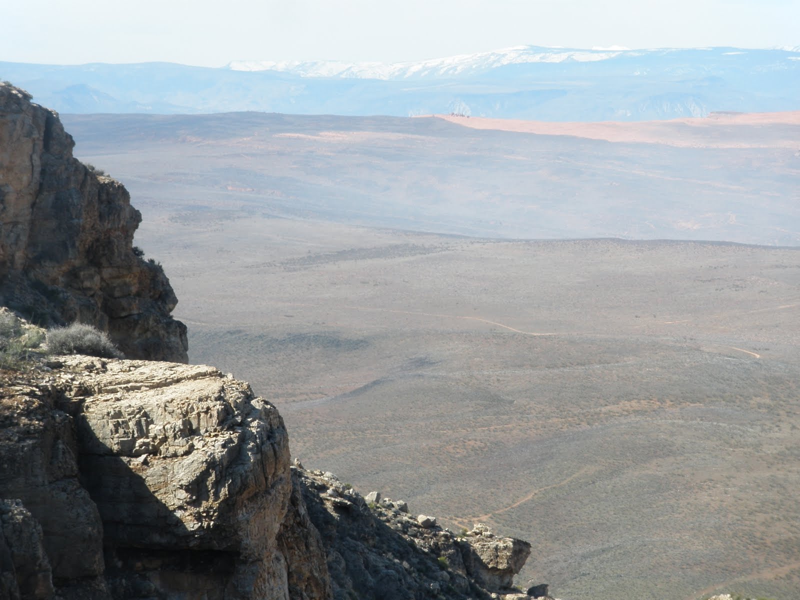 ABOVE IS A DIGITAL PHOTO TAKEN FROM MOLLY'S NIPPLE, ALONG THE HURRICANE FAULT- THIS REPRESENTS A VIEW OF SAND MOUNTAIN, WHERE MANY MILANKOVITCH CYCLES MAY BE STUDIED.
EXPANDING, WITH DIGITAL PHOTO:

 NOTE THAT THE PROGRESSION OF THE LARGER TO THE SMALLER ARCUATE FEATURES IS TO THE SOUTH OR SW- THIS IS REVERSE TO THAT AT THE KIMMEI ROTATION AND MENDOCINO TRANSFORM. AGAIN, THIS INDICATES THAT THE COMPARISON OF CENTRAL AMERICA TO KIMMEI FEATURES IS A MIRROR IMAGE (YOU MIGHT SUPPOSE THAT I REALLY AM TRYING TO CONVINCE MYSELF, AND THAT IS TRUE).
4. The Mendocino to Kimmei transform is part of a circle, which is equivalent to the circumference of the earth. It is obviously moving southward with time (to the west- 40N at CA, 33N at Kimmei), and pulls away from the Kimmei rotation feature with time. This results in an apparent north movement of the Milankovitch features with time;
5. Progression of the GRIDS and SPIRALING-ROTATING CURVILINEARS are therefore independent of each other. Grids and transforms occur due to westward movement of crust with EARTH TIDES, while Milankovitch cycles occur with WOBBLES (precessionary and elliptically) and AXIAL (tilting of the poles) MOVEMENTS of the earth. These Milankovitch cycles seem to result from asteroid strikes, as mechanical forces divert the crust temporarily; and,
6. Earth tides should be regular, with daily influence of the moon; Milankovitch cycles should result from encounters with the band of asteroids closest to the earth (as the EARTH IS DIVERTED FROM ITS REGULAR CIRCULAR PATH BY ELLIPTICAL AND WOBBLING GYRATIONS).
ELLIPTICITY 1.4 AT SAND MOUNTAIN
In both cases (comparing Kimmei rotation with that of CP) the measurements are revealing:
a. the GRID SPACING is 20 km, E-W;
b. Sand Mt. ellipse is on the west side of CP with orientation SW-NE, while Kimmel cell ellipse is on the east side with orientation NW-SE;
c.The ELLIPTICITY ratio is near 1.5 in both cases; and,
d. The 2 compared features are separated by 60 degrees longitude or 5555 km straight line distance (circumference- 40k km/7.2). See the Google measurements in the photo below:

The CONCLUSIONS LISTED ABOVE SEEM STRANGELY FORTUITIVE. For example, although the analysis is straightforward, the “even-ness” of the RATIOS, CYCLES, AND SEPARATIONS is curious. Why do numbers such as one million, those associated with the binary series, and multiples of 30 degrees longitude recur? One would expect that Earth tides are regular, but what about the concomitance of asteroid strikes with the binary numbers? One can see that the progression of the binary series backward- ½, ¼, 1/8, 1/16, etc. has an association with fairly young events also. 250k years is the average for the magnetic reversal, 15,625 years is near the end of the Ice Age, and 1953 years ago is near the time of the GREAT UPHEAVALS (COMET OVER THE NEAR EAST, "MIRACLES" ETC) of TRANSITION from BC to AD. Further, there is a 100 year cycle- part of the 2x previous n progression in effect. Remember, that the 1811 New Madrid quake (largest in history, for the New World), the 1908 Tunguska strike, and the present 2011 upheavals are on a 100 year repetition. Like Kepler’s arrangement of the planets- with respect to the sun,-there seems to be an “ORDER” to strikes, occurrence of mechanical events in the CRUST, and WOBBLES associated with ELLIPTICITY, PRECESSION AND TILT of the globe. Below are some analyses which will be incorporated next- they should excite your GASTRIC JUICES:


STAY TUNED!
SUMMARY, for Earth Dynamics and its ARCUATE FEATURES
Pacific basin TRANSFORMS are separated by 7.2 latitude degrees, and represent CIRCUMFERENCE TRACES ON THE EARTH. Multiplied by 50, the separations also calculate to be 40k km. Milankovitch 41k circular shear features in both Paleozoic limestones and Mesozoic sandstones also have a ratio of 50:1 for diameter/orthogonal spacing of circular features in rock outcrops. Ratios for other shear circles vary in magnitude from 10:1 to 100:1, according to their age and type of rotation. The RATIO, so far, pertains to features which have been formed during the period since 2.15 m.y. or the Eltanin asteroid strike, since age/50= 43k- approximately equal to the 41k year AXIAL CYCLE of the earth in its progression of tilt from 21.4-24.4 degrees.
The axial may be distinguished from the ELLIPTICITY cycle, by use of measured RADII on GOOGLE EARTH. Whenever a quarter circle is measured for its radius, and two orthogonal measurements differ from each other by more than 10% (error of the process of viewing and measuring the radii of an arc), the arc is part of an ellipse. Using ELLIPTICITY= 1st radius/2nd radius at right angles, this indicates an ellipse, for E> 1.2. After receiving sufficient comments, I will POST further findings for the precessional cycles. This should prove useful for Structural Geology Puzzles, which cannot be solved with current methods (evidently, because of “the choice to frequently HIDE, behind the mighty and convenient LARAMIDE”).
BELOW PHOTO SHOWS THAT THE COLORADO PLATEAU, CP, IS NEARLY CIRCULAR, AND NOT AN ELLIPSE AS WOULD BE FORMED BY MILANKOVITCH ELLIPTICITY CYCLE OF 100K YEARS, AND
AGREES WITH THE PROPOSITION THAT THE PLATEAU ROTATION CCW RESULTS FROM DRAG BY THE ROCKY MOUNTAINS ON THE EAST SIDE AND SHIFT AT 40N TO THE WEST ON THE NORTH SIDE. THE 800 KM DIAMETER DIVIDED BY 20 KM/YR YIELDS A TIME OF 40 MILLION YEARS TO CREATE THE VULCANISM ON THE SOUTH SIDE, FROM TAOS' LLANO QUEMADO TO THE HURRICANE FAULT (EO STRIKE BOUNDARY OF 34-41 M.Y. INITIATED THE ROTATION)
 REACHING A CONCLUSION ABOUT THE CONNECTION BETWEEN EARTH DYNAMICS, THE BINARY SERIES, AND THE SHEAR CIRCLES PRESENTED BY CORIOLIS ROTATION AND MILANKOVITCH CYCLES REQUIRES AN EVALUATION OF SOME DYNAMICS OF THE SOLAR SYSTEM. CONSIDER THE FOLLOWING:
ORDER in EARTH SCIENCE: BASIC GEOMETRY and MOVEMENT RATES
It is noticed that there is repetition in angular positioning, measurements of spatial arrangements and rates of movement of features on the spherical GLOBE. Below are some confirmed data measurements, in the cgs and Mks systems:
a. Distance from earth to sun: 93 m.y. or 150 million km. This yields a diameter for a spherical rotation (not elliptical, as is actual) at 300 m. km, and a yearly circumference of travel of 940 m.km;
b. Distance of earth to Moon: 384K km, at a ratio of Sun to Moon spacing of 390:1;
c. Tidal shift of the EARTH CRUST is 2 cm per year, or 20 km each million years. This is the normal movement, and when the influence of the sun is added, the total combined effect is 3 cm per year- the sun’s contribution being 10 mm/year. This has been measured at the Equator near the Galapagos Islands, and at the Mendocino 40N transform proceeding to the Kimmei transform. Unknown is why the feature only appears occasionally;
I FOUND THAT THE MEASUREMENTS AT THE KNOWN 41 M.Y. AGE KIMMEI SEAMOUNT YIELDED A TIDAL MOVEMENT OF 2 CM/YEAR, BY ANALYZING THE FOLLOWING CIRCULAR FEATURES AT BOTH THE PACIFIC OCEAN BASIN AND HURRICANE FAULT ZONE:


HOWEVER, THERE IS THE TIDAL INFLUENCE OF THE SUN, AND IT YIELDS A YEARLY MOVEMENT OF 10 MM/YEAR. COMBINED, THEY YIELD A TOTAL OF ABOUT 3 CM/YEAR. THE RESULTS ARE SEPARATED ON GOOGLE EARTH, AND THIS DOES NOT SEEM INTUITIVE; EVIDENTLY THE SUN TIDES OCCUR ON AN E-W LINE WHICH IS REMOVED FROM THE MOON'S E-W LINEAR, AND THEY DO NOT COMBINE. THE APPEARANCE OF THE SUN LINEARS IS MORE RARE THAN FOR THE MOON:

d. The speed of light is 3x 10 em, exp. 10, which is a multiple of the solar spacing to the earth: 30 billion cm per second/300 million km, or 300 billion m, or 30,000b. cm diameter = 1:1000 seconds (THIS IS THE RULE OF 1000). This is attributed to the rate of travel of gravity waves being identical to that of light. This makes it appear that gravitational arrangement of planets, Moon, and Sun are constrained by the velocity of light (the spacing of the planets about the sun is in an order also, from the measurements of the radii of the large bodies for their yearly circumferences- all multiples of the distance of MERCURY from the SUN);
e. Milankovitch cycles of precession, axial tilt, and ELLIPTICITY are in an order, if you “round out” the calculated values: 25k (equinoxes), 40k (tilt cycle, from 21.5-24.5 degrees- or the location of the TROPICS of CANCER AND CAPRICORN), and 100k years (elliptical movement of earth in its travel about the sun). This is a ratio of 1:1.6:4; and,
f. The ratio of the diameter of the axial Milankovitch to its tangential edge grid separation is 50:1. for the orthogonal or perpendicular distance to the circular shear around the arc made by the rotation (an adjacent shear line parallel to the circumference of the shear circle).

THE PORTTRAIT ALONG THE MENDOCINO TRANSFORM HAS MAJOR N-S ORTHOGONALS AT SEPARATIONS OF 16 M.Y., PLUS OTHERS. THIS STRONGLY INDICATES THAT THESE DATES CONFIRM THE INFLUENCE OF ASTEROID STRIKES CREATING THESE ORTHOGONALS. NOTE THAT THERE IS ONE ORTHOGONAL WHERE AN ASSOCIATED ASTEROID AND ITS EXTINCTIONS HAS NOT BEEN REPORTED IN THE LITERATURE. THIS OCCURS AT ABOUT THE 124 M.Y. TIME, AND THE EXTINCTION GRAPH SHOWN EARLY IN THE DISCOURSE INDEED SHOWS A SIGNIFICANT EXTINCTION NEARBY. THIS OCCURS NEAR 150 M.Y.- NOT IN THE EXPECTED 2, 4, 8, 16, 32, 64, 128 M.Y. BINARY SERIES.
An “In Town” example of Milankovitch Rotation, Shear, and Lateral Faulting
The Earth Tide movement of 2 cm/year westward can be observed in Washington County, Utah, where it is easy to hike and photograph the results of lateral shear. This occurs at the Washington fault, which crosses the I-15 freeway in the town of Washington, UT. This fault is parallel to the Hurricane fault, Hf, and expresses itself as a scarp, warm springs, and cracked concrete slabs in homes along it. The photo below shows that the expression is exactly 20 kilometers from Hf, along the Green Springs Road, and it has a spur where the spacing can be measured, the temperature of the springs emerging from the Navajo formation found, and the scarp may be photographed. Below is the Google photograph, showing the geometry of the laterally-moving feature:
 ABOVE IS THE DIGITAL PHOTO OF "BOILER" AND BELOW IS THE GOOGLE EARTH PHOTO:
The larger view is shown below, where the distances are measured with the Google earth measurement tool:
 PHOTO BELOW WAS ANALYZED, WHEN I ESTIMATED THAT THE ANNUAL MOVEMENT WESTWARD WAS THE SAME AS THAT NEAR Hf, USING 1 MM/YEAR (CONSIDERABLY INACCURATE):
Notice that two spacings are shown; the Washington Fault has two expressions: at Green Springs Road and at the “boiler” warm springs- just north of I-15 Freeway. The 20 km separation occurs between Hf and the farther west Green Springs Road, while the ½ km spacing occurs between the two drainages. This example of GRID SPACING allows some qualitative conclusions to be made:
a. The extension of the Radius of a rotation (Wa fault and Hf being parts of shear circles) is a small feature, N-S. This indicates that EARTH TIDES “fixes” the positioning of the spacing for a short tine interval only (thereafter, the GRID wobbles to the east- see the “hook” in the drainage);
b. Conclusion a. indicates that whatever creates the shear and drainage operates only part of the time; this would result from the portion of Earth-Moon cycles only a few days, or years, during each period. I have measured the temperature of the “boiler” springs just north of the I-15 feeder, and it is low (72F) at the New Moon and highest just before the Full Moon (77F), indicating that HEAT OF FRICTION IS GREATEST DURING the FULL MOON;
c. The RATIO of E-W grid spacing of 20 km to .5 km= 40 indicates that this is part of the AXIAL CYCLE of 40- 41 k.years. Consequently, it appears that the rotation produces shear only part of the time. Evidently, there are critical portions of the cycle where shear is produced- such as the times of reversal of the tilt cycle of the earth’s poles;
d. The “hook” in the drainage pattern to the north is interesting. This feature would again indicate that there is wobbling of the poles, and this could result from precession or tilt changing abruptly (as at times of reversal of tilt or precession direction).
e. The drainage has a circularity to it, again indicating a change of cycling. This case has more regularity, not indicating abrupt change; and,
 ABOVE ANALYSIS INDICATES THAT, WHEREAS THE WA FAULT HAS A CIRCULAR PATTERN, THE GREEN SPRINGS "DUO" RESULTS FROM SEVERAL SMALLER MILANKOVITCH CYCLES, WITH SMALLER RADII (SUCH AS THE EQUINOX 23 M.Y. ROTATION,) AND THAT IT YIELDS AN ELLIPSE FOR THE TWO DRAINAGES.
AGE of FEATURES MAY BE MEASURED with EARTH TIDES

The steady progression westward of Protruding crust appears to be the most reliable entity for measuring TIME. Although it is unknown whether the crust underneath the Pacific basin undergoes shove to the west similar to the Sierras, the appearance of “tic marks” is consistent in spacing. These intermit with major N-S linears, so that they can be relied upon to indicate E-W cycles of earth tides. Occasionally there does occur a shear circle which distorts the portrait, and the ticK (as with a CLOCK) marks do not proceed very far to the north or south of a linear arrangement, but for the two cases investigated they are regular. The region investigated at the Equator portrays them tracing a linear pattern N-S (orthogonal to the ones shown at the Mendocino transform). This is a clue as to their origin, and at the Equator there could be no Coriolis rotation to explain them. They could indicate a regular shift of the POLES orthogonal to the Equator, or they might realte to a northward shift of the Australian continent (including NZ and the Pacific Islands), subsequent to the PTr strike of Paleozoic time. This north trend is indicated by the steady movement of the Tonga Trench- the fastest moving entity known for the entire crust.


Proceeding to a feature closer to hikers, where all can evaluate it up close, we present a Google Earth photo of the Green Springs anomaly- which has GRID LINES associated with an elliptical rotation. This case shows the smallest division of significance of the crust, which indicates GRIDS tracing to the east, E-W: SPACING is 5 meters each separation, indicating an elliptical figure with a variable radius, a calculated age of 12,800 years (64 m/.005 meter spacing), and a double rotation of arcuate figures. This is sufficiently close to the expected LARGE MAMMAL EXTINCTION STRIKE of 12,900 years, to make me wonder which is the more correct.
 ABOVE GOOGLE PHOTO SHOWS HOW THE AGE OF A FEATURE MAY BE CALCULATED; KNOWN IN ADVANCE IS THE RATE OF WESTWARD TIDAL MOVEMENT (E-W DIAMETER/RATE= AGE OF DEVELOPMENT); IN THIS CASE, IT APPEARS THAT WE HAVE "STUMBLED ONTO" THE LARGE MAMMAL EXTINCTION ASTEROID STRIKE OF 12,800 YEARS AGE. THIS DOES NOT MEAN THAT THIS IS THE LOCATION OF THE STRIKE, MERELY THAT THE STRIKE HAS ACCELERATED THE PRESENTATION OF WHAT WOULD HAVE OCCURRED OTHERWISE (NOTICE THAT THE RATE IS 5 MM/YEAR, MUCH SLOWER THAN THE 2 CM/YEAR EARTH-MOOON TIDES' RATE).
Notice that the grid has regularly-spaced linears, tracing N-S, which is that expected for Earth-Sun (NOT Moon) tides or RATIO of diameter/adjacent tangential shear of 10:1. Not clear is the spacing shown; is it per cycle or half cycle? I’ll try to magnify the image to clarify this result. The Moon tides are shown for the larger rotations of the Washington and Hurricane faults, where the spacing is 20 km/m.y (2 cm/year west movement).
f. General observations indicate that the Earth-Moon cycles have mostly times where there is short duration of shear in rocks, and that reversals occur. Some shear cycles operate continuously for long periods (such as for more than a half cycle), but others only for small portions of the time.
This FINDING of world-wide significance may apply to the EASTERN HEMISPHERE as well, but I have not yet incorporated it, since I have concentrated my time on the NORTH AMERICAN QUADRANSPHERE, which I have recorded this 3rd of March, 2011, at 2:22 am (3/3, 2:22/11).