First we will take the Grass Valley, UT case, where the Hurricane Fault, Hf, has created several Coriolis cells by moving both CCW around the Colorado Plateau, CP, and by rising on the Hf side. these lie just north of the AZ border, where the rotation can be seen in Google photos of canyons cutting Hf:


 The above photos and diagrams show that there is rotation within the CRUST, for small Coriolis cells (NOT GREATER THAN THE THICKNESS OF THE CRUST). One of these occurs just south of the town of Hurricane, near the Grass valley and Divide vulcanism. Further, as shown below, there are SPIRALING RODS OF SALT found in the Gulf Coast of USA:

Notice the creek atop the SALT DOME, and its response to the CCW spiralling of the salt as it rises by bouyancy.
Other geometric figures may be found near the Aleutian Islands, where they are most sensitive to the great Coriolis rotation of the Quadransphere for North America, and for the rotation of the 40N shear transform southward:
 These cells are huge, so that I am still investigating whether they can occur in the Crust, without spiralling upward from the Mantle (Atmospheric cells operate internationally, with only a 10 km thickness in the weather zone- BUT THEY INCUR FRICTION WITH THE GROUND SURFACE).
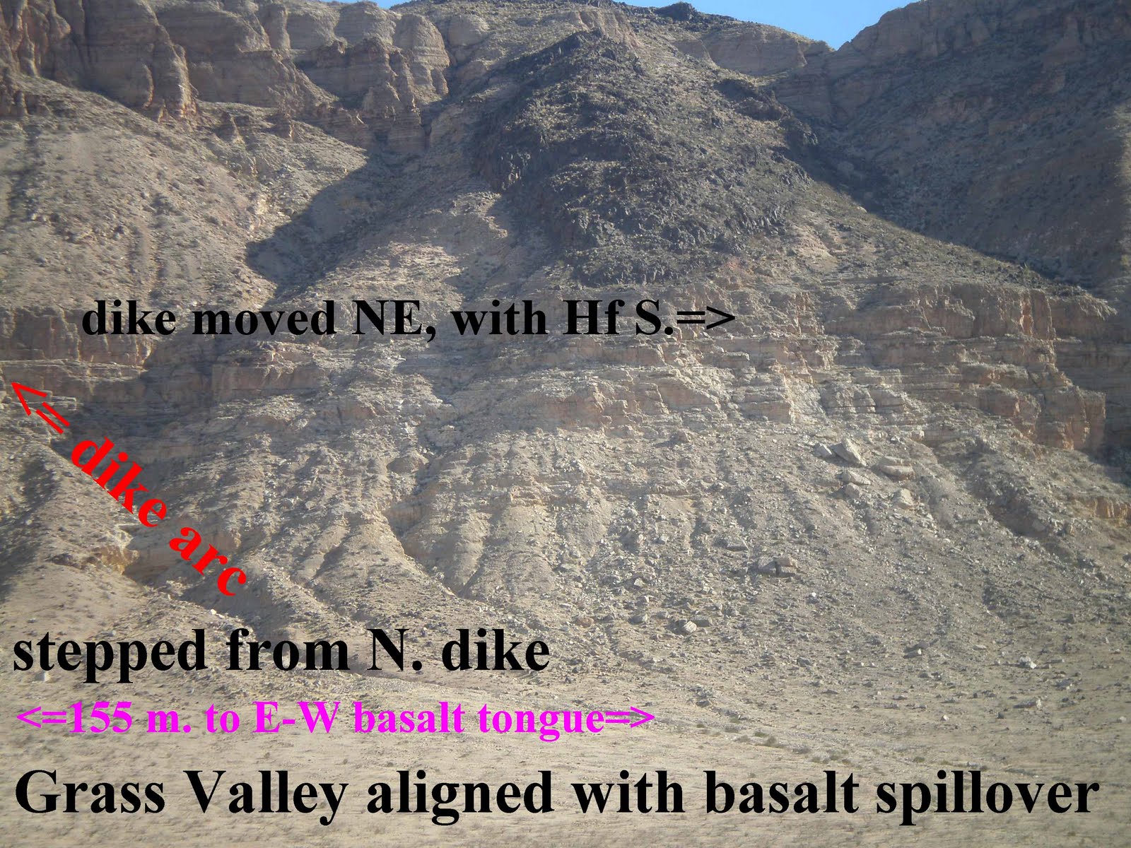
Continuing with the analysis of Grass Valley flow and subsequent rotation:

Above may be seen the NET MOVEMENT AND DISPLACEMENT/YEAR OF THE WHOLE ENTITY- Grass Valley and later eruption of the Divide Vulcanism. The rotation of CP has caused a southward displacement of the CP and basalt on top of the RIM.

To get the "Big Picture" before we solve the rotating sphere geometrical case (where we can calculate the rate of rotation vertically, within the Crust), look at the region near the border of AZ and UT- where several shear zones have produced basaltic extrusions:

The photo above will assist in working on the LARGE PROJECT OF LOCATING THE B&R SHEAR ZONE, which involves the entire state of NV and UT west of the Wasatch Line.
Hopefully, we won't have to climb the Virgin Mountains, and it appears that the B&R shear fault lies near the Virgin River at the AZ, NV, and UT region (near Littlefield, AZ).
Below is the first run, for solving the Grass Valley cell rotation- which is entirely within the Crust- possibly being forced eastward by the Mantle, which is moving slightly faster than the Crust. Field data for tilted beds on the SE side of the cell were used, to find the cotangent of the angle of tilt of the linestones at the edge of the cell. In addition to finding the ratio of velocities of CP uplift and Mantle velocity (.268), we have solved or gotten a hint what is causing CP to move westward:
 And below is one scenario for the "pulsing" of the Magnetic Polarity and display of westward progression of benches above the Hurricane Fault, Hf:
Below are the photos of horizontal slats or laths, which have been impressed into the sheared and plastic limestone wall on the SE corner of the rotating outcrop of the Grass Valley cell:


We didn't find slickensides nearby, but these tell the same story as would slickensides. Movement was lateral, and shear was planar in the vertical dimension. These horizontally-arranged exotics are located just downstream of a tell-tale limestone layer, which shows the 15 degree dip and tilt (strike to NE) of the Crustal Cell (which is rotating vertically, as well as horizontally).

This publication will be continued, but most of the information is given in previous blogs. Scroll down!
2 comments:
This is INTERESTING and BEAUTIFUL. I would like to FOLLOW your blog. Why noty get the Gadget?
Post a Comment